The “Tell Trail” is a new long-distance trail in the Lake Lucerne Region, divided into 8 stages, visiting many mountains, alpine lakes, and historic villages along the way.
These stages of the Tell Trail are suitable for most average hikers and older children with a good fitness level, as the trails are moderate and not technically difficult. There is one short exposed section with a steep slope to one side, with a chain rail for safety. So you’ll need steady footing and a head for heights for this part.
In this article, I explain Stages 6 and 7 in detail, with trail maps, costs, where to stay, and step-by-step photo story. I also give day trip alternatives for those looking for shorter/easier options in the same areas.
Enjoy!
Note: Thanks to Luzern Tourismus for sponsoring this trip.
| Region: | Lake Lucerne Region, Switzerland |
| Starting point: | Engelberg – Titlis gondola station Gerschnistrasse 12, 6390 Engelberg |
| Ending point | Lungern train station |
| Trail: | two one way hikes: 19 km & 18.4 km |
| Time: | 2 days, about 8 hours each day |
| Difficulty: | moderate (see trail maps below for elevation profile) |
| Condition: | mountain trails, one short exposed section with chains |
| Elevation: | highest point 2204m |
| Open: | best July to early October |
| Cost: | starting around CHF 160/adult for transport and overnight costs |
| Extras: | mountain restaurants along trail, see below for details |
| More info: | luzern.com • webcams • forecast |
Location
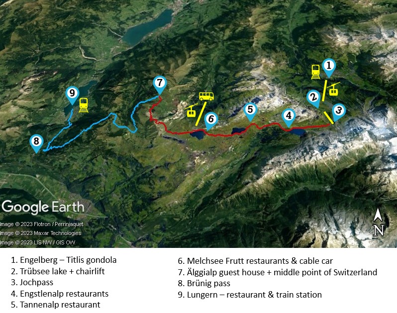
The Tell Trail wanders through several mountain areas south of Lucerne Switzerland. The map below shows Stages 6 (red) and 7 (blue), which are located in the Engelberg, Melchsee Frutt, and Lungern areas. I’ve labeled important points on the map, which are explained in the photo story below.
Gallery
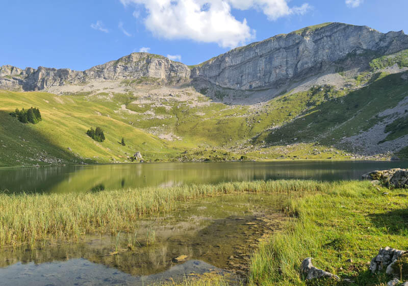
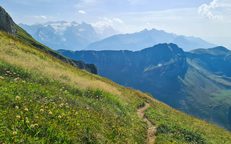
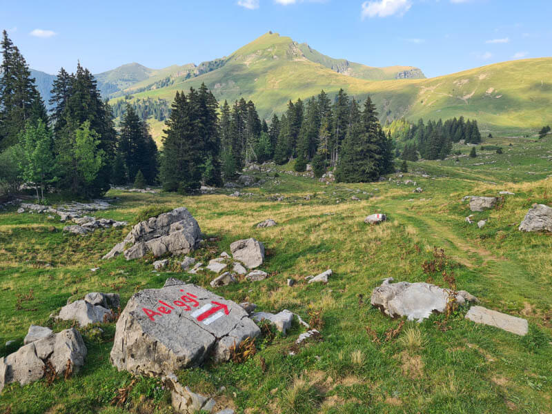
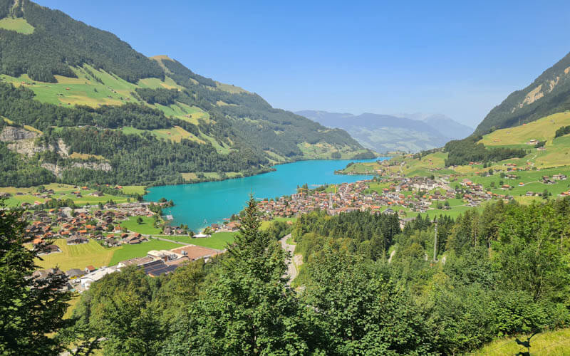
Here are a few photos to get you excited about the Tell Trail. A full photo story is at the end of this post.



Trail maps
Below are trail maps for Stages 6 and 7. For a full description of each trail, see the Photo Story below. For more Tell Trail stages, see Luzern.com.
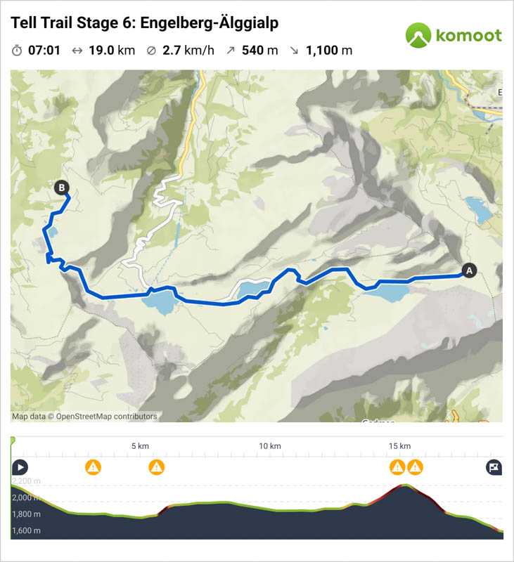
Map for Stage 6: Engelberg Jochpass to Älggialp
This stage starts in Engelberg, where you start by riding a gondola and chairlift up to the trail head at Jochpass. The trail ends in Älggialp, where you must stay overnight in a mountain guesthouse, then continue the following day on Stage 7.
We spent 8 hours on the trail, including breaks, with 5h40 actual walking time. The Komoot map says 540m up, but it my watch tracked 770m up.
Download map on Komoot • SchweizMobil • OutdoorActive
To reach the trail, you ride the gondola up to Trübsee, then chair lift up to the Jochpass. You can skip the chairlift and hike up instead, adding about 2.2 km and 420m of elevation gain. We think the hike is long enough and you don’t miss anything by taking the chair lift.
Good to know
For day one, there are several mountain restaurants on the first half of the hike at Jochpass, Engstlenalp, Tannalp and Melchsee Frutt (halfway point). After Melchsee, there are no services until you reach the Älggialp guest house. So make sure to replenish your water and snacks before leaving Melchsee. You can eat dinner at Älggialp Gästehaus and get water and snacks for the next day’s hike.
Trail conditions
This trail is well built and relatively easy. However, there is one exposed section around the 16k mark that requires extra care. It is a rocky descent with a steep slope to one side. There are iron rungs in the rock to help you climb down and a chain hand rail for support. It’s not extremely dangerous, but you’ll need to go slowly and carefully.
More details about the trail in the photo story below.
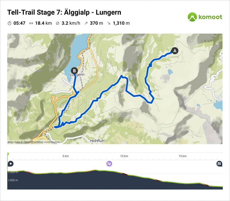
Map for Stage 7: Älggialp to Lungern
This stage starts at the Älggialp guest house where you slept overnight. It hikes through fields and forests and over a mountain pass on well defined paths, nothing tricky. The trail ends in Lungern where you can catch a train back home.
A full description of this trail is in the photo story below.
Download map on Komoot • SchweizMobil • OutdoorActive
Good to know
There are no services on this trail until you reach the end at Lungern. So make sure to bring enough food for your lunch or ask Älggialp to make you a packed lunch for the day.
Note that there are a few different trails leading to Lungern, which you’ll see on the trail signs with shorter times than your trail. But these are steep switchbacks in the forest straight down the mountain. The route mapped here is longer, but a pleasant descent with mountain views, much preferred in my opinion.
If you need to shorten this trail, you can catch at train at the Brünig pass instead of hiking down to Lungern. To do this, simply turn left when you reach the train tracks. It’s just a few minutes to the Brünig train station.
Planning the trip
Costs
As described in this post, this two day hike has following costs, not including meals. I would budget about CHF 160/person plus meals, more if you stay overnight in Engelberg before the hike. Prices were updated in 2023.
- Transport to Engelberg – one way from Lucerne CHF 18.40/adult
- Gondola & chair lift to Jochpass – CHF 34/adult, discount with Swiss travelcards
- Overnight in Älggialp Gästehaus – Private room with breakfast CHF 85/person, dormitory CHF 55/person
- Transport from Lungern – one way to Lucerne CHF 15.80
Your costs will vary based on factors like your starting point, discount travel cards, meals, hotel options, etc.
How to get there
Since this is a one way hike, you must use public transport to access these trails, even if you arrive by car.
Stage 6 starts in Engelberg, which is easily accessible by train from Lucerne. From the Engelberg train station, it’s a short walk or bus ride to the Titlis gondola, which you ride up to start your hike.
Stage 6 ends and Stage 7 starts in the alpine village Älggialp, which is not accessible by public transport. So it’s not possible to do Stage 6 or Stage 7 as day hikes without an overnight in between. You must hike both stages in succession. However, I do have some day hike alternatives below.
Stage 7 ends in Lungern, where you can catch a train to Lucerne.
By car
If you must come by car, you will need to park near the start or end of the hikes and take the train to connect the ends.
I recommend parking at the end of your hike at the Lungern train station P+ Rail spots, which cost CHF 6/day. Then ride the train to Engelberg to start the hike. Alternatively, you could park in Engelberg. The Engelberg train station P+Rail spots are CHF 8 day. The Engelberg Titlis cable car parking is CHF 5/day.
The train ride between Engelberg and Lungern is about 1hr50, connecting through Lucerne. In 2023, a one-way ticket costs CHF 18.40/adult full price.
I do not recommend parking in Lucerne because it is very expensive, about CHF 60-90/day.
Best to download the SBB P+Rail mobile app, so you can manage your parking with your phone.
Where to stay
If you plan to do the two day trek as described here, you must stay overnight in Älggialp, which is in the middle of the two hikes. There is only one option there, the Älggialp Gästehaus, which has private rooms, family room, and a dormitory. In 2023, it cost CHF 85/adult for a private room and CHF 55/adult for a dormitory bed. This includes breakfast.
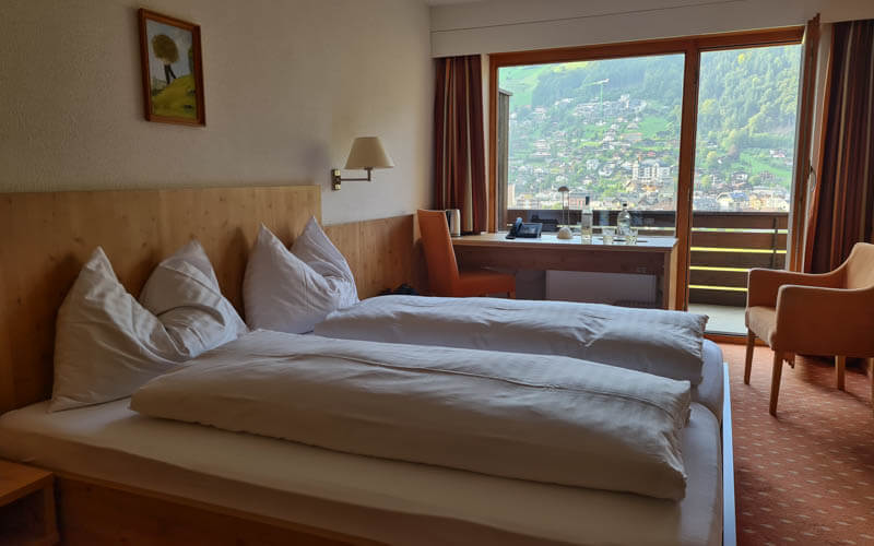
The night before your first hike, we suggest staying overnight in Engelberg so you can get an early start. We stayed at Hotel Bänklialp, which is a short walk from the Engelberg train station and Titlis cable car station. Our room had a fabulous view over the Engelberg valley and river. The food was quite good, definitely a step above typical Swiss hotels.
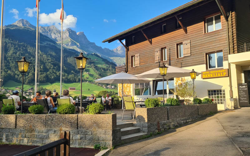
The hike ends in Lungern, where we caught the train back home to Zurich. If you prefer to spend the night, there are a few hotels near the lake and a campground.
When to go
This trail is best done from July through September, when the trails are clear of snow and restaurants, hotels and other services open. Depending on weather conditions, you may be able to hike this starting in mid June and perhaps into early October.
Please check with local mountain resorts for current conditions and opening times of lifts and other services.
What to pack
In addition to your regular hiking supplies, you’ll need to carry everything you need for an overnight. There is no luggage transfer service for the Älggialp guest house. If you booked a private room, the beds have sheets and a duvet. But if you booked the dormitory, you’ll need to bring a sleeping bag liner.
Make sure to bring sun protection as there isn’t much shade, especially on day one. I suggest a sun hat with a wide circular brim, sun screen applied multiple times per day, and sunglasses.
For the hikes, bring a minimum of 2L water per person and snacks to last you between meal times. They have a restaurant, so you don’t have to bring all your food. You can also buy picnic supplies for day 2.
We recommend wearing sturdy hiking shoes with good tread, particularly for the second half of day one. Hiking poles were very useful on the second half of day one and much of day two.
Where to eat
For day one, there are several mountain restaurants on the first half of the hike at Jochpass, Engstlenalp, Tannalp and Melchsee Frutt, the halfway point of the hike. Since Melchsee Frutt is the halfway point, we suggest stopping here for lunch, perhaps at the lakeside “Beizli”cafe or Frutt Mountain Resort, which has a lovely panorama terrace and delicious food.
After Melchsee Frutt, no services until you reach the Älggialp guest house. So make sure you have enough water and snacks to last the second half of the hike. Dinner is served until 20:00 at Älggialp .
On day two, there are no mountain restaurants or other services on the hike until you reach the end in Lungern. So either bring food for day two lunch or buy a picnic lunch at Älggialp.
In Lungern, there are a few restaurants in town, but I don’t have any particular recommendations. We got a picnic at the Volg grocery and ate it at the lake.
Alternative day hikes
If you want to hike in this area, but need a shorter/easier hike, here are a few options that work as day hikes.
Route 574 Vier-Seen-Wanderung: Engelberg Trübsee to Melchsee Frutt
This trail is the same as the first half of Stage 6, but stops in Melchsee Frutt where you can ride a cable car down, then bus back to your starting point. This trail is about 10 km if you use the chair lift from Trübsee to Jochpass or 15 km without this shortcut. Learn more.
Melchsee Frutt Lake Walk
This is a super easy wander along the lakes near Melchsee Frutt, even suitable for strollers and wheelchairs. You would start and end at the Melchsee Frutt cable car, optionally shortening the walk with the Fruttli shuttle that has a couple stops along the trail. Learn more.
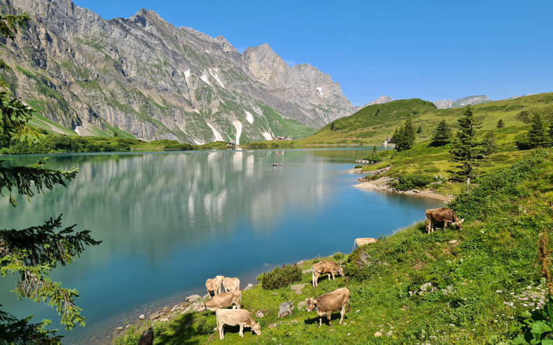
Engelberg Trübsee Lake Walk
With little kids, our first choice would be the easy Smuggler’s activity trail around the Engelberg Trübsee lake. You can optionally ride chair lifts up and over the Jochpass to visit the Engstlensee. Then ride back to finish your day in Engelberg where you started. Learn more.
Hasliberg Skyline Trail
This trail starts at the Hasliberg Alpine Tower and traverse the mountain to the Tannensee lake. Then down to the Engstlensee and a bus and train back to your starting point in Meiringen. You see a lot of the same scenery from the first half of Stage 6. Learn more.
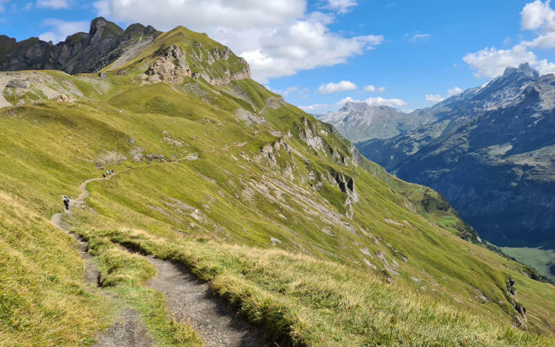
Photo story of Stage 6: Engelberg to Älggialp
In August 2023, my friend Julie from @gelatotravel and I hiked two stages of the Tell Trail (6 & 7), from Engelberg to Lungern, with an overnight in the alps in between. We absolutely loved this experience, seeing so much beauty and variety over the two days – a classic Swiss summer adventure.
It was an epic journey and I wish I could show you every minute and every inch of the trail. But we’ll just stick to some highlights so you know what to expect.
Overnight in Engelberg
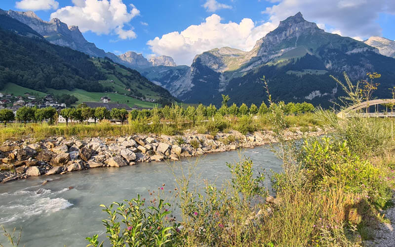
We wanted to get an early start and be well rested for our long hike. So we stayed overnight in Engelberg at Hotel Bänklialp. It was just a 10 min walk from both the train station and Titlis gondola, where we would start our adventure the next day. Absolutely fantastic views from their restaurant terrace.
Comfortable room with the same amazing view from our balcony.
View from the river just below the hotel.
Riding up to the Stage 6 trail head
We had breakfast at our hotel at 7:30 and were at the Titlis gondola when it opened at 8:30. You need a one way ticket to ride the gondola to Trübsee and chair lift to Jochpass.
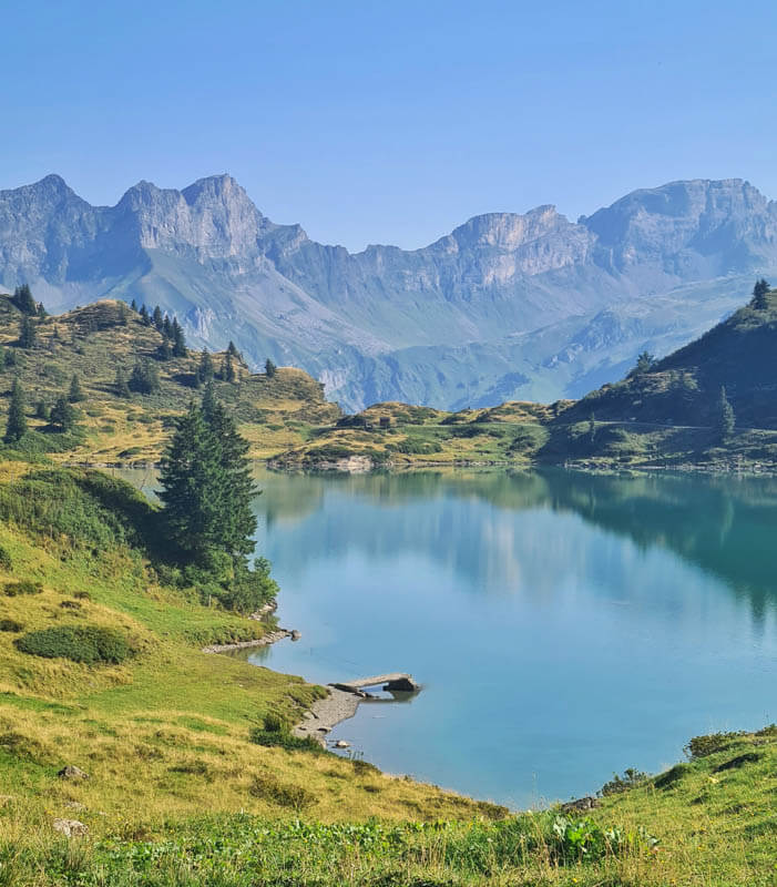
We started our day by riding the gondola from Engelberg to Trübsee. Exit the gondola station and walk down to the lake. Follow the path on the left to the chair lift straight ahead.

It’s a gorgeous lake, so let’s just admire it for a minute before moving on.

Then ride a chair lift up to Jochpass, where the hike starts. If you want a little extra fitness, you could skip this chairlift and hike up, about 2.2k and 440m ascent. You can see that trail a bit on the right side of the photo. But you have a very long distance ahead, so I think it’s better to get to the Jochpass quickly.

Looking back at the Trübsee lake as we ride up.
Starting the trail at Jochpass
You get off the chair lift at the Jochpass. There are toilets at the Jochpass restaurant if you want to go before getting on the trail.
Start by following signs to Engstlenalp and the green 574 Vier-Seen-Wanderung.

The trail is a narrow dirt footpath down to the Engstlensee lake shown here. The mountain bikes follow different trails to your left. There’s also a chair lift that takes you down most of the way to the Engstlensee. I wouldn’t take that chair lift for this hike.

When you get close to the lake, I suggest taking the trail that hugs the water so you can enjoy this lake a bit more before leaving.

Near the west side of the lake, there is a picnic area with toilets. Even though we had only been hiking an hour, we did a quick swim in the cold lake to cool off. Definitely recommended.

Near the end of the lake, follow the path towards the parking and bus stop. You’ll pass a cheese shop, hotel and mountain restaurant.

Hike up to Tannalp
Now follow signs to Tannalp, still on the green Route 574. The path leads through some cow pastures to the trail snaking up the mountain as shown in the below picture.

Looking back to Engstlenalp. This uphill section lasts about 45 mins, not too difficult.

This short section, called Spycherflüö, has a steep slope to one side and a rope to hold for safety. The path is pretty wide and well built, so it’s not particularly dangerous. But use caution and be courteous to passing hikers.

Passing through Melchsee Frutt
The climb ends at Tannalp, the start of the Melchsee Frutt resort. Here you’ll find a restaurant and toilets. This is probably too early for lunch. I suggest continuing to Melchsee Frutt, about another hour, and eating there instead. That little blue/yellow shuttle takes non-hikers back to the cable car.

Just past Tannalp, you’ll reach the third lake on this hike: Tannensee. It’s an easy walk around the lake on wide flat dirt path.
After the lake, the official trail has you cross the dam over to the paved road and follow that to Melchsee Frutt. But I think it’s much nicer to follow the dirt path shown here. Either way, it leads to the Melchsee lake.

Following the dirt path with Melchsee lake coming into view.

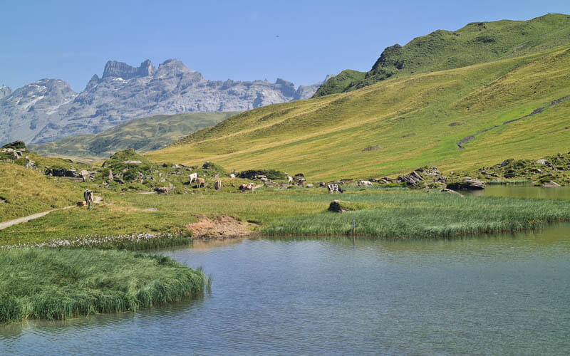
The trail leads you to the water, near the little church in the picture below. Along the lakeside, there are a couple restaurants and picnic areas with places to swim and lounge.

On the lakeside, you’ll find this little “Bärgbeiz” café for a quick and relatively inexpensive meal. There are also free toilets here.

We walked over to the elevator and rode it up to get this nice aerial view of the lake.

From the elevator, it was a short walk to the Frutt Mountain Resort hotel, which has a nice restaurant with a panorama terrace overlooking the lake. The food is more expensive here, but also more delicious. We were super happy with our big salads, refreshing and nourishing on this hot day.

Hiking up to Abgschutz peak
After Melchsee Frutt, there are no services until you reach the end at Alggialp. So make sure to refill your water bottles and stock up on snacks here. There is a small grocery called Tutti Frutt in the resort village.
As you leave Melchsee Frutt, follow signs to Abgschütz and Älggialp, your final destination. This is also green Route 57 Obwalden Höhenweg.

From this point, the paths are well marked but don’t always have signs telling you where the trail is going. So I found it very helpful to have an offline trail map on my phone to check that we were always going the right way.
The hike continues westward, heading higher into the mountains. You will hike up and over that center section which looks rather flat.
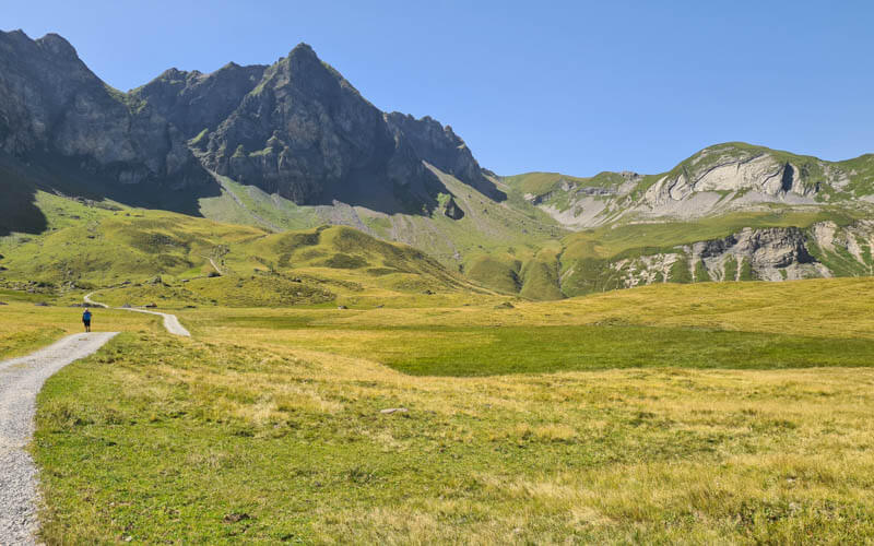
You’ll pass the small Blausee lake just before you start the steep climb up to the pass.
Don't miss out on today's trending deals!
Join thousands of users enjoying exclusive benefits right now.
Hiking up in the heat. We lost the breeze in this section, making it a sweaty climb. It took us a little over an hour from Melchsee to finish this climb to Abgschütz.
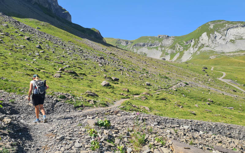
Looking back to Blausee in the foreground and Melchsee in the distance. We only passed two other hikers on this part, so quiet.
Here’s Abgschütz, the highest point of the trail at 2,204m. That little hut is private and cannot be used for shelter.
From Abgschütz, you can look over the mountain to see the Seefeldsee lake below and your end point far in the distance. From here, you have about 2 hours left to hike.
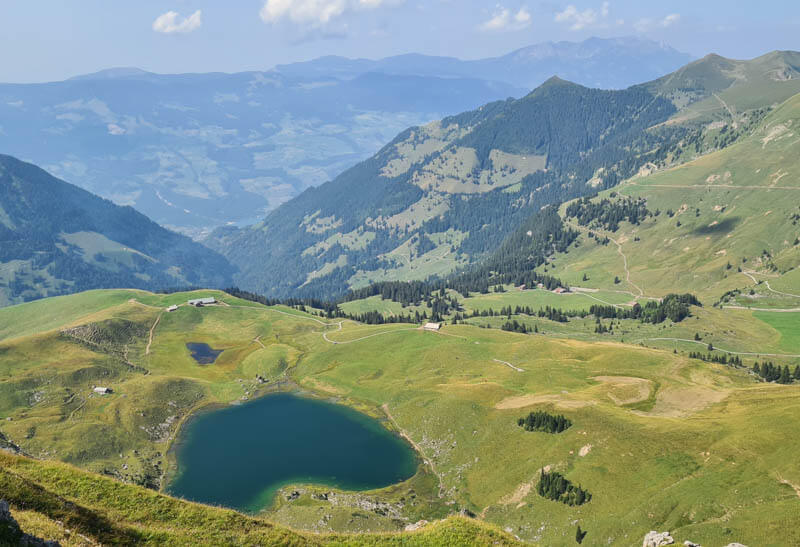
Down to Seefeld & Älggialp
The next 45 mins are full of switchbacks on a rather steep slope, as shown in the pic below. You need to be extra careful here to avoid an accident. I set my backpack down for a minute and it started to roll down the mountain. I luckily caught it before it got too far.
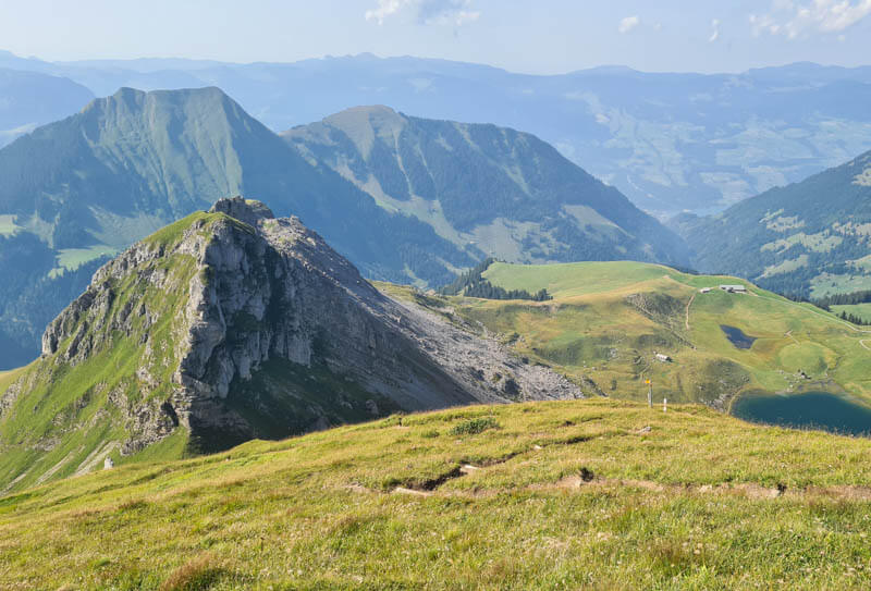
One of the prettiest views of the hike, with the Jungfrau Region mountains and glaciers in view.
The afternoon light was so perfect on these cliffs. I wanted to linger longer here. But it was already 16:00 and we were a little concerned arriving in time for dinner at the guest house. Later we learned that the kitchen closes at 20:00. So as long as you arrive before about 19:30, you’ll get fed.

For the next 30 mins or so, the trail is a bit exposed with steep slopes off to one side. The trail is still well built, but is narrow with lots of rocks and tall steps, often with metal rungs to make the way a bit easier to navigate. Move slowly and carefully through this section to avoid an accident.
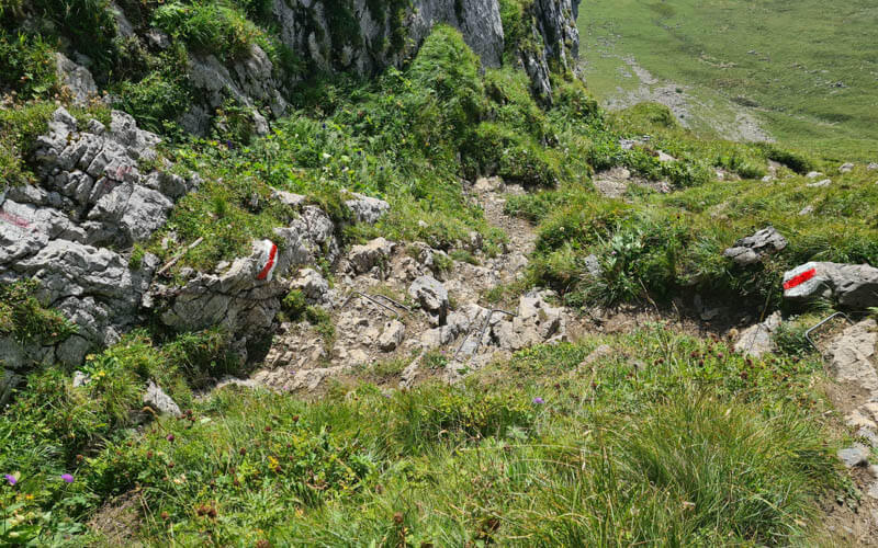
The trail loops back northward toward another pass. This is your last climb of the day.
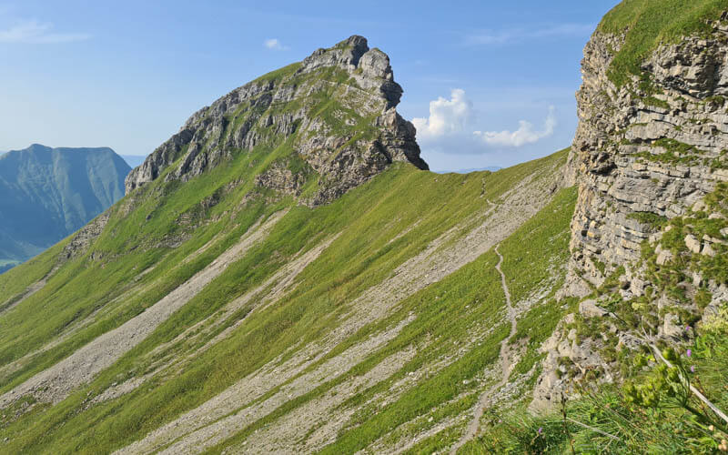
Then you descend a mess of loose rock for about 20 mins, which can be challenging since your legs are tired from the climb you just did.
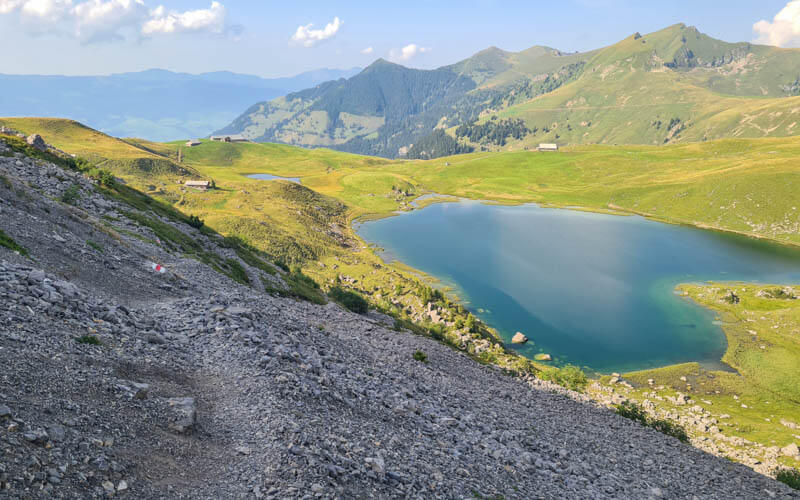
The trail eventually reaches the grassy fields again.
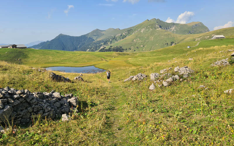
Then you pass by the Seefeldsee lake. I suggest a brief detour closer to the lakeshore for some pretty pictures before moving on.
Ending day one at Älggialp
When you continue, make sure to not follow the trail that loops around the lake, but straight across the fields towards Älggialp.
Your trail joins a paved road that winds down the mountain a bit.
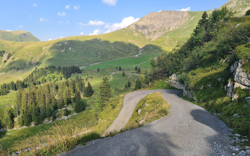
The official trail stays on the road. But it’s shorter to branch left onto the red/white mountain path, which leaves the road and heads directly to Älggialp. It wanders through some meadows, then into the forest.
The last part of this trail is a rocky path cut into a cliff wall, a bit exposed with steep steps and a ladder. It was a bit tricky to manage with our tired legs, but not scary.
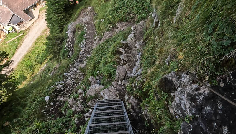
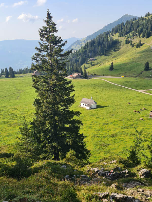
After you descend this last rock wall, you cross a large alpine meadow with lots of cows, passing a cute white chapel before reaching the guesthouse, which you can see in the pic below.
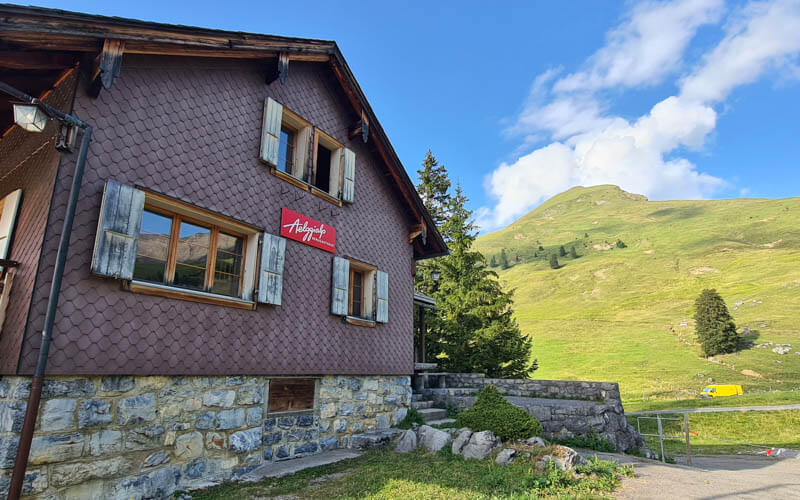
So happy to arrive at our accommodations for the night. We got there at 18:00, with plenty of time to shower before dinner.
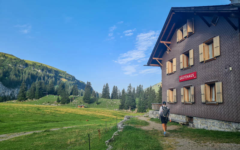
The guesthouse rooms are in a separate building from the restaurant, just a few steps away.
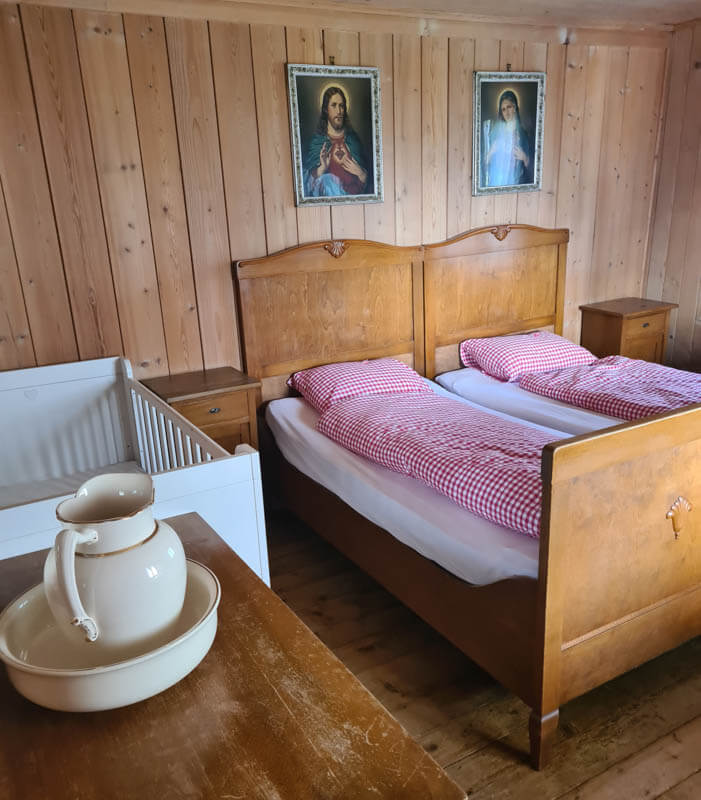
We had this cute room on the first floor. There is a shared bathroom with flush toilets and hot shower. The water is not drinkable, so you need to ask the restaurant staff fill your bottles in their kitchen.
We had the fixed 3 course menu for dinner, which included soup, spinach knodel and salad, and ice cream sundae with raspberry sauce for dessert. Yum yum!
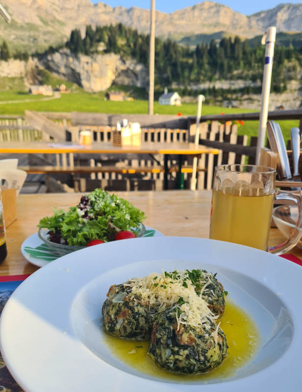
View from dinner and our room. A couple hours earlier, we were on top of the mountain on the right.
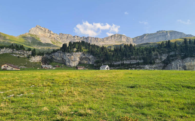
Photo Story of Stage 7: Älggialp to Lungern
We had a great sleep and ate breakfast at 8:00, as soon as they opened. We started walking about 8:30, waving goodbye to Älggialp shown here. FYI, we were alone the entire hike. We only saw a couple people on farms but no hikers the entire day.

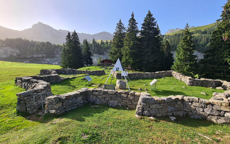
Our first stop, after just a couple minutes, was the “Mittelpunkt der Schweiz” monument, the middle point of Switzerland. The rock wall is in the shape of Switzerland. In the middle, there is a rock with a hole showing the exact middle point of the country.
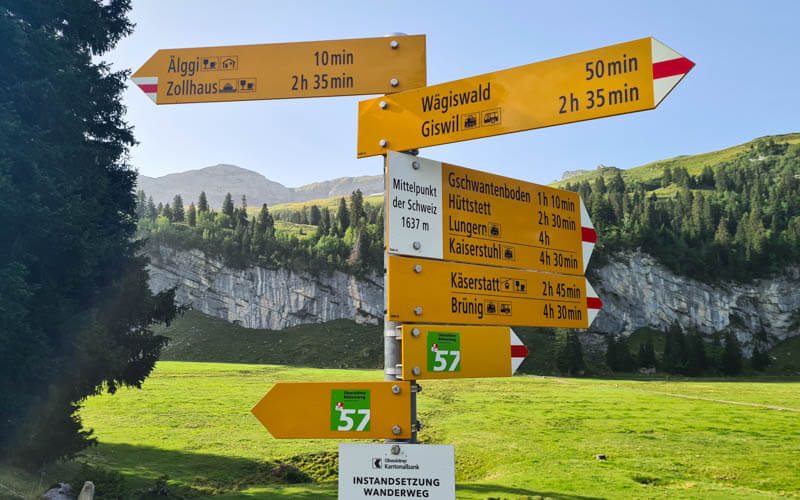
Now follow signs towards Brünig on Route 57 Obwalden Höhenweg.
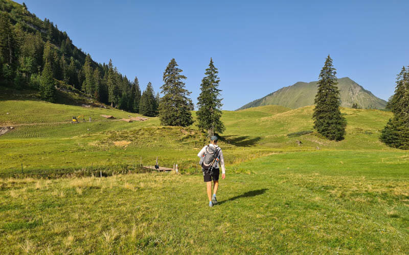
We start with an easy stroll through the alpine meadows.
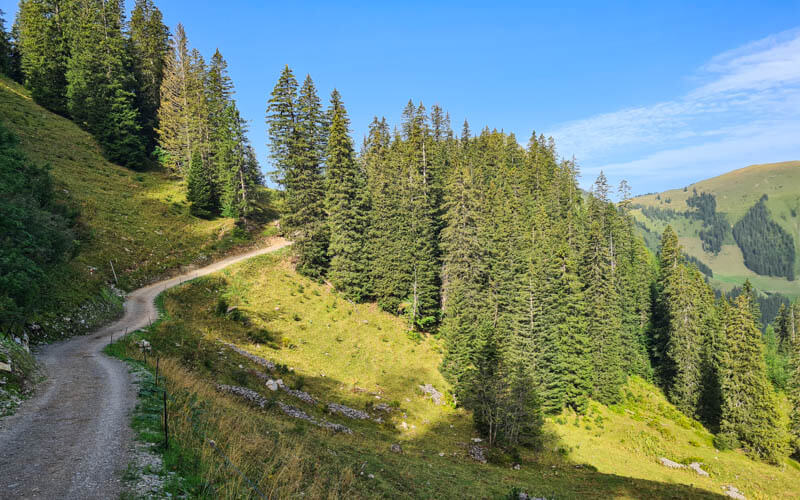
Then we join a dirt service road for a bit.
We were happy for the early morning shade and forested sections after getting too much sun the day before.
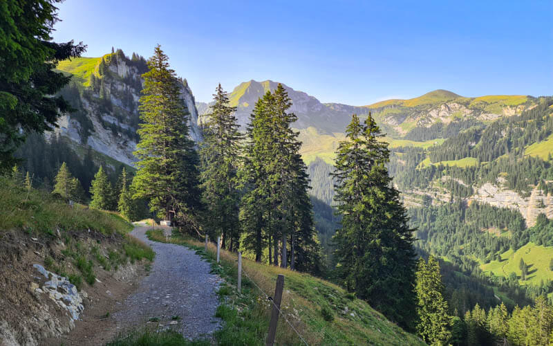
One of my favorite views from this day, looking at the Chingstuel peak. We’ll be hiking under that peak soon.
Loved the lush forest sections, totally different from the day before. The trail gets quite narrow and overgrown here.
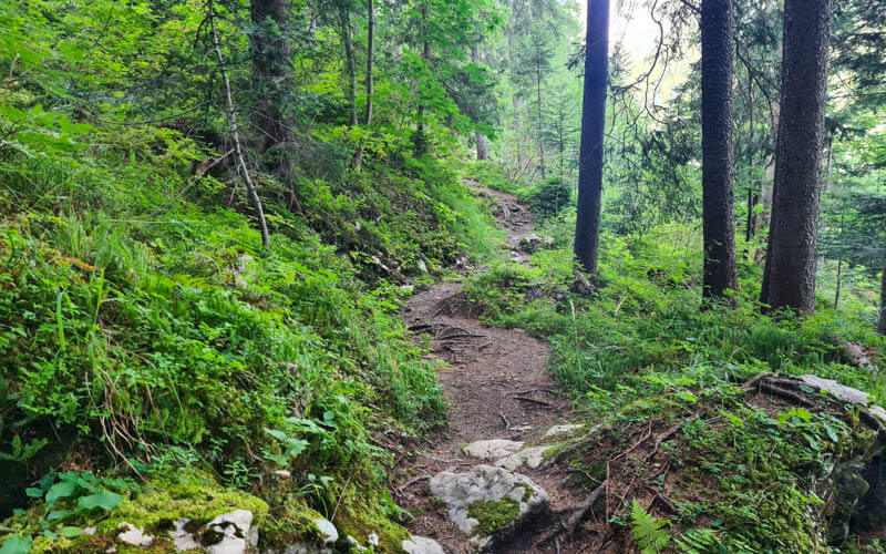
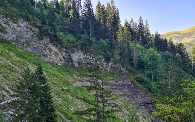
This section looked like a rockslide had either happened recently or was about to happen or both. Proceed carefully but quickly.
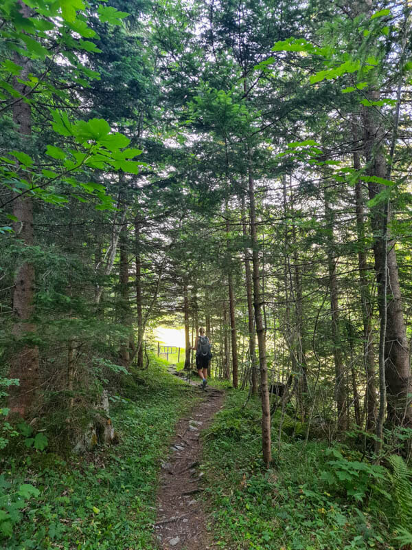
More beautiful forest with the morning light peeking through.
Hiking around Melchtalalp
Loved emerging from the forest to this spectacular view.
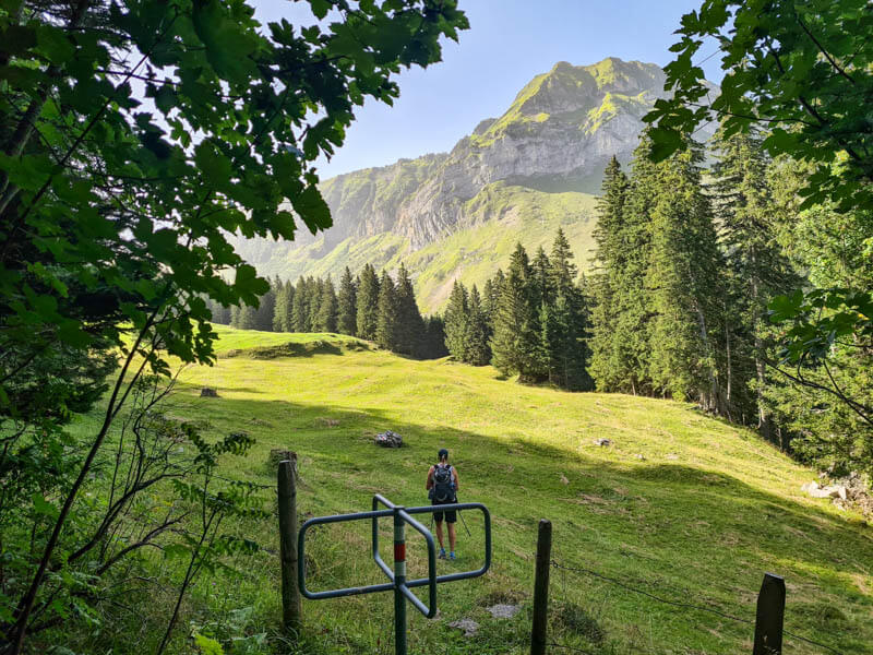
Walking through some pastures, passing through several cow gates.
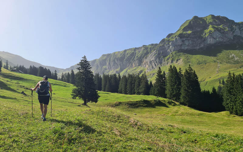
In the distance, I could see the Käserstatt chair lift from the Hasliberg resort. It’s so fun when you realize how different mountain areas are connected to each other.
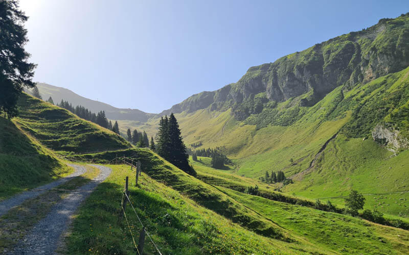
Now we start our last big climb on this trail in the sun. Glad we did this early in the day before it got too hot.
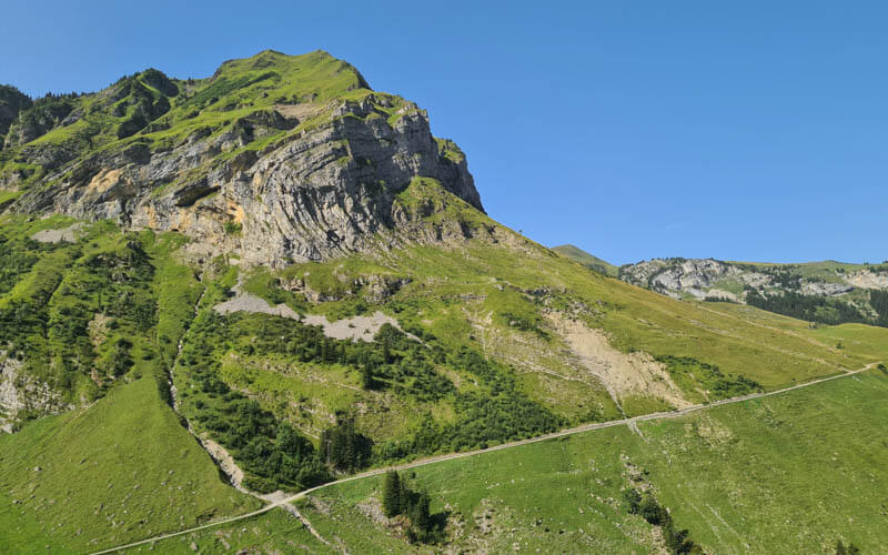
Passing a few dairy huts on the way but no signs of life beside the cows.
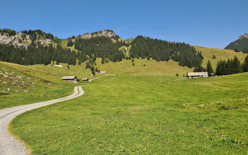
Looking back at the Melchtalalp as we climb.
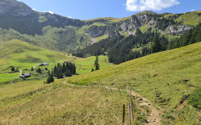
The last part of the climb up this grassy hill.
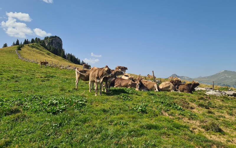
Reaching the top of the climb, with the Horn peak on the left.
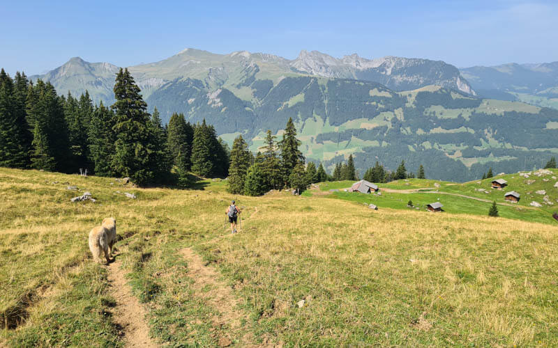
Hike west towards Brünig Pass
After crossing over the pass (labeled Sunnentag on the map), you can see the Brienzer Rothorn mountain in the distance, which is Stage 8 of the Tell Trail. We’ll leave that for next summer.
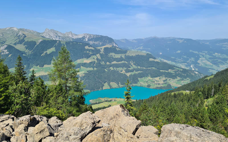
You can also see the Lungern lake, where we will finish in a couple hours.
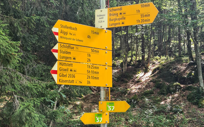
As you head west towards the Brünig pass, you will see signs pointing to Lungern in multiple directions as shown below. You may feel concerned you are hiking in the exact opposite direction of your final destination. And you are. But it’s a tall mountain, so hiking this way gives you a more gradual way down. The other trails to Lungern head straight down the mountain on steep switchbacks in the forest.
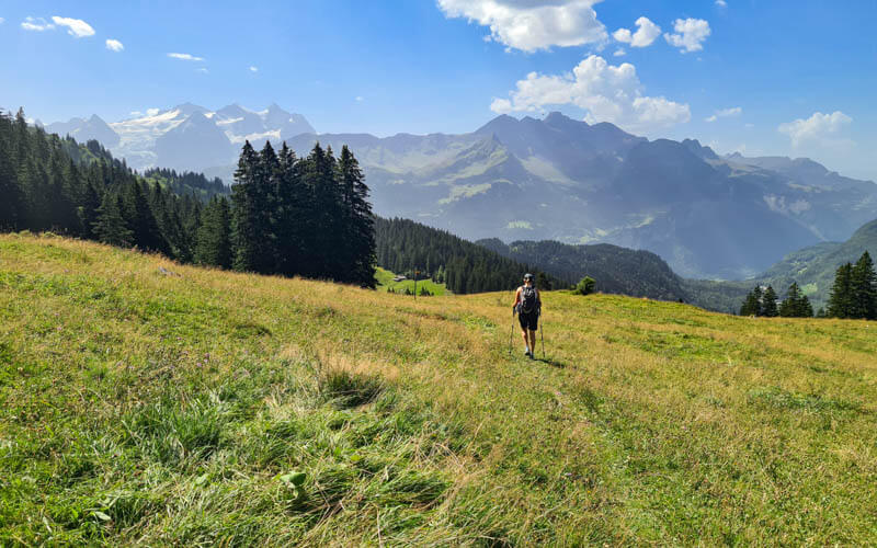
On our route, you often get these gorgeous views of the Jungfrau Region mountains.
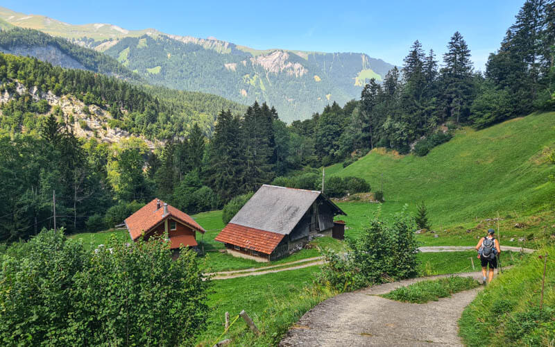
Winding down past mountain chalets and barns, sometimes walking on service roads for a bit.
Down to Lungern, with detour
The trail leads you to these train tracks. You can turn right and follow signs to Lungern like we did. Or you can follow the official trail by turning left, walking for a couple mins, then turn right onto Route 4 towards Lungern. Either trail will get you to Lungern, so don’t worry.
If you don’t want to hike anymore, you can turn left and walk a few minutes to the Brünig train station and ride home from there instead. There’s also a restaurant at Brünig pass if you need sustenance.
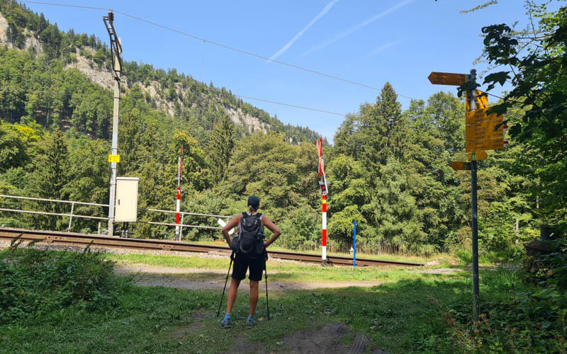
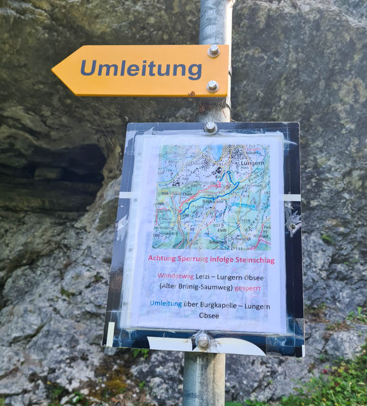
Then the trail heads uphill to the road. Here the trail splits at this trail sign with “Umleitung” aka detour. Due to rockslide damage, there is a semi permanent detour from the main trail down to Lungern. Make sure to follow the Umleitung sign, which points you to a higher trail above the cliffs. As you climb a little elevation, you may feel that you are the wrong trail. But don’t worry, you are doing it right.
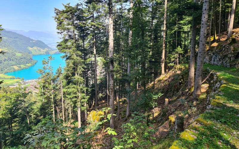
The detour trail traverses the steep mountain, mostly in the forest, which occasional views of the Lungern lake. So pretty from up here!
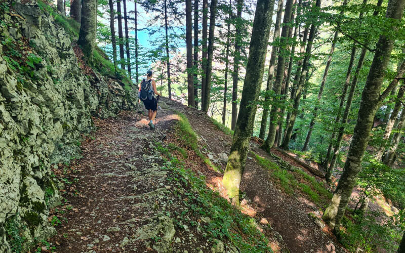
A few switchbacks through the forest, but mostly a mild descent.
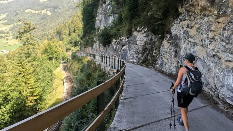
Another section along the train tracks on this paved road.
Ending in Lungern
Getting close to the lake. We were happy to be higher up on the hill so we could get this nice overview pic of the lake.
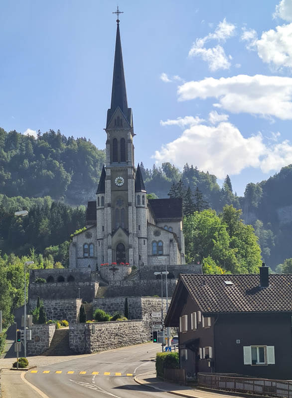
The trail leads to this church on the edge of town.
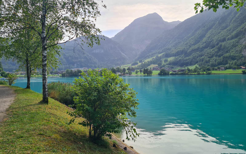
We stopped at the Volg grocery to get picnic supplies and went down to the lake to eat and swim.
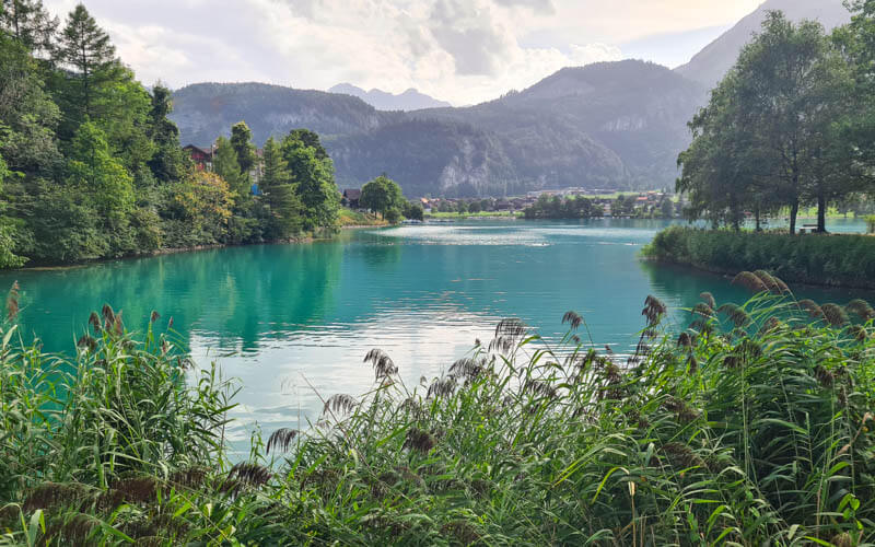
Our favorite spot to picnic and swim is the island – see on map.
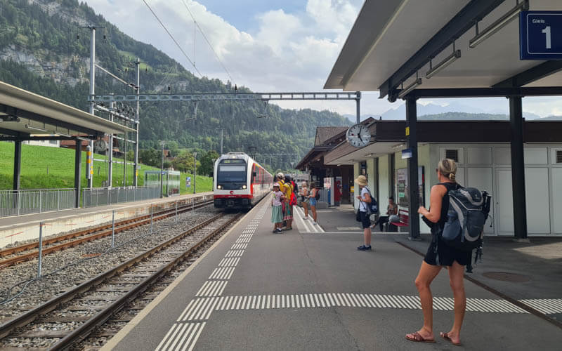
From the lake, it’s about a 10 min walk up to the Lungern train station (see on map). Check the train schedule on SBB.ch.
The end! Now it’s time for you to plan this hike for next summer or perhaps sooner, right?





