
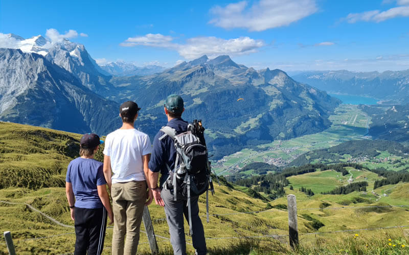
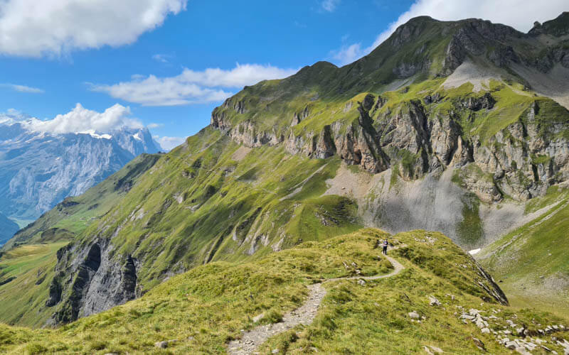
This panorama trail has big mountain views and a lot of variety in the terrain, with ridges, lakes, grassy marshes, cliffs and dramatic peaks. It has just enough climbing to make it feel like a proper hike, but not so much that our kids complained.
This one way trail starts in one mountain resort and ends in another, with a scenic bus and train ride back to your starting point. There are beautiful alpine lakes at along the way, where there are picnic areas with fire pits and tables and also nearby restaurants.
It’s a full day outing that requires a little planning so you don’t miss the last bus. Keep reading for all the info you need to plan the hike.
Note: The mountain bus service is back! To do this one way trail, you must reserve a spot on the shuttle at least one day before.
| Location: | Berner Oberland, Switzerland |
| Address: | Meiringen-Hasliberg cable car |
| Car: | Parking: Steinmühlestrasse 40, 6072 Meiringen 25 mins from Interlaken, 1hr20 from Zürich |
| Train: | Train station: Meiringen, then 10 min walk to cable car 20 mins from Interlaken, 2hr15 from Zurich |
| Trail: | 10.2 km one way, about 3.5 hours |
| Elevation: | 150m up, 490m down, highest point 2250m |
| Skill: | moderate, red/white mountain trail, Swiss trail rating T2 |
| Condition: | narrow footpath, some steep sides but no cliff drop-offs, not suitable for strollers |
| Services: | restaurant and WC at start, mid point and end of trail |
| Cost 2024: | Round trip adult CHF 58. Discount with Swiss travel cards. |
| Open: | late June to mid-October, first ascent 8:30, last bus 17:10. |
| More info: | www.meiringen-hasliberg.ch • engstlenalp-bus.ch • webcam |
Check out our Horizontweg video on YouTube.
Gallery



Location
This trail is located in eastern part of the Berner Oberland region of Switzerland.
Here is part of the summer hiking map for Hasliberg, just showing the Horizontweg trail (trail D). See the full Hasliberg summer map here.

Trail map
Here is the detailed trail map. Starting in Meiringen, you ride a series of gondolas to the Alpen Tower. Then you hike across the mountain to an alpine lake at Engstlenalp. Then then ride a bus and train back to your starting point.
The total distance is about 10.2 km and took us about 3hr walking time, plus time for lunch and snack breaks.
See trail on Komoot • SchweizMobil
The path is a red/white mountain trail, mostly a narrow dirt footpath with rocky sections and lots of uneven terrain. There are often steep slopes on the side, but no cliff drop-offs. I found it to be a relatively safe trail and would bring children from about 7+ with hiking experience.
How to get there
You’ll start and end your day in Meiringen. It’s a one way trail, starting by riding aerial cableways from Meiringen to the Alpen Tower viewpoint.
Then hike to Engstlenalpsee. To return to Meiringen, you ride the private shuttle bus back to Innertkirchen. Then train to Meiringen.

You must reserve a spot on the shuttle at least one day in advance!
By car:
Drive to Meiringen and park in the metered parking near the Meiringen-Hasliberg cable car at Steinmühlestrasse 40, 6072 Meiringen. Then a short walk up to the cable car. You can pay for the parking using the Sepp-Parking app.

At the end of the hike, the shuttle drops you off at Innertkirchen. Then you ride a train to the Alpbach station shown below, which is closest to the parking.
You might want to park closer to the train station so you don’t have to walk so far to your car when you are tired. We parked close to the cable car and wish we had done that differently.
By public transport:
Take a train to Meiringen. There are convenient connections from Interlaken (about every 30 mins on the xx:04 and xx:33) or Luzern (every hour on the xx:02).
From the Meiringen train station, walk about 10 mins to the Meiringen-Reuti cable car.
At the end of the hike, the shuttle drops you off at the Innertkirchen train station. From there, you can take a train to Meiringen, then ride another train to Interlaken or Luzern.
Planning your day
Ticket prices
Buy your ticket at the Meiringen-Hasliberg cable car. They sell a special Horizontweg round trip ticket, which includes the entire journey: mountain transport from Meiringen to Alpen tower, the bus from Engstlenalp to Innertkirchen, and the train from Innertkirchen back to Meiringen.
In 2024, this Horizontweg ticket costs CHF 58/adult, CHF 29/children aged 6-15.99. See current prices.
Discounts:
You get a discount with GA, SBB Day Pass, SBB Half-fare card or Swiss Travel Pass. Children under 6 and those with a SBB Junior card ride free.
If you have the Tell Pass or Berner Oberland Pass, it includes your ride up the Hasliberg Alpen Tower. You only need to pay for the bus and train back to Meiringen, which will cost you CHF 22 for the bus and CHF 2.20 for the train. You can also purchase this at the cable car ticket desk.
Operating times
In general, this trail is possible from about mid-June to mid-October. The gondola to the Alpen Tower opens for summer season in mid-June (in 2021 scheduled for 12 June). The Engstlenalp bus runs on weekends in June and every day from the first week of July through mid-October. But check the current schedule before heading out.
The Meiringen-Hasliberg cable car starts running at 8:30, the gondola up to the Alpen Tower at 9:00.
Bus reservations
You’ll need to reserve a spot on the private shuttle bus that runs from Engstlenalp to Innertkirchen. It has limited spots and only runs twice in the afternoon.
You must reserve at least one day in advance. Instructions here: engstlenalp-bus.ch
Make sure to plan your day so you reach the bus in time. We started hiking about 11:00 and arrived in Engstlenalp at about 14:30.
Photo story of the trail
1. Riding up to Alpen Tower
From Meiringen, we rode a cable car up to Hasliberg Reuti. Then we switched to gondola up to Mägsialp. Then we switched to another gondola up to Alpen Tower.

From the Alpen Tower restaurant, I recommend first walking past the restaurant out to the western viewpoint before starting the hike. It’s a short easy path, well worth the detour.

2. Starting the Horizontweg trail
When you are ready to start the hike, walk back past the restaurant and through the gondola station and start walking east. Your trail is the highest one in the pic below.
Follow signs to Engstlenalp. The estimated time was pretty accurate for us.

Looking back to the Alpen Tower.

Starting on a narrow dirt footpath.

The trail winds around this mountain.
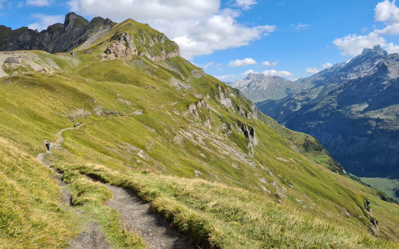
The mountain slopes are often steep on the sides of the trail, but not a sheer drop off. We felt safe.

Don't miss out on today's trending deals!
Join thousands of users enjoying exclusive benefits right now.
Pretty easy walking on this part.

3. Uphill climb to Talistock
Now the toughest uphill part of the trail, only about 600m long but quite steep in parts.

Looking back down the trail.
The climb ends at the top of this lift (not running in summer), aka Talistock.

Lots of people crowd at the top, taking a break, like us below. I recommend walking a bit further down the ridge to find a quieter spot.
4. Along the ridge
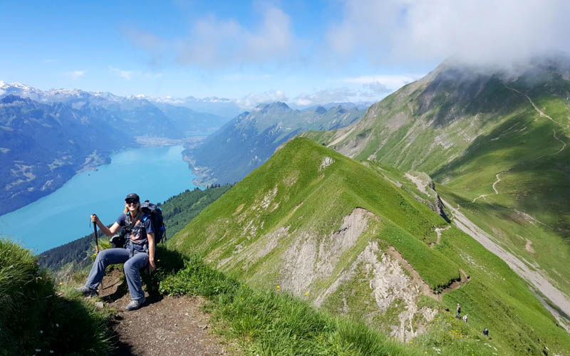
Now you walk along the ridge toward Tannalp. I loved that you get long views on both sides of the ridge.

There are a few downhill stretches that aren’t super difficult but I was glad to have my hiking sticks.

But mostly, the ridge trail is easy walking.

Some parts are narrower than others, but I didn’t feel that it was particularly dangerous and we saw several families with small children here.
You can almost see the Engstlenalp lake in the distance, which is our final destination.

So much drama in this mountains.
5. Down to Tannalp
The ridge descends to the Tannensee lake and the small hamlet of Tannalp, those houses in the distance.
I love the grassy marshes on this part.

View towards the Melchsee Frutt area.

Lots of rolling grassy hills here.

The trail leads you to the shore of the Tannensee lake.

Walk past the picnic area and turn right on the road, following signs to Tannalp.

Walk a few minutes along the paved road until you reach Tannalp, with a restaurant, chapel and barns.

6. From Tannalp down to Engstlenalp
From Tannalp, follow trail signs to Engstlenalp. There are a few trails but most everyone is on the path to Engstlenalp.

You start down on a wide gravel path.

Then it gets a bit narrow. This part was very crowded the day we were there. There were lots of hikers and mountain bikes going both directions. Plus there was a trail running race, with runners buzzing by. This was my least favorite part of the trail.

The trail winds around the mountain to Engstlenalp.

Arriving in Engstlenalp, just a few barns and hotel/restaurant.

The bus picks up in the parking lot. It’s a yellow PostAuto bus. I was worried there wouldn’t be enough space with so many hikers. So we had made reservations. But no one checked the reservations and there was room for everyone on the bus. The road is one-lane the whole way down the mountain, so I was happy not to be driving. The bus drops you at the train station in Innertkirchen, where you catch the train to Meiringen. If you came by car, get off at the Alpbach station, which is closer to the parking.

7. Detour to Engstlensee lake
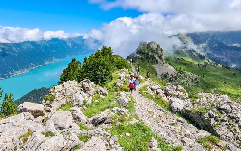
If you have time before the bus comes, I highly recommend taking the short detour up to the Engstlensee. It’s less than 10 mins from the bus stop up to the picnic area next to the water.

Enjoy the view but keep an eye on your watch so you don’t miss the bus.






13 responses
The bus is in operation already! Reservation is a must and only from 4 pax onwards
I saw that as well. So happy this trail is still possible with this mountain bus.
Just FYI this bus is no longer in service as it was losing too much money! I did the hike as an out and back though!
Glad you figured out how to do the trail without the bus. They have reinstated the bus service, hopefully it sticks around.
This looks like an amazing hike but I am worried about the bus schedule. The hike is at the end of my ability and if I hiked slower, taking ,ore breaks I would be worried we might miss the bus back to Meiringen. Can you suggest a hike not requiring the bus? I see the Sonnenweg trail from the website but I am unclear of how to get down from Kaserstatt. We are thrilled to return to Switzerland next summer. Your website is so helpful.
Most hikes on my site do not require a bus. If you want to hike in the Hasliberg area, perhaps the Muggestutz trail. Or you could try the Bonistock loop at Melchsee, which is near the end of the Horizontweg trail.
As usual, you helped us yo hace a great day of hiking. Thanks again.
thanks for youre great movie we like to do it olse, where is the bus station to go back, wat is the price, and can we bay ticket on the bus.. hope to heare greathings sjaak en cyn from holland… netherlands
All the information for this hike should be in the post. Yes, you can purchase tickets on the bus shuttle from Engstligenalp.
Love your channel. Thank you for all the hard work you do!
Thank you! And thanks for following along. It’s nice to know my work is appreciated.
Thanks again for the details here. It’s an excellent hike, spectacular views all the way today. I decided to extend the hike by continuing to trubsee via Jochpass ending at Engelberg. The addition was a little harder than i thought (The uphill to Jochpass) but very much worth it. Started at 11am from the gondola Bahn Alpen Tower, and arrived with half an hour to spare before the last gondola down from Trübsee to Engelberg (17.15). Fantastic day!
Happy hiking!
Note: trains from Engelberg back to Luzern or Zurich run every hour only at that time of day, so a little wait, but enjoyed the rest 🙂
Thanks for the report! I’ve wanted to do this longer hike as well so it’s good to hear directly from someone who has done it. Glad you caught the last lift down or that would have been an extra long day.