In October 2019, we spent our fall break hiking around the lakes district in northern England, doing a few sections of the Wainrights famous Coast-to-Coast long distance trail. Not only was a great experience for our family, but a lucky choice since it snowed in Switzerland while we were away, making hiking there not possible.
Now that our children are a bit older, we were able to do more challenging hikes, basically hiking up and over a mountain each day. But still we had to adapt almost every trail suggestion we found, since they are geared to adults who can walk fast without breaks. With kids, even older kids, you need to adapt distances and expectations. So I’m sharing our itinerary, trail maps and experience here in case you might want to follow in our footsteps.
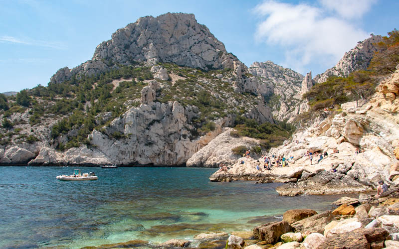
We loved the scenery in the Lakes District, more wild and rugged than what we’re used to in Switzerland. We didn’t have great weather, with some rain on most days and a lot of rain on a couple days, not unusual for this area. And my younger son had a broken finger in a cast we had to protect from the wet (with that funny blue thing on his arm). But we were prepared with full rain gear and it made for an exciting adventure we’re still talking about.

Trip Overview
We flew into Manchester, rented a car and drove about 2 hours to the lakes district. We stayed in at traditional B&Bs in three villages: Ambleside, Patterdale & Keswick. We did 6 hikes in the lakes district. In a couple cases, we hiked from one village to the next and had our luggage transferred by taxi. We finished with a hike on the coast, then we drove to Liverpool and flew back home.
- Day 1: Fly to Manchester, drive to Ambleside and check in our B&B.
- Day 2: Bus to Windermere, hike 12 km over Wansfell Pike ending back in Ambleside.
- Day 3: Send luggage to next B&B in Patterdale. We drive to Grasmere, park in long term parking and hike 12 km to Patterdale.
- Day 4: Loop hike 13 km from Patterdale to Place Fell and back.
- Day 5: Send luggage to Keswick. We hike 11.5 km from Patterdale over Sticks Pass to Thirlmere. Bus to Grasmere to pick up car. Drive to next B&B in Keswick.
- Day 6: Loop hike 9.5 km to High Seat & Bleaberry Fell. Return to Keswick.
- Day 7: Hike 4 km to Cat Bells and back. Return to Keswick.
- Day 8: Drive to St Bees and hike 6 km along coast. Drive to Liverpool and stay in airport hotel.
- Day 9: Early flight back home to Switzerland.
We planned to leave the car for the week in Ambleside and hike between towns over the week, using luggage transfers. But bad weather made us shorten a couple of our hikes and adjust our plans a bit.
Planning resources
We used the Macs Adventure Lakes District itinerary as a rough guide for our trip. We did most of the hikes on this itinerary, but shortened all of them to match the needs of our family. My husband has booked walking holidays through Macs Adventure before and really liked them. If you book a self-guided walking tour through them, they arrange all the accommodations, luggage transfers and taxis, which makes the trip hassle free. We chose to book everything ourselves because it’s cheaper that way when traveling with four people, but much more hassle.
![]()
My favorite resource for trail maps was Mud & Routes. Love love love them! They detail dozens of trails in this area, giving me so many options. I mostly had to reconfigure and shorten the hikes I found here, but it was an excellent resource.
![]()
What to wear: Muddy bogs & very wet feet
This region is notoriously wet and full of the boggiest bogs you ever might see. I knew this, yet I didn’t really understand what we were getting into until I stepped into my first bog and realized how unavoidable they were. The trails often just meander through sopping wet boggy mud where you can barely see path and there’s just no way around it. No joke! I didn’t believe it until I saw it.
After picking our way carefully for 15 mins through our first bog, keeping our feet as dry as possible, we climbed over a wall to see another enormous bog and no way around it. So eventually we just slogged right through it and gave into the inevitable wet feet.

We all had high quality waterproof hiking shoes and none of them completely protected us from the wet. Boots definitely help as mud and water quickly slosh over the side of low profile shoes. My husbands all leather boots were the driest of the bunch. Mysteriously my son’s low profile trail running shoes always had one dry foot and one soaking wet foot, not always the same one.
Each night we stuffed our shoes with newspaper and set them on the radiators to try to dry them out. But most mornings, the shoes were still quite wet. One of our lodgings had a drying room that was super warm with hot vents you could place your shoes over. Everything was dry and warm each day. So happy! This is definitely something to seek out when booking accommodations.
We all brought high quality rain jackets, rain pants, and rain ponchos. We had waterproof covers for our backpacks. We had gloves but they were quickly soaked. So next time we would bring waterproof gloves. Under our rain gear, we were warm, with long sleeve shirts and layers of fleece and down jackets. On the sunny days, we were in often short sleeves unless the wind picked up.
Getting There
Manchester is the closest international airport to the Lakes District. From Manchester, it’s about 1hr50 by car and 2hr40 by train/bus to Ambleside where we started our trip. We happened to get a cheap flight that had us leave out of the Liverpool airport, which is about the same distance as Manchester. Happily, our car rental allowed us to drop the car there instead of going back to Manchester.
Once you are in the Lakes District, there are lots of buses and ferry servicing the whole region. See the Cumbria bus timetables and Keswick visitor website.
Lots more info about getting around on the Lakes District National Park website.
 We had planned to take a ferry from Ambleside to Bowness and start our hike there, following the hike suggested by Macs Adventure. But the ferry drops off almost 4 km from the where the real hike starts, and that walk is mostly on roads through town. As much as I wanted to be on the water, we thought this extra walking was pointless.
So instead we took a bus from Ambleside to the Windermere train station (check bus schedule here, 555, 599. about £17 for our family of four) and started our hike here. Good decision!
The hike starts up to a lovely viewpoint at Orrest Head, then wanders through a bunch of boggy fields. At about the halfway point, it dips down, passing through a tiny village of Troutbeck. Then straight back up to the highest point at Wansfell Pike. Then a steep descent on many stairs to Ambleside.
We had planned to take a ferry from Ambleside to Bowness and start our hike there, following the hike suggested by Macs Adventure. But the ferry drops off almost 4 km from the where the real hike starts, and that walk is mostly on roads through town. As much as I wanted to be on the water, we thought this extra walking was pointless.
So instead we took a bus from Ambleside to the Windermere train station (check bus schedule here, 555, 599. about £17 for our family of four) and started our hike here. Good decision!
The hike starts up to a lovely viewpoint at Orrest Head, then wanders through a bunch of boggy fields. At about the halfway point, it dips down, passing through a tiny village of Troutbeck. Then straight back up to the highest point at Wansfell Pike. Then a steep descent on many stairs to Ambleside.  We could have taken the bus to Grasmere, but instead we drove and parked in the Red Bank Road car park which allow long-term parking. You can buy a 3 day or 7 day parking pass and use at several parking lots in the area. This includes overnight parking during the validity period.
In Grasmere, there is a small grocery Co-op Food and several cafes where you can get sandwiches for a picnic. We also bought some of the “World’s Best Gingerbread” at Sarah Nelson’s, so delicious!
We started in the rain and it got increasingly worse over the first 8 km. As we crossed the pass, the rain and wind were so strong, I had a small panic that we might have made a horrible mistake. We had to cross a small stream, which should have been easy. But it was so full of water, the normal stepping stones were flooded over. So we stomped our way through the icy water and continued on.
But the sun came out eventually and we were glad we hiked instead of driving to our next destination. More stories to tell!
We could have taken the bus to Grasmere, but instead we drove and parked in the Red Bank Road car park which allow long-term parking. You can buy a 3 day or 7 day parking pass and use at several parking lots in the area. This includes overnight parking during the validity period.
In Grasmere, there is a small grocery Co-op Food and several cafes where you can get sandwiches for a picnic. We also bought some of the “World’s Best Gingerbread” at Sarah Nelson’s, so delicious!
We started in the rain and it got increasingly worse over the first 8 km. As we crossed the pass, the rain and wind were so strong, I had a small panic that we might have made a horrible mistake. We had to cross a small stream, which should have been easy. But it was so full of water, the normal stepping stones were flooded over. So we stomped our way through the icy water and continued on.
But the sun came out eventually and we were glad we hiked instead of driving to our next destination. More stories to tell!  The Macs Adventure itinerary suggested this loop hike while in Patterdale, but it stayed in the valleys and skipped Place Fell, the high peak viewpoint, which seemed ridiculous to me. So I found this Place Fell loop hike, which I used as a base for my planning. My idea was to hike from Patterdale up to Place Fell then down to Howtown and take the ferry back. But high winds shut down the ferry, so we did the following 13.5 km loop instead. Good decision!
The climb up to Place Fell was tough but not too long. The views at the top were spectacular and I loved walking around on the top. But once we dropped down to the lakeside, it was a little boring, I must say. It’s often in the thick forest so you can’t see the lake much. Also you aren’t near the water but often high up on the side of the mountain. So I wish we could have continued to Howtown and taken the ferry back, which I think would have been much better.
The suggested hike went from Patterdale to Keswick, a total of 19.7 km. This was never going to happen so we shortened the hike, starting in Patterdale, hiking over Sticks Pass, then down the mountain stopping after 11.5 km at the bus stop at Legburthwaite. This still took us about 6 hours (4 hrs walking time) and we were beat, so good decision to shorten it!
One bad call was hiking the section between Patterdale and the Glenridding river instead of walking on the road as suggested by the itinerary. I really wanted to be on a path, not a road. But that path on the side of the hill through the ferns was so wet and boggy that I was cursing my decision for an hour.
In Legburthwaite, we were so happy to find a tiny cafe open where the kids and I got hot chocolate and scones while my husband went to catch the bus to Grasmere to get the car. (Well, actually he missed the bus because he was on the wrong side of the road and ended up hitchhiking, but that’s another story.) Then we all drove together to Keswick to check into our next B&B.
Thankfully we had very little rain this day, not too many bogs and mostly very pretty skies. But we were still a wet muddy mess by the end of it, for sure.
The Macs Adventure itinerary suggested this loop hike while in Patterdale, but it stayed in the valleys and skipped Place Fell, the high peak viewpoint, which seemed ridiculous to me. So I found this Place Fell loop hike, which I used as a base for my planning. My idea was to hike from Patterdale up to Place Fell then down to Howtown and take the ferry back. But high winds shut down the ferry, so we did the following 13.5 km loop instead. Good decision!
The climb up to Place Fell was tough but not too long. The views at the top were spectacular and I loved walking around on the top. But once we dropped down to the lakeside, it was a little boring, I must say. It’s often in the thick forest so you can’t see the lake much. Also you aren’t near the water but often high up on the side of the mountain. So I wish we could have continued to Howtown and taken the ferry back, which I think would have been much better.
The suggested hike went from Patterdale to Keswick, a total of 19.7 km. This was never going to happen so we shortened the hike, starting in Patterdale, hiking over Sticks Pass, then down the mountain stopping after 11.5 km at the bus stop at Legburthwaite. This still took us about 6 hours (4 hrs walking time) and we were beat, so good decision to shorten it!
One bad call was hiking the section between Patterdale and the Glenridding river instead of walking on the road as suggested by the itinerary. I really wanted to be on a path, not a road. But that path on the side of the hill through the ferns was so wet and boggy that I was cursing my decision for an hour.
In Legburthwaite, we were so happy to find a tiny cafe open where the kids and I got hot chocolate and scones while my husband went to catch the bus to Grasmere to get the car. (Well, actually he missed the bus because he was on the wrong side of the road and ended up hitchhiking, but that’s another story.) Then we all drove together to Keswick to check into our next B&B.
Thankfully we had very little rain this day, not too many bogs and mostly very pretty skies. But we were still a wet muddy mess by the end of it, for sure.  The itinerary suggested the Derwentwater and Walla Crag Circuit, which in retrospect, would have been a better choice. Instead I cobbled together the following trail, with the goal of catching the three highest points: High Seat 608m, Bleaberry Fell 590m and Walla Crag 376m. Bad decision! In fact, they are not really peaks because the top of this mountain very round. So you don’t get that sense of accomplishment like you might on a typical mountain.
Also, every website warned “This walk is best undertaken after a period of dry weather due to the extremely boggy section between Bleaberry Fell and High Seat.” They were not kidding! I thought, it can’t possibly be worse than what we’ve already seen. Wrong, it was 100% worse.
The entire mountain top was one enormous bog that was extremely challenging to navigate, let alone walk on. There are almost no trail signs and no trail markers and the trail is very difficult to see. You absolutely need a GPS device to navigate up at the top. Even with using my GPS trail map on my phone, we lost the trail multiple times and had to trace our steps. That said, we weren’t the only dum dums up there, so that made me feel a little bit better.
We started the day riding the ferry from Keswick to Ashness Gate, a short 10 mins ride but very lovely. The ferry runs hourly during the summer schedule, late March to early November. It cost about £7 for our family of four for this short journey. If we expected better weather, we might have started our hike in Keswick and ended at the boat and done a long boat ride at the end of the day.
The itinerary suggested the Derwentwater and Walla Crag Circuit, which in retrospect, would have been a better choice. Instead I cobbled together the following trail, with the goal of catching the three highest points: High Seat 608m, Bleaberry Fell 590m and Walla Crag 376m. Bad decision! In fact, they are not really peaks because the top of this mountain very round. So you don’t get that sense of accomplishment like you might on a typical mountain.
Also, every website warned “This walk is best undertaken after a period of dry weather due to the extremely boggy section between Bleaberry Fell and High Seat.” They were not kidding! I thought, it can’t possibly be worse than what we’ve already seen. Wrong, it was 100% worse.
The entire mountain top was one enormous bog that was extremely challenging to navigate, let alone walk on. There are almost no trail signs and no trail markers and the trail is very difficult to see. You absolutely need a GPS device to navigate up at the top. Even with using my GPS trail map on my phone, we lost the trail multiple times and had to trace our steps. That said, we weren’t the only dum dums up there, so that made me feel a little bit better.
We started the day riding the ferry from Keswick to Ashness Gate, a short 10 mins ride but very lovely. The ferry runs hourly during the summer schedule, late March to early November. It cost about £7 for our family of four for this short journey. If we expected better weather, we might have started our hike in Keswick and ended at the boat and done a long boat ride at the end of the day.  We chose the short hike up Cat Bells on the west side of the Derwent Water lake near Keswick. It was a great hike and quite popular, the most crowded of the trip. It has all the feels that a mountain hike should have, panorama views, with varied, dramatic scenery in all directions. The trail is easy to follow, though there are a couple rocky scrambles that felt a little dangerous.
We planned to do the loop shown below. But it was so nice on the ridge, that we decided to simply hike there and back. I think the loop would be nice too, so I left it on the map just in case.
We drove to this hike and parked on the side of the road near the trailhead, near the Cattle Grid bus stop. Make sure to heed the “no parking” signs and markings on road. We saw a cop giving out parking tickets to several cars. It’s clearly a money maker for them.
We also thought about taking the ferry from Keswick here, but we slept in too long. If you do that, you could take the ferry to the Hawes End and start your hike there. Here’s one trail variation that goes back on the side of the mountain instead of the ridge.
We chose the short hike up Cat Bells on the west side of the Derwent Water lake near Keswick. It was a great hike and quite popular, the most crowded of the trip. It has all the feels that a mountain hike should have, panorama views, with varied, dramatic scenery in all directions. The trail is easy to follow, though there are a couple rocky scrambles that felt a little dangerous.
We planned to do the loop shown below. But it was so nice on the ridge, that we decided to simply hike there and back. I think the loop would be nice too, so I left it on the map just in case.
We drove to this hike and parked on the side of the road near the trailhead, near the Cattle Grid bus stop. Make sure to heed the “no parking” signs and markings on road. We saw a cop giving out parking tickets to several cars. It’s clearly a money maker for them.
We also thought about taking the ferry from Keswick here, but we slept in too long. If you do that, you could take the ferry to the Hawes End and start your hike there. Here’s one trail variation that goes back on the side of the mountain instead of the ridge.  So we called a taxi and asked him to take us near the St. Bees lighthouse. Although the map shows a parking lot near the St. Bees lighthouse, the taxi driver told us this road is closed to non-local traffic. So he dropped us in Sandwith at this dirt road. We just walked a couple minutes down this road to connect with the coastal trail. Good decision!
We had a gorgeous sunny day, couldn’t have asked for better. The trail was beautiful, so nice to be on the coast again. It was super easy walking after hiking over mountains all week. It ends at a beach and little seaside park with a big playground, cafe, WC, and ice cream truck.
It was a perfect end to our hiking trip, absolutely loved it!
So we called a taxi and asked him to take us near the St. Bees lighthouse. Although the map shows a parking lot near the St. Bees lighthouse, the taxi driver told us this road is closed to non-local traffic. So he dropped us in Sandwith at this dirt road. We just walked a couple minutes down this road to connect with the coastal trail. Good decision!
We had a gorgeous sunny day, couldn’t have asked for better. The trail was beautiful, so nice to be on the coast again. It was super easy walking after hiking over mountains all week. It ends at a beach and little seaside park with a big playground, cafe, WC, and ice cream truck.
It was a perfect end to our hiking trip, absolutely loved it!