During spring break, our family walked on the Pembrokeshire Coast Path in Wales, a long distance path covering 300km. We hiked seven days, about 12-20 km each day, staying overnight in villages along the way. Even though our boys are great hikers, we had never done a multi-day hike like this. So it was very exciting to see them do well and enjoy it. The trail is very beautiful, sea cliffs on one side, rolling farmland on the other side, lots of flowers, birds and even some seals. We loved this special holiday and want to go do it again right away.
Below are details for where we hiked, where we stayed, how we transferred luggage, etc. Don’t get overwhelmed. There are tour companies that will arrange all this for you, so you just show up and hike. But we booked it ourselves to save some money. Either way, if your family likes to hike, I’m sure you’ll love it.
First a video of day 1 on the trail, just to give you a taste.
Overview
The Pembrokeshire coast path in Wales is a designated national trail, 186 miles (299 km) from Cardigan to Amroth. The trail has its own website, which has current news and many resources.

This map from by Wikishire, CC BY-SA 4.0 (Wikipedia Commons)
Some people do day hikes on certain sections. Some do multi-day journeys, staying overnight in towns along the way. To do the whole trail, an average adult will break this up into about 15-18 sections, completing the trip in about three weeks including a couple rest days.
What we hiked
We hiked seven days on this path, from Cardigan, the northeast start of the path, to Solva near St. Davids, a total of about 112 km.

- Day 1: St. Dogmael’s to Ceibwr Bay – 11.5 km (7 mi), 380m elevation gain
- Day 2: Ceibwr Bay to Newport – 13 km (8 mi), 420m elevation gain
- Day 3: Newport to Fishguard – 18.5 km (11.5 mi), 430m elevation gain
- Day 4: Fishguard to Pwll Deri – 16 km (10 mi), 425m elevation gain
- Day 5: Pwll Deri to Trefin – 14.5 km (9 mi), 285m elevation gain
- Day 6: Trefin to Whitesands – 18 km (11.2 mi), 400m elevation gain
- Day 7: Whitesands to Solva – 20 km (12.5 mi), 365m elevation gain
Scroll down to the bottom of this post for details for each stage, with trail maps, pictures, where we stayed and ate.
Quick impressions
Although every section is very beautiful, my favorite section was Day 4: Pwll Deri to Trefin. IWe saw seals on this section and I have the best pics from that day. My least favorite section was Day 1: St Dogmael’s to Ceibwr Bay. At the time, I loved it. But as we kept hiking, it was consistently in last place.
The hardest section for us was Day 6: Trefin to Whitesands because it was so long. Day 1 & 2 were supposed to be the most difficult, but maybe because some people combine those into one day. In two parts, they weren’t so hard.
Day 6 also had the prettiest sandy beach, Traeth Llyfn, which is a short hike from Abereiddy Beach or Trefin. Whitesands beach near St. David was also very nice, but since you can drive directly there, it’s more civilized, with surf lessons and an ice cream shop and clearly expecting lots of visitors in summer.

The busiest section was between Whitesands and Porthclais Harbor, probably because it’s close to St. Davids, a tourism hub in this area. Plus it was a nice sunny day and super pretty.
We saw seals on two sections, on Day 4 between Fishguard and Strumble Head and on Day 6 between Abereiddy and Whitesands. It’s not unusual but you need calm weather and a bit of luck.

You can walk the trail either directtion, but I kept thinking I might prefer to walk eastward on the north coast sections, because then the sun is at your back. We were often walking late (finishing at 18:00) so the sun was low, casting long dark shadows on the cliffs ahead of us. But behind us everything was lit up with the golden light. After we turned the corner at Whitesands and were walking southeast, the sun was at our back and it so pretty in the late afternoon.
Book through a Tour Company
Before I get into any of the nitty gritty, it’s important to know that you can book the whole experience through a walking tour company that will arrange all lodgings, taxis, luggage transfers, etc. This will save you a lot of time and hassle.
On previous walking holidays in Cornwall and Wales, my husband used Mac Adventures and Contours Walking Holidays. Both were good but he slightly preferred Mac Adventures. We have no affiliation with either company.
For this trip, my husband chose to research and book everything himself because it was much more affordable when traveling with four people (economies of scale, etc.). But he said that with two people, he would probably use a tour company even if it was slightly more expensive than booking everything himself. It’s a lot of work and so many moving parts when trying to book so many different elements individually.
If you want to plan it yourself, read on for all the details.
Planning Resources
We bought two trail books and a map as shown below. We used the map a lot and really liked this version. The path is pretty easy to follow but there were a few times we needed that map and we didn’t always have mobile service. So having a physical map was helpful.

We used the light blue book on the left most because it was written in the same direction we were hiking. The blue and red book on the right was written in the opposite hiking direction, so it didn’t really match our experience. The books were a nice when planning the trip but not that necessary during the trip.
We also watched these YouTube videos from Mark & Howard, which are comprehensive and amusing.
Trail quality & difficulty
Some stretches are more difficult that others. But in general, we found the whole path well within our comfort zone and not particularly difficult for our children, aged 11 and 15, who are experienced hikers in Switzerland.
Many sections are close to cliff edges with no barrier. The trail is well built and if you stay on the trail, you are safe. But I did feel a little nervous watching my kids walking these sections. I would only go with kids that know how to safely hike and don’t take risks. If you easily get vertigo, this is not the trail for you.

The trail is mostly a narrow dirt trail as shown above. There are lots of rocks and uneven terrain. I liked having my walking sticks, especially going downhill. Some parts were through mud and wet grass, so we were happy to have our rain pants and gaiters even when it wasn’t raining.
Also note that you’ll likely hike a couple more km than the official trail map says, depending on where your lodgings are and how many detours to beaches and headlands you take. Each day, my fitness watch usually tracked 2-4 km more than the official trail map.
Lodgings
The idea of this long distance hike is that you hike all day to the next village where you stay overnight. The next day you hike again and stay overnight in the next village. And so on. You can pay for a luggage transfer service to take your bags to the next stop.
In most cases, the trail ends at a small village where you can find lodging, but you must book ahead. Some villages are so small (with only a handful of rooms to rent) that you might not find anything available. So on a couple days, we stayed two nights in the same village and took a taxi back and forth to the trailhead. It’s not quite as romantic and adds to your cost, but it’s also nice not to have to pack your luggage up for a transfer every morning.
We stayed in traditional B&Bs, small inns, and hostels. We booked family rooms when possible, which was more affordable that booking two rooms. Here’s where we stayed. Some were nicer than others. But all were fine, no big complaints. I give more details in my day-by-day trail reports below.
- St. Dogmael’s – Teifi Netpool Inn – small B&B with a family room for four people.
- Newport – Castle Inn – very nice small inn with a family room for four people.
- Fishguard – Hamilton Lodge. A backpackers hostel with shared rooms and living spaces, including a kitchen.
- Trefin – Cranog B&B – This tiny inn was our most luxurious lodging of the trip and breakfast was delish!
- St. Davids – Y Glennydd – A small hotel, not fancy but good value. Close to lots of services.
In some cases, the village is not directly on the trail/coast, so you need to take a taxi from the trail inland to reach the village, unless you want to walk some extra km.
Food
Most places we stayed included breakfast, which was usually cereal, yogurt sometimes with fruit, lots of toast, and a cooked traditional Welsh breakfast with fried egg, sausage, bacon, hashbrowns, grilled tomato, mushrooms, and black pudding. Usually there wasn’t a menu, they just asked what we wanted to eat and if they had it, they would make it. Our boys are rather picky and sometimes didn’t like the type of cereal on offer (Weetabix???) and survived on toast and OJ.

For lunches, we visited grocery stores along the way to gather supplies, but sometimes the village only had a convenience store or nothing. Some inns can pack you a lunch, but best to give them some notice. At our first inn, she didn’t have enough supplies on hand to pack a lunch on our first day. But later in the week, we asked at 19:00 when we checked in and they were fully prepared to provide a packed lunch the next morning.
For dinner, we sometimes ate at the inn, sometimes at pubs and cafes in town. Options are limited. Our best food by far was at the Castle Inn where we stayed Newport. We also liked Hooked in Fishguard for fish & chips.
Taxis
We took a lot of taxis during the trip. In most cases, it was from the end of the hike to our lodgings, then back to the trail the next day. Most taxi trips were between 6 – 15 pounds. We had no problems getting taxis, even in remote locations. We simply called the taxi company and they came within 15 – 30 minutes to pick us up. We had one day at Whitesands beach near St David’s where we didn’t have mobile reception on the trail and had to walk inland towards town for a couple minutes before being able to call for a taxi.
Remember to save the numbers for local taxi companies on your phone or write them down if you don’t have mobile service later.
Luggage Transfers
So you don’t have to carry your luggage between stops, you can book a luggage transfer company to drive your luggage from village to village. Then you only have to carry a day pack on the trail. This is very common in this area and there are several luggage transfer companies to choose from.
You pay per bag and the fee varies by distance. We paid between 30-40 pounds for each luggage transfer (4 bags). You can check the fees with this company.
We had one problem, when the car showed up a day early to pick up our luggage and fortunately the inn keeper told them to not take the bags. We had to pay for the day (12 pounds), even though it was a mistake. Otherwise, the luggage transfers went smoothly.
Typically, we had to have our bags packed and sitting near the front door at 9:30 each morning.
Getting to and from Pembrokeshire
This was the most complicated part of the trip, even more so because we were doing this during spring break before the summer bus schedule starts. So public transportation options were limited while we were there.
We flew to London, rented a car, and drove 4 hours to Haverfordwest in Pembrokeshire, where we parked our car at the bus terminal for the week (Haverfordwest SA61 2LJ, United Kingdom). It cost 7.50 (coins only) for 7 days, it didn’t seem like we could pay for longer than that. We could have taken a train here, but it was 3x more expensive than renting the car for the week.
In Haverfordwest, we took a bus to St. Dogmael’s, about 1.5 hr ride, costing about 35 pounds for our family of four. We stayed overnight near the start of the trail and started hiking the next day.
We ended the trip in St. Davids. On our last hiking day, my husband took a bus early in the morning to Haverfordwest (about 30 mins, about 10 pounds), where he picked up the car and drove it back to our hotel. We hiked that day, spend the night, and woke up early the next day to drive back to London to drop off our rental car. We added on a couple days in London before flying home.
When to go
We went during spring break at the end of April and beginning of May, a time period that statistically has less rain. We had a little rain but not too much, a day of 50mph winds, and three sunny days. Of course, no one can control the weather, so you have to be prepared for the worst.
The guides we read recommended April to June and September for long distance walkers because high summer can be very busy with lots of day hikers on popular parts of the route.
What to wear
Besides regular hiking clothes and shoes, you need to bring good quality rain jackets and pants. I brought a rain poncho and it was fantastic, easy to slip on for a short rain burst without taking off my pack. My kids wore their rain pants every day and my husband wore gaiters, even when it was sunny because it protected their legs from wet grass. mud and the wind.

Looking for the best online services?
Explore top-rated platforms and secure your discount before it expires.
Now details for the sections we hiked, with trail maps, some photos and our impressions. I’m not giving a detailed play by play of each hike, which is already available in the excellent guide books I mention above.
Day 1: St. Dogmael’s to Ceibwr Bay

This section was the shortest but supposedly the hardest when combined with Stage 2, which many people hiked together in one day. After all the hype, we didn’t think it was that difficult, plus it was much shorter than our other legs. But it was also our first leg, so we were fresh and not tired. This section starts by walking on some country roads before getting to the dirt path. This is kind of annoying but you can’t avoid it. It was very pretty but in retrospect, it was probably the least impressive of the sections we hiked.
Day 1: St. Dogmael’s to Ceibwr Bay
Actual distance: 12.3 km
Our active walking time: 3hr40
Our total time on trail: 5hr15


The night before hiking we stayed at Teifi Netpool Inn in St. Dogmael’s (near Cardigan). It’s a small B&B with a family room for four people. It’s right at the start of the trail, so you don’t need a taxi that first day. Very friendly inn keeper and ok food.
We stayed here two nights because the accommodation near Ceibwr Bay at the end of Day 1 didn’t have a family room, making it much more expensive if we had to book two rooms. So after the hike, we took a taxi back to the Netpool Inn after the hike, then another taxi back to the trail the next morning.
One downside is that it is not within walking distance of services. There’s only a convenience store near the inn, so we took a taxi into the larger town nearby Cardigan (5 mins) for dinner at a popular Mexican cafe and to get lunch supplies at the larger grocery.
Day 2: Ceibwr Bay to Newport

This was supposed to be our hardest day, but it wasn’t that bad except for the 50mph winds. The trail is very rugged, lots of up and down (Strava says 1000m of total elevation gain), and many sections near the cliff edge. But it didn’t seem particularly harder than the day before or the following days.
The trail “ends” on a big sandy beach near Newport, which was a real treat after all the cliff hiking. But warning: the beach is still 2 km from Newport village, which is on the opposite side of the river that cuts through the beach. You have to walk way up river and cross a bridge, then walk back down river to the town. It seemed like the longest part of the day, even though it was easy walking.
Also, if you want to spend time on the beach, do it now. You will not want to walk back later after checking into your lodgings.
Day 2: Ceibwr Bay to Newport
Our actual distance: 14.3 km
Our active walking time: 4hr
Our total time on trail: 6h20
We stayed at the Castle Inn in Newport, a very comfortable small inn with a family room for four people. The room was above the bar which played music until midnight. But it didn’t bother us too much. The food was really good here, both for dinner and breakfast! It’s right on the trail so no taxis needed. One block away, there’s a grocery open early and late, so you can get supplies for the trail.


Day 3: Newport to Fishguard

After this day, I declared: “This is the prettiest day of the trip!” It got even prettier on subsequent days, but at that moment, I was sure we had seen the best. The cliffs were particularly photogenic on this day. This section had several little rocky beaches to explore – lots of rock skipping for our crew. It passed through two tiny villages, both with toilets, cafes and ice cream – really yummy ice cream. I had ginger honey, so good!
It was a long, long day, tracking about 20km on my fitness watch. Once we got to Fishguard, we were still only at the port and had to walk up a long road to the main village where we were staying. We were so tired that we walked the last 1.5km at as snail’s pace.
Day 3: Newport to Fishguard
Our actual distance: 20 km
Our active walking time: 5h30
Our total time on trail: 8h
In Fishguard, we stayed at Hamilton Lodge, a backpackers hostel with shared rooms and living spaces, including a kitchen. We had a room with four beds just for our family, while other guests shared rooms with strangers. It’s not fancy, but clean, cosy, and friendly with lots of personality. We appreciated the well stocked kitchen that made preparing our breakfast and other meals easy. We really liked our two night stay here, especially interacting with the other guests and our host Q, who was very nice.
There are plenty of services within 500m, including a grocery and restaurants. We really like the fish & chips place Hooked, that also has fantastic ice cream. Don’t miss it!


Day 4: Fishguard to Pwll Deri

To start the day, we took a taxi to the trailhead, skipping a uninteresting couple km of walking on the road through the port area. We read a few reviews that recommended this and we totally agree. Unless you are a purist, just skip straight to where the trail starts again on a dirt path here.
The best part of this days was sighting seals, which requires calm seas. Luckily storm had passed and the ocean was almost glassy. I had been casually scanning the water during the hike, hoping for something and when I saw its little head poking out, I wasn’t sure what I was seeing. It was so exciting. We followed one seal around for awhile and he eventually led us to a cove with a dozen or more seals swimming around and lounging on rocks. It was a very special moment.
The main landmark on this section in the lighthouse at Strumble Head, about 2/3 through the hike. In summer, there is bus service running to the lighthouse, but not while we were there.
Day 4: Fishguard to Pwll Deri
Our actual distance: 13.3 km
Our active walking time: 4h
Our total time on trail: 7h
This section ends at the Pwll Deri youth hostel, which must have the best view of any hostel in the world. There is no village or any services here. The hostel has a kitchen but doesn’t provide meals. So if you stay here, you need to bring any food you want with you (perhaps in your luggage transfer). I chatted with the retired couple that was managing the hostel for the week on a volunteer basis. The hostel can’t afford full time employed staff. So volunteers run it. They have two dorm rooms (male or female) and a private 2 or 4 person room.
In retrospect, I really wish we had stayed there. I think it would be a special experience even if it’s not as comfy as a regular inn. We chose to take a cab back to our lodge back in Fishguard then take another cab back out here the next day.


Day 5: Pwll Deri to Trefin

This section was more of the same, but in a very good way. More cliffs, more sea rocks, more lush grasses, more wildflowers, more rocky beaches. The highlight of our day was flying kites at Aber Mawr beach, a popular are for casual walkers and dog. We saw lots of people come through here while we were having our picnic though we saw almost no one the rest of the day.
We thought we might find some services in Abercastle, a little village in the middle of the trail. But there was nothing happening there. Maybe it looks different in season.
As we neared Trefin, the trail signs were a little confusing and we had to use our map to make sure we cut off on the right trail to reach the village and our lodgings.
Day 5: Pwll Deri to Trefin
Our actual distance: 16.6 km
Active walking time: 4hr
Total time on trail: 8h30
In Trefin, we stayed at Cranog B&B, an adorable tiny inn that we loved. It was our most luxurious lodging of the trip. The decor and linens were fancy and and the food was extra special, with home cured bacon. They even had pancakes for the boys, which made them very happy! We were sad to only stay one night here. They didn’t have a family room, so we booked two rooms.
There are basically no services in this tiny village and only one pub for dinner, which I’m sorry to say was our worst meal of the trip. Happily, the Cranog made us sandwiches for our lunch the next day, giving us a full packed lunch with fruit, chips, and homemade cake. Yay!


Day 6: Trefin to Whitesands

What a difference the sun makes! For our last two days, we got warm sun and everything looked so different, with brighter, more saturated colors. Lucky us!!! This day was so beautiful, I thought my heart might burst. It was also super long and we were all dragging at the end. We even took a little shortcut on accident and didn’t think twice about correcting our mistake.
This section has the prettiest sandy beach in the middle, Traeth Llyfn, surrounded by cliffs that have warnings about rock falls, so be careful. It’s close enough to some villages, that casual walkers can easily visit it, so I suspect it might be quite popular in summer. We saw more seals on this day, but we were so high up on the cliffs, it was a little harder to see them than the previous sighting.
The hike ends at Whitesands beach, which is a big sandy beach, with a restaurant, ice cream truck, surf school and probably other services in summer. You can easily drive here from St. Davids, so I’m sure it’s quite full in summer. It’s a bit too far to walk into town, so you need to call a taxi. However, we had no cell service on the beach, so my husband walked up the road a few minutes until he could make the call.
Day 6: Trefin to Whitesands
Our actual distance: 20 km
Our active walking time: about 5h30
Our total time on trail: 9h
From Whitesands, we took a short taxi ride to St. Davids, the smallest city in Britain. There isn’t a village on the coast here (only a campground), so most people stay in St. Davids in this section. We stayed at stayed a small hotel called Y Glennydd, It’s not fancy but they were friendly and it was comfy and good value. Again, we booked two rooms here. We stayed here two nights. Once at the hotel, there are a few restaurants, cafes, a deli and large grocery within a 500m radius.


Day 7: Whitesands to Solva

Our last day of hiking, so sad! We had sun and wind and lots of beautiful views. This was the busiest section we hiked. There were lots of casual hikers and locals doing shorter hikes, especially near Whitesands. After about 3km, there is a ferry dock at Porthclais where many people pick up ferry tours to the nearby islands. That would have been nice if we were staying longer.
We passed one rocky cove Caerfai Beach where a big group of kids (maybe a camp or school group) where splashing around in the water. Looked too cold for me! There’s a campground and parking lot right above this beach, so it’s easy to visit without a long walk.
Day 7: Whitesands to Solva
Our actual distance: 20 km
Our active walking time: 5h20
Our total time on trail: 8h
We ended our hike in Solva, which has a small harbor and village. There are inns and cafes here if you want to stay there overnight. Since it was our last day, we simply took a cab back to Whitesands and stayed in the same hotel. The previous day, my husband took an early bus to Haverfordwest to pick up our rental car and drive it back to St. Davids and parked near our hotel. On day 8, we had breakfast at the hotel then drove back to London, dropping the rental car at the airport, then rode into London for a couple days of city exploring and shows.


Well, that was a very long post. I hope you found it helpful.
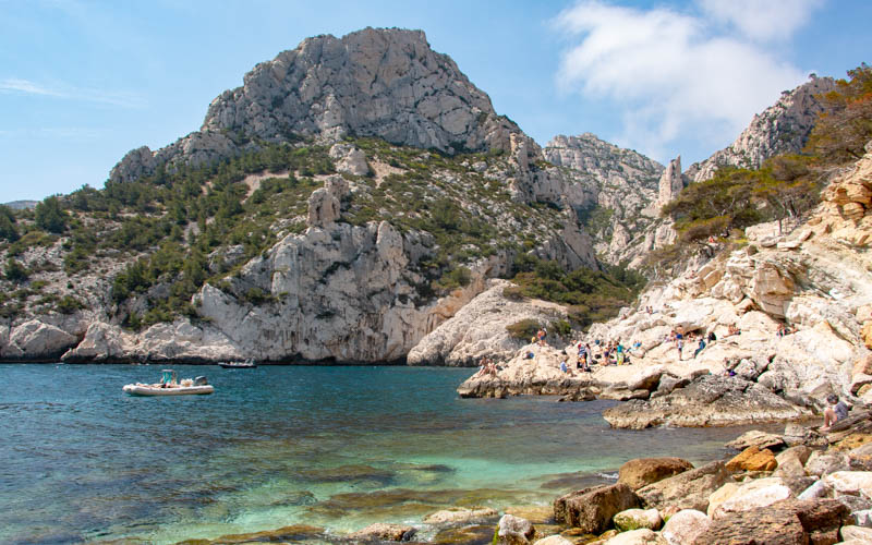
For another beach cliff hiking holiday, what about the Calanques in southern France








4 responses
Hey Swiss Family Fun,
What an adventure! The Welsh coastline is so beautiful, we’ve loved our adventures there too. We hiked the coastal path further south around Tenby, so if you’re ever back I would highly recommend checking that area out. We have however visited Whitesands beach, which as a Brit I thought was great, my Australian fiance said it was commendable haha. The Blue Lagoon is a nice stop too.
We love hiking and are looking forward to exploring Switzerland sometime in the near future.
Thanks for a good read,
Beck & Dan
http://www.travelmademedoit.com
Hope you make it to Switzerland soon! We’re hoping to be back on the coast this summer to mix things up.
What a great walk. We love the coastal path in Pembrokeshire and have cycled several times from Broad Haven South to the Green Bridge.
We’ve love to go back! Cycling sounds nice too. We met some cyclists during our trip and admired how they kept going in the rain, which seems harder on a cycle than on foot.