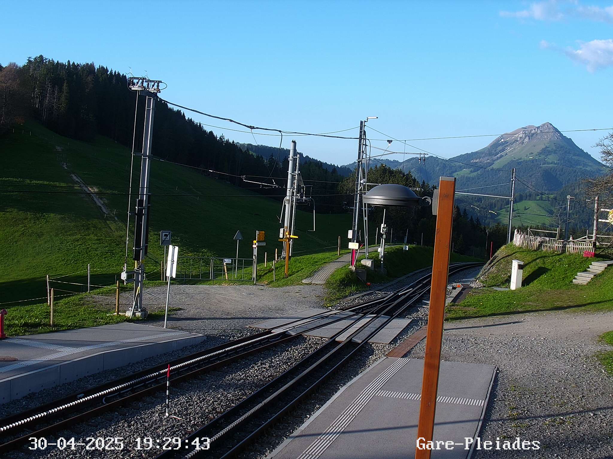
This trail at Les Pléiades is the best and easiest place to see the famous narcissus flowers near Montreux in western Switzerland. It’s a popular destination, especially on a sunny weekend, but for good reason because the mountain views are spectacular and the flowers seemingly endless.
The flower hike is relatively easy loop, with lots of places to lounge and picnic along the way. If you prefer not to hike, you can simply ride the train to the top and enjoy the flowers from there.
The narcissus flowers bloom for a short season, typically end of May and beginning of June. So you’ll need to plan your trip carefully to catch them at their peak.
Check bloom status here. Also check the webcams and Instagram pics of the place you want to go to see the flower status. We loved this special spring outing and hope you catch the flowers soon too.
Our visit was in collaboration with Montreux Riviera tourism, who sponsored our trip.
Quick info
| Location: | Montreux, Lake Geneva Region, western Switzerland |
| Address: | Les Pléiades mountain |
| By car: | Les Motalles parking, Blonay – GPS: 46°29’09.0″N 6°55’12.3″E 25 mins from Montreux, 1hr10 from Bern, 2hr25 from Zürich |
| By public transport: | Les Pléiades train station 1hr from Montreux, 2hr15 from Bern, 3hr20 from Zürich |
| Trail: | 5.45 km, about 2 hrs |
| Elevation: | highest point 860m, 200m up/down |
| Condition: | dirt path, not suitable for strollers |
| Skill: | easy |
| Open: | narcissus usually blooming late May to early June trail open from May to Oct |
| Cost: | free to park and free to hike check train prices on SBB.ch |
| More info: | www.lespleiades.ch • webcam • weather |
Gallery


Hike overview
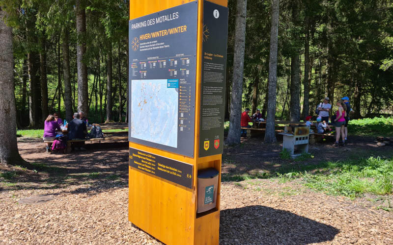
Here is the summer map for this area that should help you understand how things are organized. You’ll see the map on a signboard near the parking.


flower hike shown on Google Earth map
Hiking map
We did the Circuit de Pratin trail, a 5.5 km loop which starts at the Les Motalles parking.
The path starts by climbing up to the top of Les Pléiades, which has a big open grassy area with mountain views, a small playground, picnic area with grills and restaurant. The trail follows the ridgeline to the east, passing several big fields of narcissus. Then trail descends and loops back to the parking.
See interactive hiking map on Komoot • SchweizMobil • OutdoorActive
It’s mostly easy walking, with a couple steep, but short, climbs. There were lots of families with very small children on this trail. No strollers because the path is quite lumpy and there is a long section on a wooden walkway that would be too narrow for passing.
Skip the climb
If you came by train, you can start the trail top at the Les Pléiades station and follow hike through flower fields. When you reach the parking, continue walking to the Lally mountain train station. instead of hiking back up to Les Pléiades. See trail map for this version.
If you came by car, you can walk over the Lally station and ride the train one stop up to Les Pleiades.
Shorter version
Ride the train to Les Pléiades and walk around the top, enjoying the views and planetary stations (jump to those pics below). There is a big narcissus field there so you don’t need to hike at all if you don’t want to.
How to get there
This trail is located in western Switzerland near Montreux. It is easily accessed by car or mountain train.
By train:
Get yourself to the Vevey train station. Transfer to the mountain train to Les Pléiades, about a 38 min journey. The train station drops you at the top, skipping the steep climb. You can start the Circuit de Pratin trail directly across from the train station.
End your hike at the Lally station and ride back down to Vevey.
By car:
You can drive all the way up the mountain to the trail, parking at Les Motalles, Blonay (GPS: 46°29’09.0″N 6°55’12.3″E). The road is a winding mountain road, but wide enough for passing and not scary.
The parking is free and there are a lot of spots. But it can fill up quickly on sunny weekends. We got there at 10:00 on a sunny Sunday in peak season and the parking was about half-full. When we left at 13:30, it was completely full and cars parked along the road for at least 1 km.
From the parking, it’s 1km walk (140m elevation gain), about 20 mins to the top of Les Pléiades. The trail is a loop that ends back at the parking.
By car & train:
If you prefer to skip the steep climb up, you can drive to the area and park near one of the train stations and ride the rest of the way up. There is a lot of parking at Blonay, about halfway up the mountain. The train comes once an hour, an 18 min ride from Blonay to the top. In 2021, this return trip costs CHF 28.40 (SBB discounts apply).
You could also park at the Lally train stop, just one stop before the top. There are only a few parking spots at this station. If they are full, you can park at Les Motalles and walk to the Lally station, about 900m on a paved road, 50m elevation gain. The train only comes once an hour, so check the schedule so you can coordinate. It’s a 7min ride from Lally to the top (SBB discounts apply).
Services
There are two restaurants. Restaurant des Pléiades is at the top near the train station.
Restaurant de la Cha is near the big flower fields on the trail.
There are picnic areas with grills at the top of Les Pléiades and near the parking. There are no fires allowed near the flower fields, as indicated on the signs near the trail.
There is a WC near the parking, one at the Les Pléiades train station, and one at each restaurant.
Photo story
Starting the trail at Les Motalles
Here’s the parking at Les Motalles. We chose to hike the loop clockwise, starting with the climb up to Les Pléiades. You can do the loop either way.

We followed signs for Circuit de Prantin.

About 1 km to the top of Les Pléiades on this paved road, 140m elevation ascent.

A few cow gates to pass through.

We saw the mountain train pass by. If you want to skip the climb, take the train as described above.

Arriving at the Les Pléiades train station.

That’s our trail over there climbing the hill. But first we will explore the top of Les Pléiades.

Planet path
Head up the grassy hill directly above the train station. Do not follow signs to Sentier des Planètes – that goes somewhere else.
At the top, there is a huge grassy field with a bunch of galaxy and star related activities.
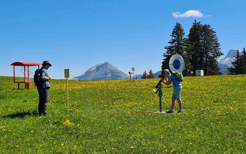
This one is showing how the star constellations make figures. My son wasn’t convinced.
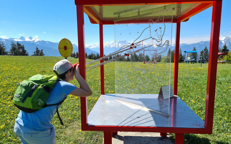
Great view from up here. If you don’t want to hike, this is still a nice place to come for the views.

There is a big narcissus patch just below the grassy field. There were still tons of flowers that hadn’t opened yet, so the field was only semi-white.
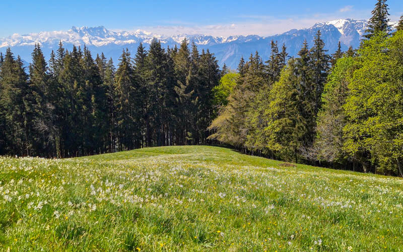
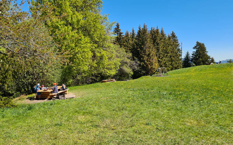
There are two picnic areas on this field and a small play area with a slide and swing.
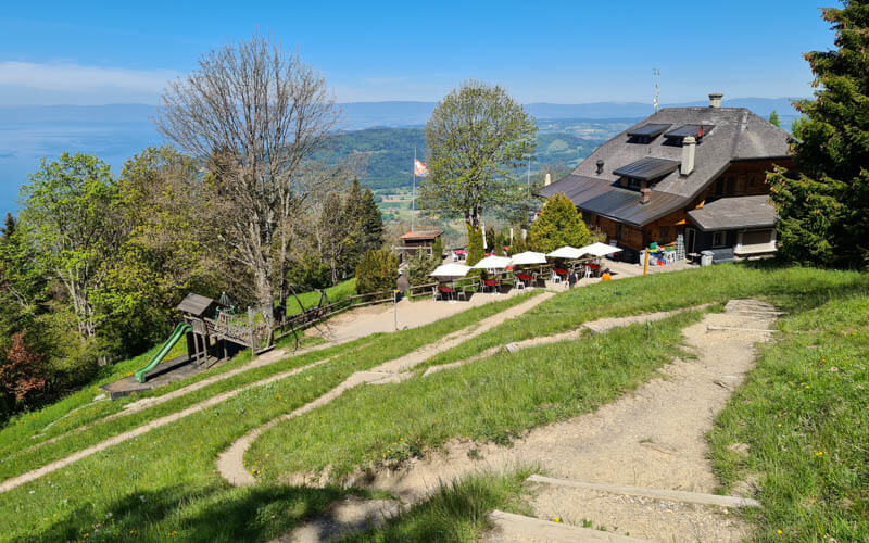
There is also a restaurant with a view, bigger playground and lounge chairs.
Hiking the narcissus fields
When you are ready to hike, go back to the Les Pléiades train station and follow the dirt path that goes up the next hill.

Everyone is ooo-ing and aah-ing at this first big field. It’s a good one, take lots of pics.

The view back down the trail is a bit better as you have the big mountains in view.
The trail goes straight back down the hill, a bit steep in parts with no switchbacks.

The big flower fields
Now you reach the super big fields, the best part of the trail. You can leave the main path and follow the small footpath through the flowers. Stay on the path and don’t trample the flowers.
So many flowers!!!
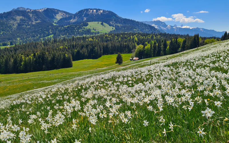
Lots of people taking lots of pics in this area. fWe found a nice place to sit near the flowers and had our little picnic while we enjoyed the breeze rustling through the blooms. Highly recommended!
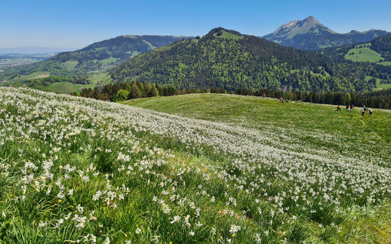
The trail makes it way down the hill around the flower fields.
The view up the hill is just as impressive.
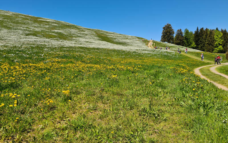
If you want to do an easier hike with no climb, you could walk from the parking straight out to this field and enjoy the flowers from below.
Walking back to the parking
Wave a fond farewell to the flowers and follow the main path back to the parking on the Circuit de Prantin. There are several other trails in the area but they are not focused on the flower fields.

The last section of the trail is on a long wooden walkway, presumably over a marsh. The walkway is a bit narrow so be polite when passing.

Back at the parking, there is a picnic area in the shade with grills. There is also a public toilet across the street.
That’s all for now. I hope you go do this trail and enjoy it as much as we did.
Video of trail
Check out a video from our Les Pléiades hike.
Other narcissus trails near Montreux
- Caux
- Le Mont-Pèlerin
- Glion
- Les Avants Orgevaux
- Article about the endangered narcissus