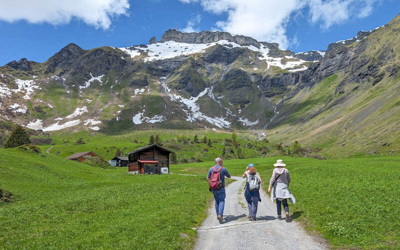
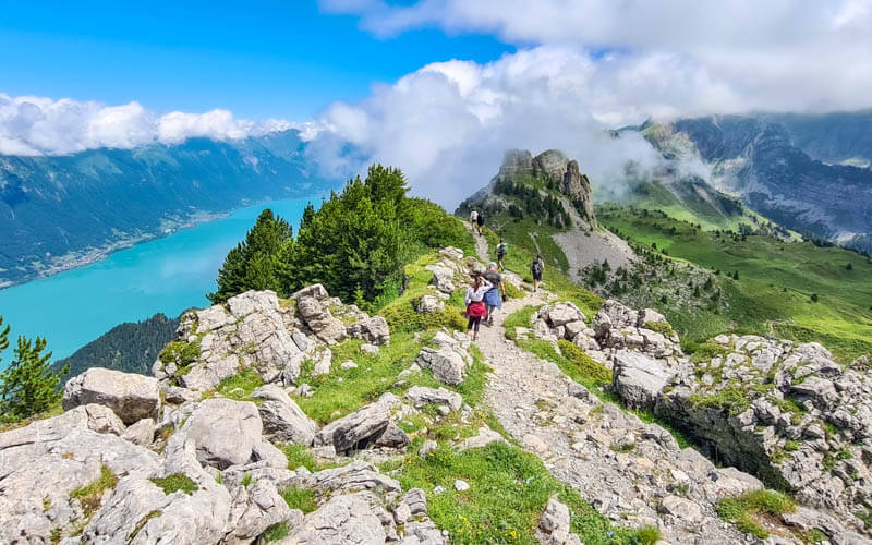
This beautiful trail near Mürren hikes through alpine meadows with spectacular mountain views. For a special treat, you can do a short detour to the Sprutz waterfall, where you can walk under the raging water.
Along the way, you’ll pass mountain huts where the dairy farmers tend to their cattle and make cheese during summer. A few huts have cafes, where you can eat traditional mountain food with some of the best views you can get in this region.
Keep reading for all the details you need for this hike.
Quick info
| Region | Mürren • Jungfrau Region • Berner Oberland |
| Trail start: | Allmendhubel funicular in Mürren |
| By car: | Parking at Stechelberg cable car – Lengwald 300B, 3824 Stechelberg CH From Interlaken 30, Grindelwald 35min, Bern 1h15, Zurich 2hr15 |
| By public transport: | From Lauterbrunnen, cable car + mountain train to Mürren (instructions below) From Lauterbrunnen 30 mins, Interlaken 1h, Grindelwald 1h20, Bern 2h, Zurich 3h |
| Trail: | 7.4 km (with waterfall detour, variations below) • ⬇️ trail map |
| Duration: | 2h30 |
| Difficulty: | moderate • 170m up, 420m down |
| Condition: | dirt footpath, uneven terrain, some stairs |
| Elevation: | 1630m – 1940m |
| Open: | June to mid-October |
| Cost 2025: | Mountain transport to reach Mürren + Allmendhubel funicular Adult CHF 32.40 |
| Discounts: | Free with Bernese Oberland Pass Heavy discount with Swiss Travel Pass Swiss Half Fare Card, Jungfrau Travel Pass, or GA |
| Services: | restaurant and playground at start of trail, mountain restaurants along trail |
| More info: | muerren.swiss • webcam • forecast |
Gallery


Trail Overview
The map below show the Northface trail (red line), starting at the top of the Mürren-Allmendhubel funicular and ending in Mürren.

The purple line shows the optional detour to the Sprutz waterfall. For a longer day, you can add on a walk down to Gimmelwald (yellow line).
Step-by-step itinerary
The following instructions start the trail at Allmendhubel and hike downhill to Mürren. You can hike it in reverse if you prefer uphill.
- Get to Mürren alpine village, directions below.
- Ride the funicular from Mürren to Allmendhubel.
- Follow Northface trail signs, direction Suppenalp
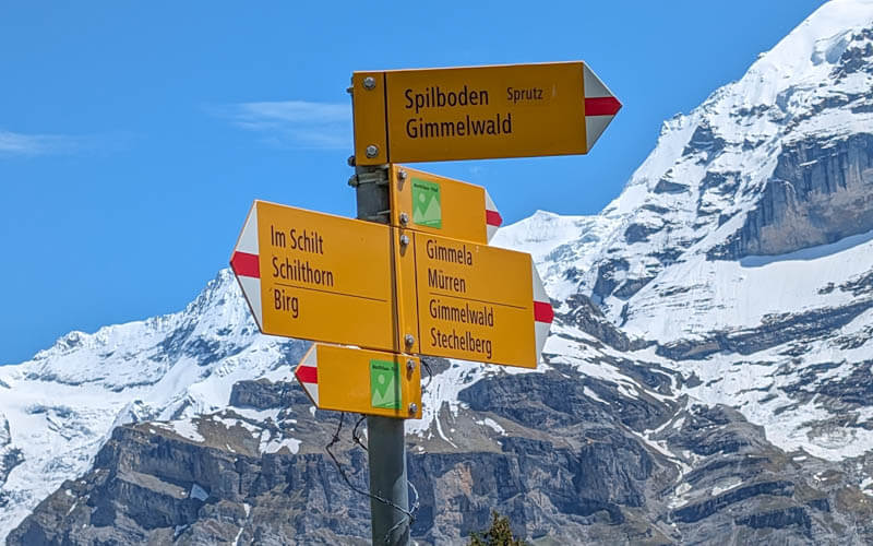
- Keep following Northface trail signs towards Spilboden, where there is another mountain restaurant. If you want to visit the waterfall, branch of the main trail when you see signs pointing to “Sprutz.”
- The “Sprutz” signs lead you down through a forest to the big waterfall. After walking under the waterfall, follow signs to Mürren to rejoin the Northface trail.
- Or… follow signs to “Gimmelwald” to option B. In Gimmelwald, you can ride the cable car up to Mürren or down to Stechelberg.
Hiking map
Here is the trail map that you can use on your phone. This version includes the detour to the Sprutz waterfall and returns to Mürren.

See this trail map on Komoot • SchweizMobil • OutdoorActive
My map shows you hiking downhill but you can hike uphill instead.
Trail conditions
The trail alternates between a gravel service road and dirt footpath through forests and meadows. It’s mostly easy walking, especially if you go downhill. The path has uneven terrain and is not suitable for strollers.
Waterfall detour
The waterfall detour is more difficult with steep switchbacks through the forest with uneven terrain. It also includes walking behind the waterfall, which can be very wet and slippery.
The path approaching the falls is steep in parts, without a railing. So not the best for those that have a fear or heights or very small children. You may want to skip the waterfall if these conditions don’t sound great to you.
➡️ Northface trail without waterfall – 2h • 6.5km • 100m up, 360m down. See “no waterfall” trail map
Skip the funicular
If you prefer to skip the funicular, you can hike between Mürren and Allmendhubel. This adds about 30 mins to your hiking time.
➡️ Northface Trail as loop from Mürren (skip funicular) – 2h45 7.8km, 380m up, 370m down. See “loop” trail map.
Longer hike
Options to make your day longer
➡️ add the Mürren Mountain View trail, which ends in Allmendhubel where the Northface trail starts.
➡️ when you end in Mürren, continue walking to Gimmelwald, about another 45 mins. See Mürren-Gimmelwald trail map.
How to get there
This hike is located in Mürren, an alpine village in the Jungfrau Region near Interlaken. You access the hike with cable cars.

By public transport:
Mürren is a mountain village that can only be accessed via cable cars. Here are the options:
- From Lauterbrunnen, you can ride a cable car to Grütschalp. Then transfer to the mountain train and ride across to the Mürren village.
- From Lauterbrunnen, ride a bus to Stechelberg. Then cable car to Mürren.
Both routes are free with the Swiss Travel Pass, Saver Day Pass, and Bernese Oberland Pass. The Jungfrau Travel Pass only includes the route via Grütschalp.
I describe getting to this hike as a round trip from Lauterbrunnen. You may need to adjust this based on your starting point.
- Take a train to Lauterbrunnen.
- Ride cable car up to Grütschalp, transfer to mountain train to Mürren BLM.
- Short walk through village to Allmendhubel funicular station. Ride up to Allmendhubel.
- Start Northface trail.
- At Spielboden, you can do a detour to Sprutz waterfall (yellow line). After the waterfall, rejoin Northface trail and hike back to Mürren.
- OR… after waterfall, follow signs to Gimmelwald (gray line) and end your hike there.
- Can take cable car down to Stechelberg (7) and bus back to Lauterbrunnen. Or cable car from Gimmelwald back up to Mürren (3).
By car:
You may find it simpler to park at the Stechelberg cable car (7) instead of Lauterbrunnen (1).
In this case, drive past Lauterbrunnen, up the valley to Stechelberg and park in the metered lot next to the cable car station. Lengwald 300B, 3824 Stechelberg CH. Then ride the cable cars up to Mürren (Mürren (Schilthornbahn) station stop) and walk to the Allmendhubel funicular station.
On extremely busy days, the parking at Stechelberg may be full. In this case, you may need to park in Lauterbrunnen parking garage or even the new overflow lot Park & Ride Matten bei Interlaken and ride the train to Lauterbrunnen.
Tickets
Your cost depends on which mountain transport you use to get to Mürren and which variation of the trail you do.
You can tickets on the SBB Mobile app and scan your QR code at the turnstile. You can also buy individual tickets at the cable car and funicular stations.
Mürren via Lauterbrunnen cable car
If you travel via the Grütschalp cable car and Mürren BML mountain train, this journey is free with Swiss Travel Pass, Jungfrau Travel Pass, Bernese Oberland Pass, GA and SBB Day Passes.
If you need a ticket, you can purchase it via the SBB Mobile App or in person at the ticket office. In 2025, a round trip ticket to Mürren from Lauterbrunnen (via Grütschalp) costs CHF 23.60. Discount with Swiss Half Fare Card.
Allmendhubel funicular
If you do the trail as described here, you’ll need a one way ticket for the Allmendhubel funicular. In 2025, this costs CHF 8.80/adult.
Free with Bernese Oberland Pass. Discounted 50% with Swiss Travel Pass, Half Fare Card, and Jungfrau Travel Pass. Current prices here.
Mürren via Stechelberg cable car
You can also travel to Mürren via a cable car from Stechelberg. If you are driving, this is more convenient than the cable car from Lauterbrunnen.
This journey is free with Swiss Travel Pass, Bernese Oberland Pass, GA and SBB Day Passes. It is not included with the Jungfrau Travel Pass.
Planning your day
Opening Times
The trail is usually open from early June through late October. Check the Mürren website for trail status.
The Allmendhubel funicular usually starts running the first weekend of June. Check funicular status.
Sample timetable
Here was our schedule for a day trip from Zurich.
- Depart Interlaken 9:04, arrive Lauterbrunnen 9:26
- Cross street to Lauterbrunnen cable car station. Depart 9:38, arrive Grütschalp 9:42.
- Transfer to Mürren mountain trail, arrive Mürren 9:58.
- Walk through Mürren village to Allmendhubel funicular, about 10 mins.
- Funicular departs 10:20, 4 min ride up mountain.
- Optional time at playground/restaurant
- Start trail about 10:45, reach Sprutz waterfall about 12:15.
- Continue hike to Mürren, arrive about 13:15
- Travel back to Lauterbrunnen, arrive about 14:00
Where to eat
There is a restaurant at the top of the Allmendhubel funicular. Along the trail, there are restaurants at these mountain guesthouses:
- Pension Suppenalp – cafe usually open late June to early October. See Pension Suppenalp on map.
- Schiltalp – honesty shop for snacks and drinks. See Schiltalp on map.
- Pension Spielbodenalp – cafe open mid June thru September (not open every day, don’t count on it). See Spielbodenalp on map.
Where to stay
For quick access to this trail, stay in the Mürren village.
For good value and traditional charm, we suggest Hotel Alpenruh or Hotel Regina.
For a budget stay, Sportchalet Mürren has dorms as well as private rooms with shared or private bathrooms. We also love Mountain Hostel Gimmelwald, with a friendly atmosphere, only a 5 min cable car ride from Mürren.
For more services and comfort, you’ll enjoy Hotel Eiger or Mürren Palace (4-star).
Photo story of the trail
We started the hike at the top of the Allmendhubel funicular and ended in Gimmelwald. We did this hike the first week of June. Your journey may look different from ours.
1. Riding up Grütschalp cable car
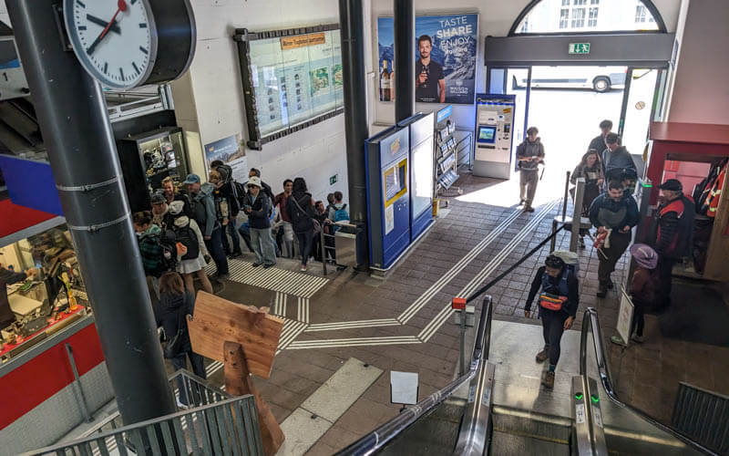
From Lauterbrunnen, you cross the street to the Grütschalp cable car station. If you don’t have a ticket, you can get one at the ticket counter. If you have a Swiss Travel Pass or other travel pass, you can go directly to the turnstile and scan your ticket.
Beautiful views of Lauterbrunnen as you ride up the mountain.

You transfer to the mountain train that goes to the Mürren BLM station.

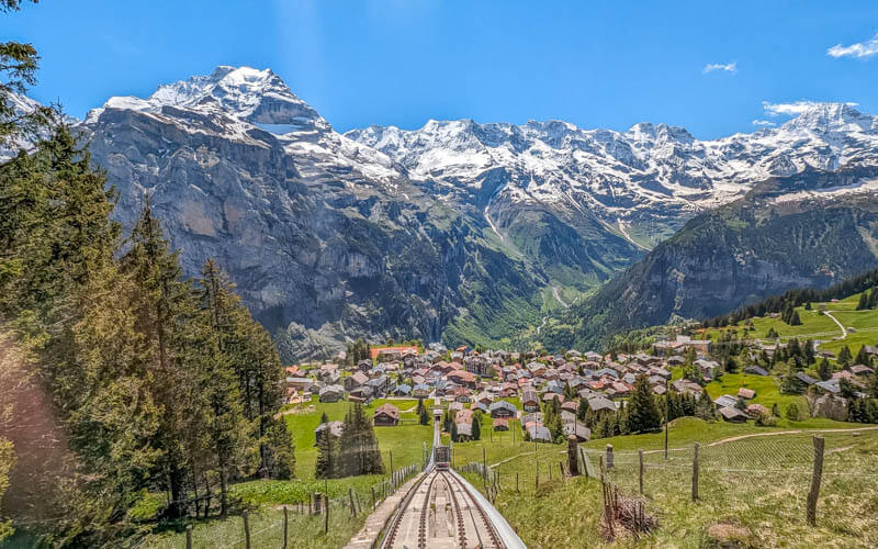
2. Riding up the Allmendhubel funicular
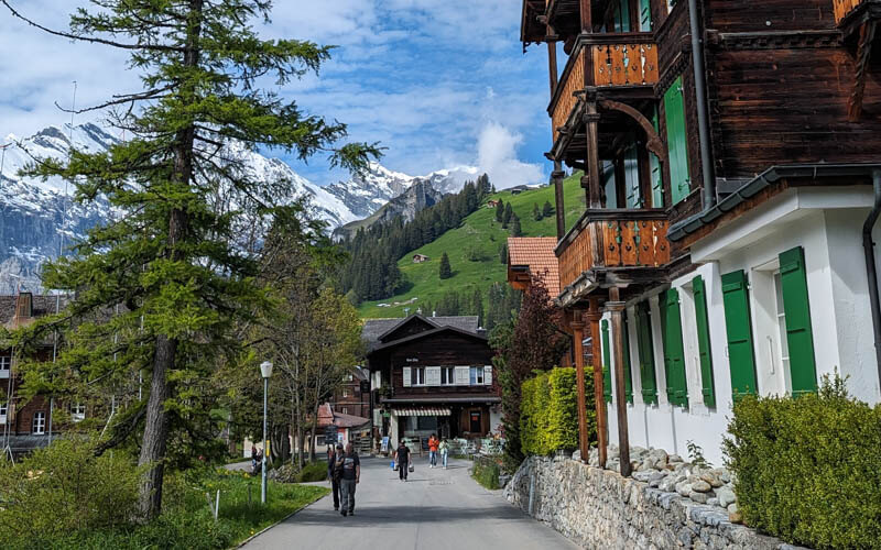
It’s about 8 min walk through the village to reach the funicular station.
Here are the funicular tracks.
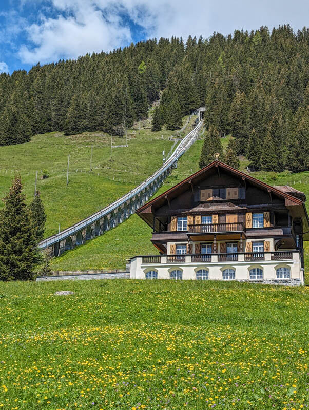
The funicular station. You can purchase tickets here if you don’t have them already. It’s not free with travel passes, but you do get a discount.

View of Mürren as you ride up the mountain.
3. Arriving at Allmendhubel

There’s a big playground here and a restaurant.

4. Starting the Northface trail
Follow the signs to Northface trail, walking away from the playground towards the mountains.

Here’s the start of the trail.

It’s not marked, but you can follow this footpath down to the service road. It’s a shortcut that everyone takes. The road below is the Northface trail.
The trail follows the service roads for a few minutes. Don’t worry, it gets more remote in a few minutes.
Make sure to follow those yellow trail signs at the splits so you stay on the walking path.

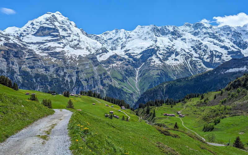
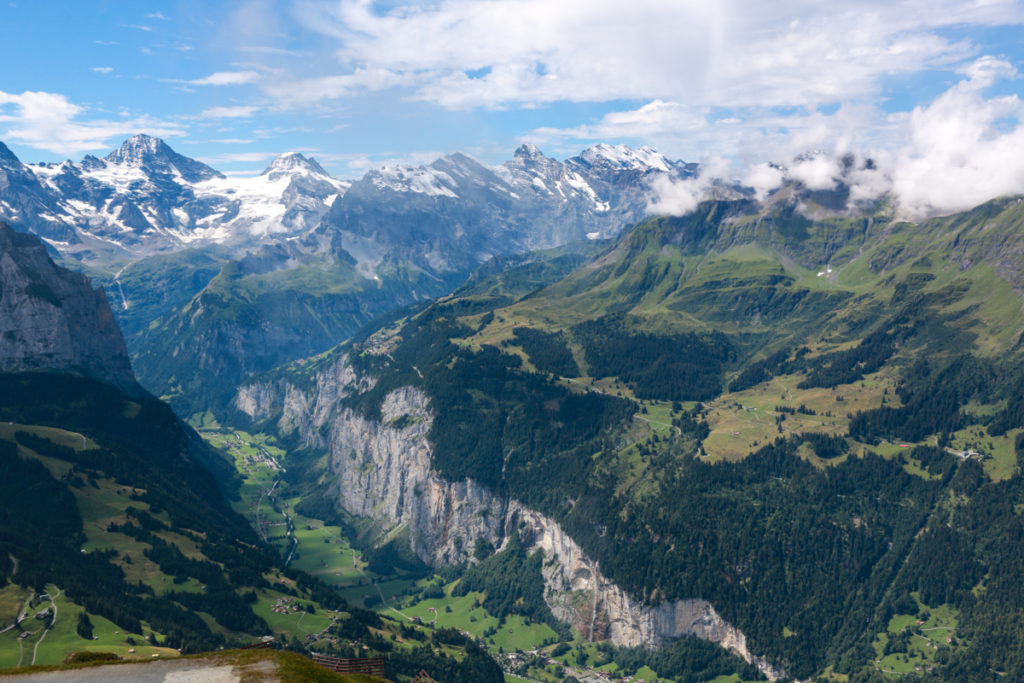
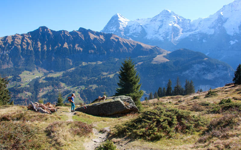
The big mountain peaks are almost always in view.

After only 15 mins walking, you’ll reach Bergpension Suppenalp, which has a cafe in summer. Their summer season starts the last week of June through early October. Closed Mon/Tues. I’ve eaten there before and it was tasty traditional Swiss.

Keep following the green Northface signs, direction Im Schilt.

After Suppenalp, you hike under the cable car line. In 2025, they are still doing some construction on the cable car, so there are signs telling you to pass quickly through this area so you aren’t lingering under the construction zone.

Now the footpath leaves the busier part of the trail and heads into pretty alpine meadows.
This would be a lovely place for a picnic. But it’s only about 45 mins into the hike.

Making our way up this valley towards Schilt.

Looking down to Spilboden where the trail is taking us.

Arriving at Schilt. When the cows are on the alp (late June), the alpine dairy here has a self-service shop with snacks.

Continue following the green Northface trail signs, direction Spilboden Sprutz.

At this sign, you can leave the official Northface trail for awhile to detour down to the Sprutz waterfall. Follow the signs with “Sprutz” on them. If you prefer to skip the waterfall, just keep following signs to Mürren.
Arriving at Restaurant Spilbodenalp. This hut has a small cafe open about mid June to mid September when the cows are on the alp. It wasn’t open yet when we were there.

After Spilboden, you are on the Via Alpina trail for bit, direction Sprutz.

Detour to Sprutz waterfall
The trail heads into the forest and descends a bunch of switchbacks.

First view of the falls.

As you get closer, you can see the stairs and trail heading up the other side of the falls.

Lots of water in early June as the snow melts. The volume decreases as you approach fall.

Walking under the raging water. It was wet and slippery, be careful!

On the other side of the falls, there are stairs leading up the rocks. No safety rail on this one, just a handrail on the rocks that you can hold.
As you get a bit higher, there is a safety railing and more stairs.

End in Gimmelwald
Just after the falls, you’ll come to a fork in the trail, left leading to Mürren and right to Gimmelwald, about 40 mins either way.
We chose to hike down to Gimmelwald, where we would ride the cable car down to Stechelberg and return by bus to Lauterbrunnen. You could also ride a cable car from Gimmelwald back up to Mürren.
The Gimmelwald direction has about 20 mins more forest before you get the big views again.

Emerging from the forest to a view of Gimmelwald.

So many flowers in early June.

In the village, we stopped for refreshments. We like the food and their specialty beer at Pension Gimmelwald.

But this time we ate pizza at Mountain Hostel Gimmelwald, which was full of young happy hikers finishing their day.


Then we rode the cable car down to Stechelberg and bus back to Lauterbrunnen.

Hope you try this hike soon!


2 responses
Hi Tania, really appreciate your website and your generosity in sharing your knowledge with everyone. Are you able to let me know how long is the walk from Murren to Allmendubel using the service road, without using the funicular ? ( the part you noted A on the map ). Thank you.
Hi. If you are walking from Mürren up to Allmendhubel on the service road, it takes about one hour, ascending 290m of elevation. It’s a bit steep but difficult terrain since you are on the road.