If you buy something through a link here, we may earn a commission. See our disclosure policy. Note that prices and opening times may change without notice.
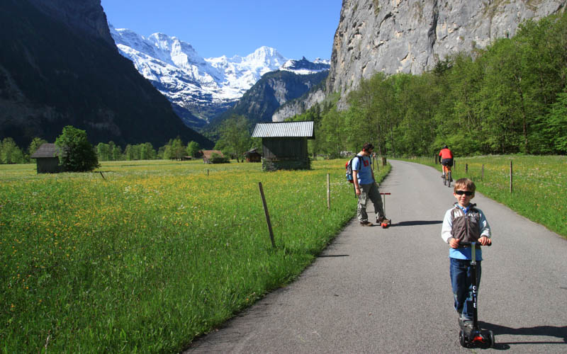
This easy hike explores the Lauterbrunnen valley, home to 72 waterfalls that tumble over the mountains on both sides of the path. Both pedestrians and bikes can use this path, which starts on a quiet private road before turning into a dirt path along the river.
This trail is particularly suitable for families and beginner hikers as there is not much elevation gain and you can walk as little as 1 km and still enjoy spectacular views. We also loved that our little kids could ride their kick scooters, so we could walk further without them getting tired.
Since this hike is free, with no gondola ride, it’s a good choice for budget travelers. We also suggest it for spring (April & May) or late fall (October & November), when mountain trails are covered in snow.
| Location: | Berner Oberland, Switzerland |
| Trail start: | Pfrundmatte 419, 3822 Lauterbrunnen |
| Car: | Parking GPS: 46°35’31.2″N 7°54’27.9″E 15 mins from Interlaken, 1hr50 from Zürich |
| Train: | Lauterbrunnen train station 24 mins from Interlaken, 2hr30 from Zürich |
| Trail: | 6.7 km one way, return with bus |
| Condition: | paved and dirt, possible with strollers |
| Skill: | easy |
| Open: | year round, weather dependent |
| Cost: | free, optional one-way bus ride CHF 4.40 |
| More info: | www.lauterbrunnen.swiss • webcam • forecast |
This valley path starts in the Lauterbrunnen village, either at the train station or parking. Then you walk down a paved private road and dirt path towards Stechelberg.

At Stechelberg, you can catch a bus back to Lauterbrunnen, with an optional stop at the Trümmelbach falls on your way back. At Stechelberg, you can also ride a cable car up to Mürren and/or Schlithorn for a mountain experience.
The map below shows the walking route starting at the Lauterbrunnen train station. The path ends at the Stechelberg cable car station, where you can catch the bus back to Lauterbrunnen. The full path is 6.7 km, which takes about 2 hours. But you can shorten this by just walking there and back a couple km as you like.
I usually suggest just walking the first hour of the trail, branching off the Trümmelbach Falls, a tourist attraction with enormous waterfalls cascading through a gorge cut into the mountain. After your visit, you can catch a bus here back to Lauterbrunnen. Or retrace your steps to the valley path and continue walking to Stechelberg.
On the trail, you’ll see a yellow trail sign pointing left to the falls. After a short walk, you’ll join the main busy road through the valley. Just a minute walking on this road to the Trümmelbach Falls entrance.
The route starts on a lightly used paved private road, frequented by both pedestrians and bikes. After about 4 km, the road ends and you continue walking on a dirt path the rest of the way to Stechelberg.
The paved section of the path (first 4 km) is suitable for strollers, wheelchairs, kick scooters and bikes. The dirt portion has some obstacles and a bridge with stairs that cannot be managed with a wheelchair, but you could probably easily carry a stroller over those parts. Kick scooters won’t work well on the dirt portion of the path.
Lauterbrunnen is located south of Interlaken in the Jungfrau Region. See on Google Maps. This valley hike is easily accessible by car or train, no gondola necessary.

Take a train to the Lauterbrunnen, Bahnhof station. Walk along the main road south through the village as shown on the map below.
Drive to Lauterbrunnen and park in the metered lot next to the church – 46°35’31.7″N 7°54’28.4″E. If that lot is full, you may be able to park in the Lauterbrunnen parking garage behind the train station – Gütli 481, 3812 Wilderswil

Catch bus 141 from the Stechelberg (Schilthornbahn) bus stop, directly adjacent to the cable car station (see on map). This bus leaves every 30 minutes on the xx:10 and xx:40. It takes about 17 mins to reach Lauterbrunnen.
A one-way bus ticket costs CHF 4.40/adult, CHF 2.20/child. Normal discounts with SBB travel cards. It is free with travel passes like Jungfrau Travel Pass, Swiss Travel Pass and Berner Oberland Regional Pass.
This walk is free unless you want to take the bus back to your starting point. If you are staying in the area, the bus is covered by your hotel guest card. It’s also free with the Swiss Travel Pass, Jungfrau Region Pass, Berner Oberland Travel Pass, and SBB Saver Day Pass.
We suggest visiting the Trummelbach Falls as part of this outing. On your bus ride back from Stechelberg, you can get off at the Trümmelbach stop and visit the falls. Then get back on the bus and ride back to Lauterbrunnen. Or you could cut your walk short and walk directly to the falls instead of all the to Stechelberg.
At Stechelberg, you can also ride a cable car up to Mürren and/or Schlithorn for a mountain experience.
Bikes are allowed on this path between Lauterbrunnen and Stechelberg, but please yield to pedestrians. It is possible to ride a longer route from Interlaken to Lauterbrunnen, then on to Stechelberg. But I haven’t ridden this section, so I can’t tell you about it.
If you are on bikes, you should plan to ride your bikes to Stechelberg and back. Although it is allowed to transport bikes on the bus, the bus is usually too crowded for that. If you do take your bike on a bus or train, remember you need a Half-fare ticket for your bike in addition to your own ticket.
You can walk this path anytime of year, even winter. The waterfalls are usually flowing strongly from April to early September. In winter, the road is often cleared of snow but the dirt portion of the path may be impassible due to snow. The bus schedule varies in different seasons, so check the current schedule carefully before planning your trip.
Check the Lauterbrunnen weather forecast and dress appropriately for the weather. The path is easy walking and only requires comfortable walking shoes, not hiking shoes. You do not need hiking sticks. Bring at least 1L of water per person and enough food for your 2 hour journey.
In Lauterbrunnen, there are several restaurants, a small grocery store and bakery in Lauterbrunnen. There are no restaurants along the path or at Stechelberg. If you stop at Trümmelbach falls on your way back, there is a restaurant just outside the entrance.
Near the Stechelberg cable car station, there is a picnic area with a fire pit near the river (see on map).
You can see the Staubbach falls already from the near the Lauterbrunnen train station. This photo is taken from the popular photospot just below the main street – see on map.

Walk on the main road through town. When the road curves to the left near the church parking lot, stay straight on private road. Follow signs toward Staubbach falls.

After 10 mins walk from the train station, you’ll reach the Staubbach Falls viewpoint.

You can do a short 10 mins detour, walking up the dirt path to a lookout behind the falls. Learn more.

The path starts on a quiet paved road. But it’s not a completely car-free area. There will be an occasional vehicle or tractor from one of the farms or homes on the road. So don’t let your kids get too far away from you.

Gorgeous mountain views.
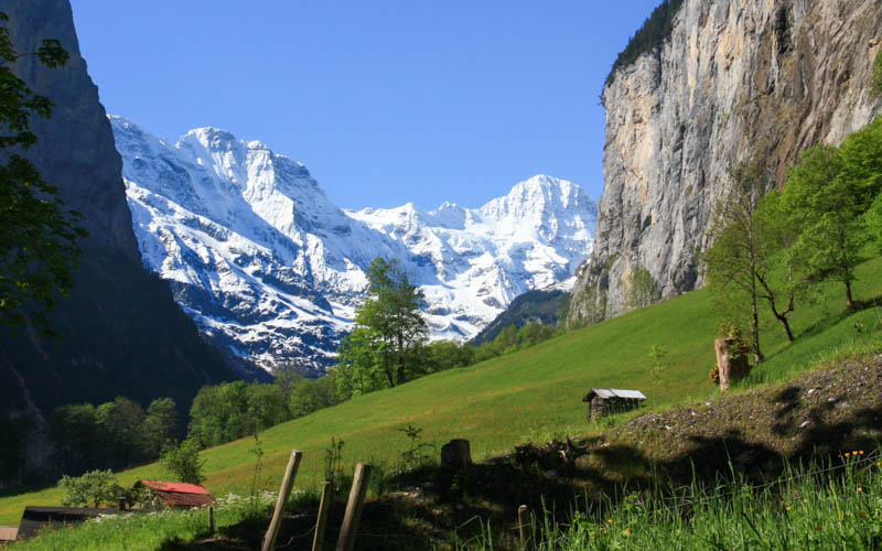
Waterfalls on both sides of the valley and big mountains ahead of you.

Nice for cycling too, no big hills.

About 2.5 km before you reach Stechelberg, the path turns to dirt. But it’s relatively smooth, fine for bikes, ok for strollers. Kick scooters, not so much.
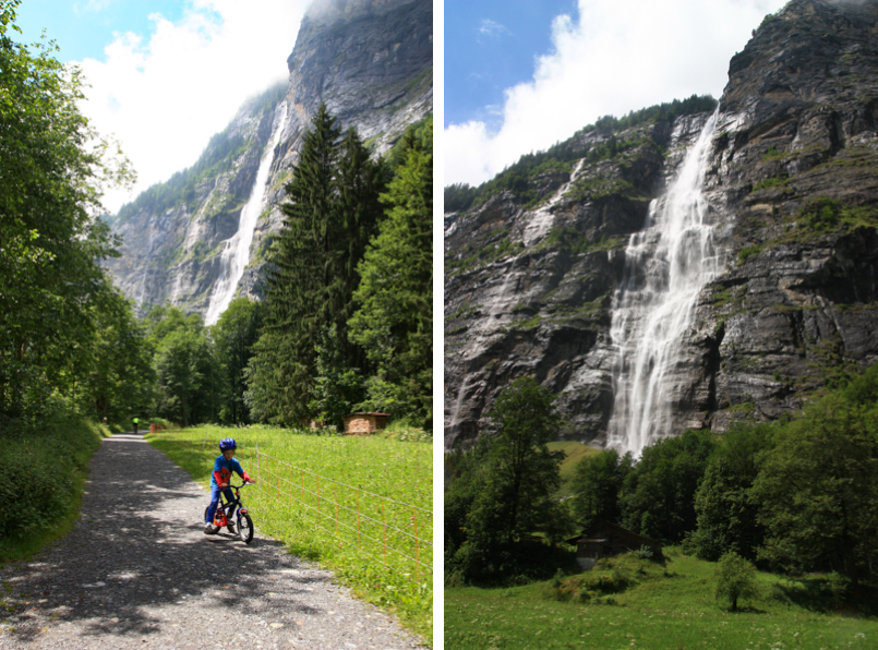
This path is also nice in winter. This pic was taken in early November.

You might also like
Comments
We respect your privacy. Please review our privacy policy to understand how we process and store data submitted through the comment form below. If you submit this form, you explicitly agree to the terms in our privacy policy.
Welcome
Hi! I’m Tanya and our family has been living & hiking in Switzerland since 2005, collecting dozens of fun hikes and activities for all ages and abilities. More about us…
Interactive Map
Get our “Ultimate Winter Guide to Switzerland” with interactive map and suggested itineraries. Learn more…
Ebook!

Subscribers may login below. At the moment, membership is by invite only.
15 Responses
Halo Tanya, Hoe zit het met scootmobiel, mag je er mee in de lift naar Murren en Wengen? en mag je je eigen elektrische step mee nemen en gebruiken in Lauterbrunnen vallei?
Vielleicht ist es besser Lauterbrunnen Tourismus Info zu fragen. Ich bin auf diese Mobilität Thema kein Expert.
Thanks for the guides! We are traveling here in a few weeks with two little ones. Does this trail get too hot to do in August?
That all depends on the weather forecast. It changes all the time.
hey Tanya, thank you for great and detailed posts.
have 2 question, cable car up to Mürren, funicular to Allmendhübel, – could it be done in May?
I’m asking as it is written as part of April/May recommendations in the area.
Second question is regarding Trümmelbach falls – is it possible to 1 adult to wait outside with a child, or lets day take turn exploring the falls? i presume it is a round trip in the falls area?
thank you,
Anna
The Allmendhubel funicular typically doesn’t start running until June. So you could hike up from Mürren but the restaurant wouldn’t be open and the playground equipment might not all be set up. Re: Trummelbach falls – yes, one parent could wait outside. There’s a cafe with outdoor seating. It takes about 1 hour to tour the falls but you could do it faster.
How can I get from the train station in Lauterbrunnen to the start of this walking trail? – and how far would that be?
I’ve updated the post with a map that shows how to reach the trail from the train station.
Heads up anyone going to the the Trümmelbach falls kids younger than 4. We made it all the way there and they didn’t let us in with out 3yo. Apparently they have to be able to climb 400 steps by themselves, carrying them is not allowed. We made it all the way there from Zurich and could not go it.
I’m so sorry this didn’t work out for you. How disappointing! I note this restriction in my Trummelbach Falls post. But they told me it was because of the noise, which didn’t make sense. But now that you explain it is because you are not allowed to carry them on the many stairs, I can understand the restriction more. I’ve added a note in this post as well, in case people don’t read the Trummelbach falls post as well.
Hi, Tanya.
I wanna ask more detail bout the bike and sorry if it sounds funny. You said tht “ride bikes to Stechelberg, cable car up to Mürren, funicular to Allmendhübel, visit the Flower Park playground there, eat lunch, do a little hike. Then back in the valley, ride bikes to the Trümmelbach falls,…”
Is there any place to keep the bikes before riding the cable car and so on and then we can get the bikes back after ? Some kind of bike storage ?
Thanks before
We just locked our bikes to a fence using the bike locks we brought. If you are renting bikes, they will provide locks or a locking mechanism on the bike. There are probably bike racks next to the cable car station. I’m not aware of any bike storage. Have fun!
Hi! How old were your kids when you biked this path? Ours are 5 and 8 (plus a 3-yo in bike seat) and we are wondering if we should bring our bikes when we visit the Lauterbrunnen Valley in May. The 5-yo just learned how to ride a bike so the trail would have to be pretty flat. Thanks!
Hi. We did part of this trail on scooters when my boys were 3 and 6. We biked the trail when they were 7 and 10. This trail is quite flat, with a gradual incline of 100m elevation over the whole path. If you ride the opposite direction from Stechelberg to Lauterbrunnen, it’s slightly downhill the whole way. My 7 yr old needed a little motivation because he has just learned to ride his bike (late learner) and kept quitting on every little hill. You might consider one of those Follow Me tandem attachments, so the kids bike can attach to yours when they get tired.
The trail map I have on the post has a funny glitch showing some elevation gain, this map is better (sorry for the long link!): https://map.schweizmobil.ch/?lang=en&land=wanderland&route=all&bgLayer=pk&logo=yes&season=summer&resolution=10&E=2635798&N=1158489&layers=Wanderland&trackId=5469471