It’s a fun ramble through the forest on this trail along the Albisgrat ridge, ending at the Albishorn (909m) where you’ll find a restaurant and panorama terrace.
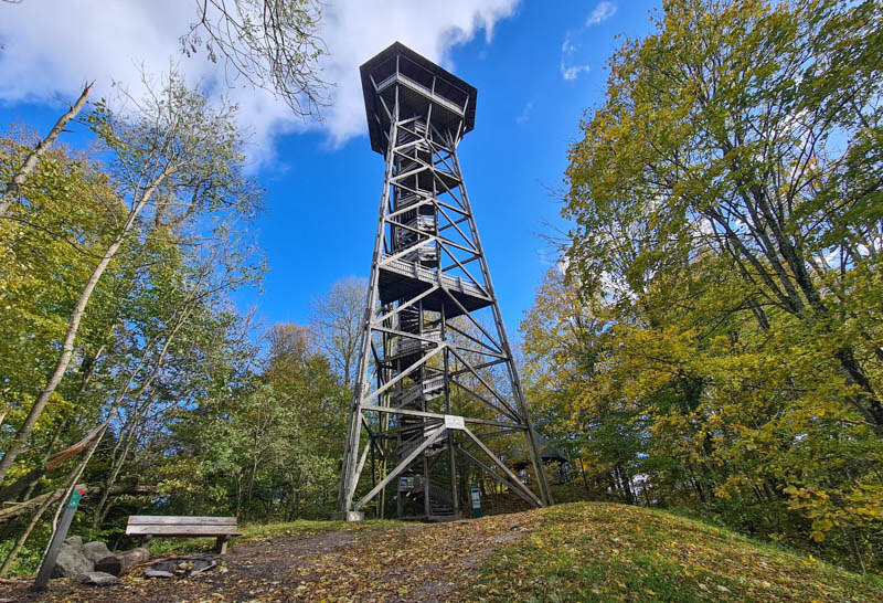
Along the way, make sure to climb the Hochwacht observation tower, 152 steps up to an observation deck where you get a beautiful panorama view across Zürich canton.
Quick info
| Region | Zürich • Eastern Switzerland |
| Trail start: | Albispass, Langnau am Albis |
| By car: | Parking: Birrwaldstrasse 21, 8135 Langnau am Albis From Zürich city, about 20 mins |
| By public transport: | Bus stop: Langnau a.A., Albispasshöhe From Zürich HB 35 mins |
| Trail: | 8 km there & back • ⬇️ trail map |
| Duration: | 2h30 walking time |
| Difficulty: | moderate (2/5) • +695m -695m |
| Terrain: | dirt path with uneven terrain, not suitable for strollers (2/5) |
| Exposure | no exposure (1/5) |
| Elevation: | highest point 909 m |
| Open: | year round |
| Cost: | free |
| Services: | Albishorn restaurant, picnic areas in forest, water fountain and toilet near parking |
| More info: | webcam • weather |
Picture Gallery




Trail Map
This trail starts at the Albispass and hikes along the ridge in the forest until you reach the Albishorn restaurant. The trail starts on a wide path, but after the tower, it turns into a narrow lumpy footpath, with some stairs. No strollers.
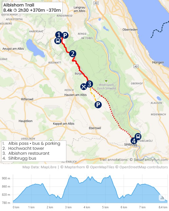
See trail map on SwitzerlandMobility • Komoot
Shorter easier option:
You can walk just to the Hochwacht observation tower and back, about 1 hour round trip. Lots of families do this walk. See Albispass Hochwacht Tower post.
If you want to eat at the Albishorn restaurant, there are two parking areas on the hill near Hausen am Albis, about a 20 min walk from the restaurant: Mittelalbis 17, 8915 Hausen am Albis and Rosrainstrasse 95-105, 8915 Hausen am Albis.
Longer option:
For a one-way hike, you can start in Sihlbrugg, hike up to the Albishorn restaurant. Then continue along the ridge to the Albis Pass, where you can catch a bus back to your starting point. Or hike the opposite direction.
Longer trail: 3 hours • 9.4 km • +567m -311m. See trail map here.
Services
There is one picnic area with a fire pit near the entrance to the forest and another picnic area right below the tower. There is a restaurant at the Albishorn as well as restaurants near the parking.
How to get there
This trail is located south of Zürich, easily accessible by car or bus. No mountain transport required.

For the main trail described here, drive or take the bus to the Albispass and start the hike there. Instructions for shorter and longer trail variation are given above.
By public transport:
Take a bus to Langnau a.A., Albispasshöhe, the stop shown here.

By car:
At the Albispass, there is a parking lot at Birrwaldstrasse 21, 8135 Langnau am Albis and parking on the street, as shown here.

Photo story of the trail
From Albis pass, follow signs to Albishorn, the green 47 Zurich Panoramaweg trail.

This trail is in the protected Wildnispark Zurich Sihlwald.

Trail starts on this wide gravel path.

The path passes by this pretty field.
Nice views towards Zurich.

Now into the forest. It’s particularly nice in fall when the trees change color.
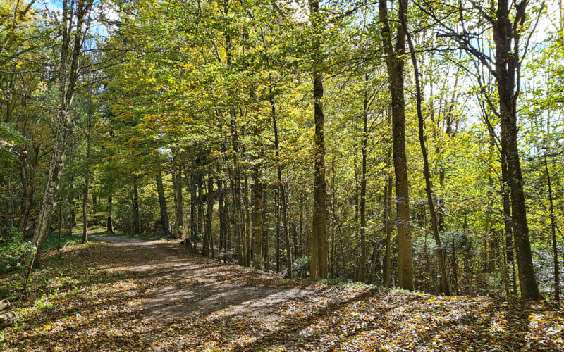
After just a few minutes, you’ll pass this nice picnic area with a fire pit and shelter.

After about 30 mins, you reach the tower. There is a firepit and bench at the base of the tower.
It’s about 152 steps to the top (we never get the same number), where there is an enclosed observation deck with a roof.

View looking southeast down Zürich lake.
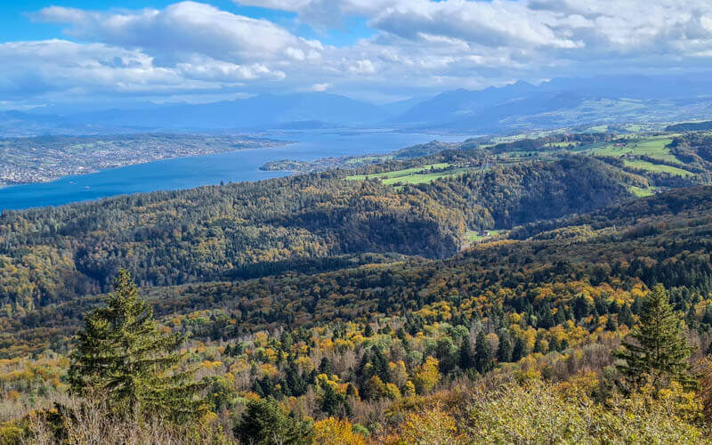
View west towards Zug, with Mt Rigi visible on a clear day.
A small picnic area below the tower with a fire pit.

Continuing on the trail though the forest towards Albishorn.

Love the shade on hot summer days.
A few ups and down on the trail and lumpy terrain. But nothing too difficult.
Lots of small interesting things to enjoy along the way.

One water fountain about 2/3 of the way to the restaurant.

A few trails criss-cross. Stay on the ridge, following signs to Albishorn.

An informal picnic area at the Turlersee viewpoint.

You can see the Turlersee lake from that viewpoint. Maybe go down there to swim later.

After about 90 mins, you’ll reach the restaurant. Walk on the path on your left to the viewpoint.

There is a small panorama terrace where you can picnic if you prefer not to go to the restaurant.

Views toward Zurich city.
This restaurant is very popular, so you might have to wait for a table. No reservations, except for large groups.

Their rösti is quite nice.

I got the veggie Flammenkuchen.

Go back the same way you came, following signs to Albispass.