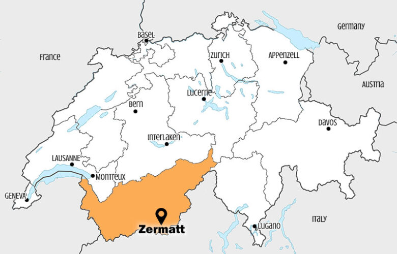
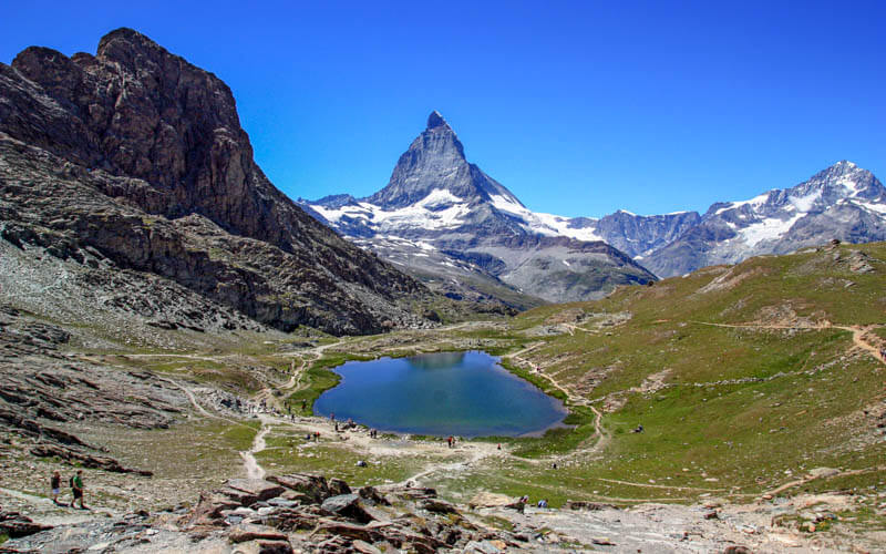
This Zermatt trail explores the valley carved out by the Gorner glacier over hundreds of years, today filled with larch trees and a rushing river. This trail is particularly nice in fall when the larch trees turn bright yellow, usually mid-October.
Later on the trail, there’s a nice playground and picnic area in the forest and a slightly scary suspension bridge to cross. The trail has some steep switchbacks, so probably better for older children, but we’ve seen kids as little as 5 on this trail.
I would definitely include this in your itinerary for a week of hiking in Zermatt.
Contents
Get our
| Region: | Zermatt, Valais, Eastern Switzerland |
| Starting point: | Gornergrat mountain train to Riffelberg Bahnhofpl. 1, 3920 Zermatt, adjacent to Zermatt train station |
| By car: | Parking in Täsch, then 20 min train to Zermatt. from Interlaken 2h20, Zurich 3hr40 |
| By public transport: | Train station: Zermatt From Interlaken 2h30, Zurich 3hr15 |
| Trail: | 7 km one way |
| Time: | 2h30 hours |
| Difficulty: | moderate • 75m up, 800m down |
| Condition: | rocky dirt path, steep switchbacks, no strollers |
| Elevation: | highest point 2123 |
| Open: | late June through early October • check trail status |
| Cost: | Mountain railways – Adult CHF 51 Discount 50% with with Swiss Travel Pass, Swiss Half Fare Card or GA. Children under 9 and dogs free. |
| Extras: | mountain hut with cafe and toilets |
| More info: | trail status – webcam |
If you want a printable itinerary for Zermatt, you can purchase my new eBook: Switzerland with Kids: 3 Days in Zermatt
Gallery


Trail Overview
This trail starts at the Gornergrat Riffelberg stop and ends at the Furi gondola station. It mostly follows trail #17 Gletschergartenweg (aka Glacier Garden Path), with a detour at 17a to cross the suspension bridge.

Step-by-step
-
Get to the Gornergrat train and ride to the Riffelberg stop.
-
Follow trail signs for Gletschergartenweg. After traversing some alpine meadows, the trail descends about 500m on switchbacks into the Gorner glacier valley.
-
Once you reach the river valley, we suggest spending some time wandering up river or picnicking along the water. You can walk up river a bit but you can’t reach the actual glacier.
-
Then continue the hike down river. When the trail forks, go right, following signs for Gletschergartenweg #17, which will climb some stairs.
-
When you reach the Gletschergarten (fenced area showing geological formations), fork left following signs to the Hängebrücke, Spielplatz, and/or Furi. You might want to check the trail map here to make sure you are going the right way.
-
You’ll pass a picnic area and playground. Then cross the suspension bridge.
-
Continue following signs to Furi.
-
The trail ends at the Füri gondola station, where you can ride down to Zermatt or continue hiking down to the village.
Trail map
See trail map on Komoot.
Shorter, safer version
If you are coming with smaller children and want to avoid the steep switchbacks, you can ride the cable car from Zermatt to Furi and walk on the service road to the Gletschergarten river valley, shown in the pic below. This is possible with an all-terrain stroller. This version is 2.5 km each way from Furi. See this trail map here.
How to get there
This trail is located in the Zermatt area in southern Switzerland. See on Google Maps.
This trail is accessed with the Gornergrat mountain train
Tickets
To start, you need a one-way ticket on the Gornergrat mountain train from Zermatt to the Riffelberg stop. At the end, you need a one-way ticket on the gondola from Furi to Zermatt. Or skip this and hike down to Zermatt.
The price varies by season. In 2025 July-Aug, this costs CHF 51 adult full fare.
Discount with with Swiss Travel Pass, Swiss Half Fare Card or GA. Children under 9 and dogs are free.
You can purchase tickets on Zermatt.ch or ticket booths on-site.
Operating Times
The trail is usually open from late June to early October, depending on snow conditions. Do not do this trail if there is snow or ice no the trail. Check trail status.
The mountain transport is open from about 8:30 to 17:30, possible earlier and later during high season. Check websites for current operating times.
Photo story of trail
Riding up to Riffelberg
Get off the Gornergrat train at the Riffelberg stop (not Riffelalp), which looks like this below.

There are trails leading all sorts of directions. Make sure to follow the trail labeled #17 Gletschergartenweg, also labeled Gletschertor.

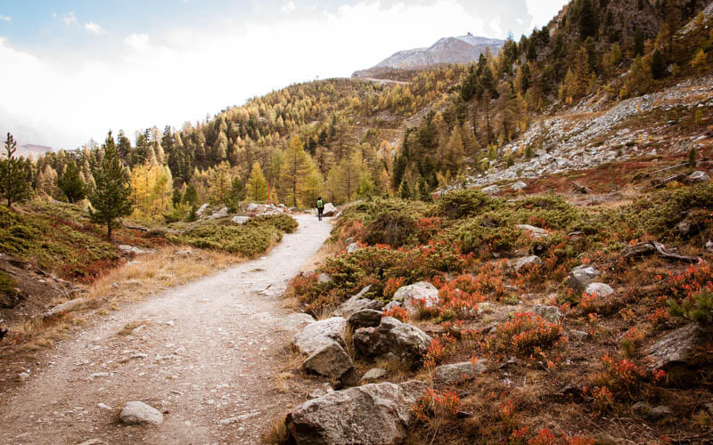
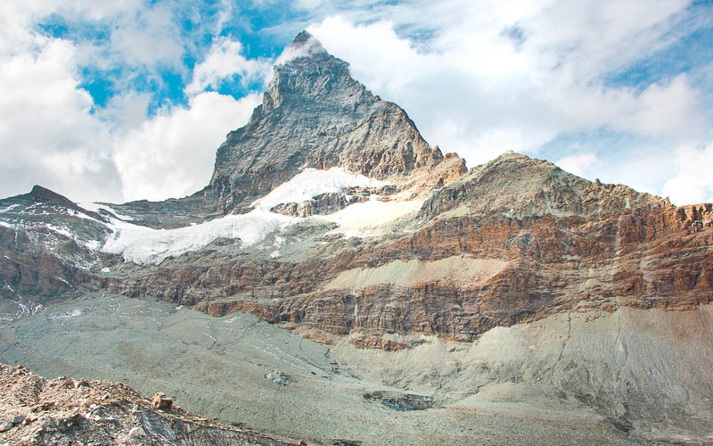
The trail starts off very easy winding around these slopes toward the Matterhorn.
At this fork, make sure to follow signs down to Gletschertor, not up to Riffelsee.
Hiking down the mountain
Then you start some serious switchbacks down about 500m of elevation descent over 1.5 km. Some of it has very tricky footing and loose rocks. Use your sticks and keep kids close on this part.
Seriously, straight down this mountain to the valley below.

Still looking down the trail down the mountain. It’s long way down.
Larch trees get thick once you get closer to the glacier valley. So pretty yellow in October.

Enjoying the glacier valley
The path takes you directly to the river, so beautiful! Great place for a picnic and throwing rocks.
There is a trail leading up river, the sign says Gletschertor, aka Glacier Gate. We hiked up this trail for about 10 mins to see if we could reach the glacier, which you cannot. The valley simply keeps narrowing then the trail basically ends. I guess you could keep going, climbing over boulders, but it wasn’t a real trail. But we liked walking up there anyway.

There are a few information signboards that tell about the glacier, text in German and English.

This sign shows where the glacier ice used to be in 1859. The arrow points to where this sign is standing near the river.

Leaving the glacier valley
When you are ready to keep hiking, follow the well-worn footpath down river. It eventually turns into a dirt road and passes a dam.
At this sign, you can either continue following the dirt road down to Furi (easy way) or climb up these stairs follow the Gletschergartenweg #17 signs. We took the stairs, with some complaining.

I liked this rocky part of the trail.

Glacier Garden park
Then you spill out onto a big clearing. On your far right, a footpath leads to the Gletschergarten (aka glacier garden) educational path. Follow the bright yellow sign shown below. After you visit the Gletschergarden, you loop back to this clearing and you can follow trail #17 again.
![]()
The Glacier Garden a small loop in the forest, passing rock formations carved by old glaciers. There are lots of info sign boards explaining what you are seeing

Below is an example of what you’ll see, lots of swirls and pockets in the rock. But honestly, it wasn’t that interesting for our crew, so we didn’t stay long. There is a picnic area there with grill pits.

Playground & Picnic
Return to the clearing and follow the dirt road down and to your left to reach the playground and picnic area (signs say “Schweizer Familie Feuerstelle & Waldspielplatz”). There are picnic tables and grill pits with wood. There is a zip line, swings, and climbing structures. I’m sure this gets busy in summer, but it was chilly and deserted in October.


Suspension Bridge
At this point, we deviated from the official Gletscherweg #17 trail, which doesn’t cross the bridge and stays on the east side of the river. Instead, we crossed the bridge and walked to Furi on the west side of the river. Either way works.
To follow our trail, walk through the playground and follow signs to the Hängebrücke, aka suspension bridge, shown below. The trail continue on the far side of this bridge.

I’m not usually nervous on these bridges, but this one made me queasy.

End at Furi cable car
Continue following the footpath toward Furi, walking through a dense forest, then some fields.

When you reach a road, follow signs to Füri where you’ll find the cable car down to Zermatt. We missed the last car down at 17:30, so we hiked another 3 km down to Zermatt, a nice trail but made for a long day.

Here is the cable car station at Furi, where you can buy your ticket. There are WCs here.


4 responses
Can i confirm this trail alloed for hiking start from late june only? We planned to go on mid Apr.
This trail will have snow in April and will not be possible to hike until probably late June. You can see the trail status on the Zermatt website.
Hello! We have two small (rather lazy) children, ages 5 and 6 years old. I love the look of the playground and suspension bridge. Do you know if it’s possible to get to those without doing such a long hike?
Yes, you can hike up from the Füri cable car station. But your kids would probably be happier at the Sunnegga playground, which is much easier to reach.