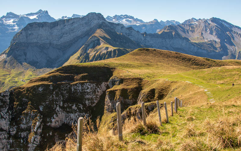
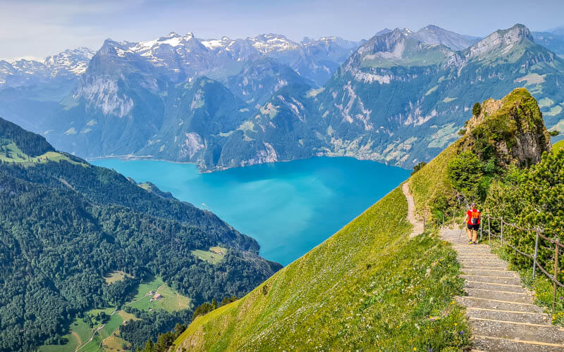
If you’re looking for fun challenge, this is it. It’s a long hike, starting by circling the Wirzweli mountain arena. Then a tough climb up the mountain to the Stanserhorn peak (1820m), where you get panorama views over Lake Lucerne. As always, directions, trail map, and photo story below.
I did this as a solo hike and it was fantastic! There’s a real sense of accomplishment when you arrive huffing and puffing at the top of Mt Stanserhorn where everyone else has simple ridden up the cable car. You earned that view and a delicious lunch at the restaurant on the panorama terrace.
If I went back with the kids, I would probably do the hike backwards as I saw several other families doing. That way you have a long downhill instead of a long uphill and you would end at the playground and alpine slide, a nice reward for a good hike.
| Location: | near Lucerne, Central Switzerland |
| Address: | Start: Dallenwil-Wirzweli cable car End: Stanserhorn cable car |
| Car: | Park at Stans train station: Durerr, Robert-Durrerstrasse 6, 6370 Stans Then 5 min train to Dallenwil, then shuttle to Wirzweli cable car From Lucerne 20 mins, from Zürich 50mins |
| Train: | Dallenwil, then shuttle to Wirzweli cable car From Lucerne 25 mins, from Zürich 1hr25 |
| Trail: | 11 km one way, about 4 hours |
| Elevation: | highest point 1855m, 856m up, 222m down |
| Technical skill: | moderate, mountain trail with uneven terrain, stairs and steep switchbacks |
| Stamina: | challenging, best for ages 8+ |
| Services: | restaurant and WC at start, after 2 km and at the top |
| Cost 2021: | combo cable car fare CHF 51.80 Discount for SBB Half-fare and children. GA & Junior card free. |
| Open: | typically June through October, weather dependent |
| More info: | Stanserhorn – Wirzweli – webcam |
Location
This trail starts at Wirzweli, a mountain resort south of Lucerne in central Switzerland. The hike ends in Stans, where you can take a train to return to your starting point.
Summer map
Here is the summer hiking map of the area (download here). I’ve pointed out the start and end points of the hike.

Trail map
This one way hike starts in Dallenwil, riding up the Wirzweli cable car. The trail starts with a steep hike up to Gummen ridge, then a slow easy traverse circling the valley. Then straight up the mountain to the top of the Stanserhorn mountain peak, where you’ll find a restaurant and other services. Then ride down an open-air cable car, then a funicular to Stans, where you can catch a train back to your starting point.
You can hike opposite direction, starting at Stanserhorn and hiking down Wirzweli. This would be difficult on the knees with the steep downshill, but it wouldn’t be as exhausting.
See map on Komoot • SchweizMobil • OutdoorActive
Trail description & timing
The trail is 11 km, with about 850m of elevation gain. The posted time is 4 hours, which would be accurate with kids. I did this solo and did it in 2hr45, hiking fast and jogging the downhill sections. The trail alternates between service roads and dirt footpaths with uneven terrain and stairs. This is not suitable for strollers.
The first 2 km is a steep uphill, gaining 300m of elevation rather quickly. The next 6.5 km are easy with some mild down and up. At the 9km mark, you start the super steep climb with lots of switchbacks and stairs, gaining another 300m of elevation over 1.5 km. The grade gets as steep as 30% in some parts.
Shorter options
You can ride a cable car directly to Stanserhorn and enjoy the views with minimal effort. At the top, there is an easy 1 km loop, restaurant, and picnic area. See details for Stanserhorn Viewpoint.
At Wirzweli, you can start with the Geoweg but instead of climbing up to Stanserhorn, you can loop back to the Wirzweli cable car. This Panorama trail loop is about 9 km, 430m up/down. See trail map. You can make this even shorter by skipping the climb up to Gummenalp and riding a second cable car up instead.
Getting Here
Since this is a one-way hike, you have to connect your starting and ending spots by train as described below.
By car: Drive to Stans where you will end the hike. Park in the Stans Bahnhof parking garage below the train station (Durerr, Robert-Durrerstrasse 6, 6370 Stans). It’s CHF 5 for 8 hours. You get a discount on the parking if you are taking the train (which you are). So buy your train ticket, then go to the ticket booth and ask for the Park+Ride validation, which they will put onto your parking ticket. You need to show a valid train ticket for that same day.
Take the train one stop from Stans to Dallenwil (CHF 3.70 full fare). This train runs on the xx:24 and xx:48. In Dallenwil, take the free shuttle to Wirzweli as described below. Your hike will end at Stanserhorn, where you ride down to Stans where your car is parked.
By train: Take a train to Dallenwil then take the free shuttle to Wirzweli as described below. At the end of your hike, you’ll be at the Stans train station, where you can catch a train home.
Free shuttle from Dallenwil to Wirzweli. There is a free shuttle van from the Dallenwil train station up to Wirzweli, but you must call in advance – +41 41 628 23 94. It takes them about 10 mins to drive down to pick you up. So best to call early and tell them when your train arrives. The van fits 8 people, so on busy days you may need to wait your turn. You could walk up the road 1.1 km to the cable car, but that’s a bit of wasted effort.

Ticket prices
You can buy a combo ticket for this trail that includes one way on each cable car, Wirzweli and Stanserhorn. In 2021, this ticket costs CHF 51.80/adult, CHF 26.30/adult with SBB Half-fare and children. GA, Junior Card and under 6 ride free. If you are driving, you’ll also need to factor in the cost of parking and the train connecting Dallenwil and Stans, the two ends of the hike.
Note: When you get to Stanserhorn, make sure to go straight to the cable car station and pick up a departure Boarding Pass. Sometimes the cable cars are sold out, so you may have to wait a long time to go down. Better to find that out right away, then while you wait, you can wander around the top enjoying the view and eat a meal.

Operating times
This trail is typically open from mid June through mid October. But make sure to check that Stanserhorn is free of snow before doing this hike.
The Wirzweli cable car opens 7:40, last car down 18:20, every 20 mins. Check current operating times. See Wirzweli webcam.
The Stanserhorn cable car opens 8:15, last car down 17:15 Su-We, 22:00 on Th-Sat. Check current operating times. See Stanserhorn webcam.
What to wear & bring
Wear sturdy hiking shoes and bring hiking sticks. It’s not a particularly dangerous trail; it has railings along cliff sections and the trail is well built. But best for those aged 8+ with hiking experience. However, I saw several families hiking down the trail, with children as young as 6.
Bring min. 1 liter water per person and snacks. At the beginning of the hike at Wirzweli, there is a restaurant, playground, alpine slide, and WCs. After 2 km, you reach Gummenalp, where there is another restaurant with a view, small playground and WCs. Then nothing till you get to the top of the Stanserhorn, where there is a restaurant and picnic area with a fire pit and wood.
Photo story of the trail
Arriving at Wirzweli
The Dallenwil-Wirzweli cable car. I took this pic in Feb, thus the snow on the mountains. When I did this hike beginning of Oct, there was a bit of snow but it melted by mid-day.

There are two cable car cabins. It runs every 20 mins.

At the top, follow signs to Geoweg. Our final destination is Stanserhorn.

Hiking up to Gummenalp
Looking back at the Wirzweli cable car station as I start the climb up to Gummenalp.

A little fresh snow on the trail in early October. Since this is a Geo trail, it has sign boards along the way describing geological features you’ll see.

Arriving at Gummenalp
After the first steep climb, you arrive at Gummenalp. If you wanted to shorten the hike a bit, you could have taken a second cable car up here. That cable car is about 800m from the Wirzweli station.

At Gummenalp, you’ll find a restaurant and playground.

There is also a picnic area with a fire pit and wood.

Hiking across to Ächerli pass
Now following a service road the circles above the valley. Another Geoweg info board.

One of the prettiest parts of the trail.


The trail forks a few times. Follow signs to Acherli and Stanserhorn.

Stay on the service road.

Looking back to Wirzweli.

View from the Acherli pass with a view of the Sarnersee lake.

Climbing up the mountain to Stanserhorn
After Acherli, you pass through a few farmhouses. It was a little tricky to see exactly which path I was supposed to take. Check the signs carefully and stay on the Geoweg to Stanserhorn.

Now the big climb begins on a dirt footpath.

You are going to gain about 300m over the next 1.5 km, about 45-60 mins.

Very dramatic views from here.

The trail was easy to follow, but sometimes slippery dirt. Hiking sticks were useful on this section.

Pretty soon you’ll be on top of those cliffs.

Most hikers were going down this trail, still difficult but not as exhausting.

Near the top, the trail wraps around the cliff. There is a fence on one side to make it safer.

The trail was quite narrow at times, but I didn’t feel that it was particularly dangerous.

Looking back at the Chil Horn peak that we passed along the way.

Some stairs on the trail.

Arriving at Stanserhorn
Finally done with the climb and rewarded with a view over Lake Lucerne.

Most of these people rode the cable car up here and just wander around the top. On the right side of this pic, you can see a picnic area with tables, fire pit and wood.

At the viewpoint, there are railings so even small children can safely enjoy the view.

Looking down at the Stanserhorn cable car station and restaurant. Remember to go pick up your departure Boarding Pass, with a designated time slot to ride the cable car down. Since it’s a popular tourist destination, the cable car can fill up fast. You don’t have to pay again. Your combo ticket you bought at Wirzweli covers this ride.

Lounge chairs and lots of outdoor seating.

Walk out to the platform for a tiny thrill.


If you walk past the cable car, there is a path leading along the ridge.

That path leads to another picnic area with a grill and wood.

Riding the cable car
Get in line a few minutes before the time on your departure Boarding-Pass. If you want to ride on top in the open air, there is a separate line.

The railing on top is quite tall, so there is no risk of falling out.

Enjoy the ride down to Stans where you can pick up your car or ride the train back home.