
This mountain hike starts at a beautiful reservoir and climbs into the mountains, wandering through Europe’s oldest wildlife reserve. It’s not unusual to see wildlife in this area. Last time, we saw a chamois on the way up the cable car and could hear marmots peeping all over the mountain during the hike.
One of the best parts is a dramatic natural land bridge over a raging river, waterfalls spilling off cliffs, wildflower filled fields, a precious little alpine lake reflecting snow peaks.
It has a nice climb at the start that might induce a little complaining but nothing serious. It will only make the reward of the views that much sweeter.
If you fancy an overnight, there’s a nice hotel near the cable car, with excellent food, small playground, and outdoor hot tub for guests.
Keep reading for all the practical info you need to plan this hike.
| Location: | Canton Glarus, Eastern Switzerland |
| Address: | Mettmenalp cable car: Kies, 8762 Glarus Süd |
| Car: | Parking at cable car: 46°58’03.9″N 9°05’26.0″E 1hr30 from Zurich |
| Transport: | Bus stop: Kies 1hr40 from Zurich |
| Trail: | 7.1 km loop, about 2.5 hours |
| Highest point: | 1960m |
| Condition: | narrow dirt foot paths, no strollers |
| Skill: | moderate, 400m up/down |
| Open: | best June through October |
| Cost 2021: | Cable car return CHF 18/adult, CHF 9/child (6-16) No discount for SBB GA or Half-fare. SBB Junior card accepted. |
| Services: | mountain restaurant, fire pits |
| More info: | www.mettmen-alp.ch • webcam |
Location
Mettmenalp is a mountain area in the Glarnerland region in eastern Switzerland. To access the hiking area, you first drive up a narrow mountain road, then ride a small cable car up to the reservoir and trails.

Here is the summer hiking map for this area. We did trail 2 on the map below, the Kärpfbrugg-Rundweg.

Trail map
This trail starts at the reservoir, hikes up one of the the surrounding mountains and loops back through alpine meadows, following the river back down to the reservoir.
We hiked this trail counterclockwise, putting the steeper climb at the beginning of the hike, with a milder descent on the second half of the trail, which we preferred. This also means you approach the big river bridge from the more dramatic side. But you can obviously hike it either direction.
Trail Conditions
The trail is a narrow dirt path, often rocky and lumpy, not suitable for strollers. There are switchbacks on the steep parts and some might appreciate hiking sticks on these parts. The trail is not dangerous, no cliffs or steep drop-offs. The only potentially dangerous section was near the part where the big river passes through a cave. The trail is set away from the cliff, but there is no barrier. So keep small children away from this part.
Other trails here
With little kids, you might prefer the short & easy 2k around the lake.
For a longer hike, you can hike up to the Legler mountain hut for lunch then back to the lake. It’s about a 12 km loop, 800 m elevation gain. See details for Legler hut hike.
Where to eat
Near the cable car, there is a hotel and restaurant with a small playground. At the lake, there are several picnic areas with fire pits and wood. There are a couple amusements for the kids included a memory game and long jump. There is a water fountain where you can fill your water bottles.
How to get there
Note: In 2023, because of landslides in this area, the road from Schwanden up to the Mettmenalp cable car is closed to public traffic. Instead, they are offering a shuttle service from Schwanden. Follow the signs to the designated parking and use the shuttle as directed. The landslide does not affect the trails.
By public transport:
Take a train to Schwanden (the S25 from Zürich HB is a direct train with no stops). Then take the Mettemenbus to Kies. This bus runs about once an hour, usually coordinated with the train schedule. But check the schedule carefully. Especially note the departure times from Kies, so you don’t get stuck waiting too long on your return
By car:
Note: In 2023, there was a landslide in the valley, so private cars may not be allowed to drive to the cable car parking when you go. Instead park in Schwanden and ride the Mettmenbus.
We don’t love driving to this cable car because it’s a narrow, winding mountain road, making it scary and difficult to pass oncoming cars, especially the bus. We much prefer to park at the Schwanden train station (metered) and take the bus up to Kies, next to the cable car.
If you must drive, drive to Schwanden, then follow signs to Kies-Mettmenalp (sometimes spelled “Chies”), driving up a narrow one-lane mountain road. Your destination is Luftseilbahn Kies-Mettmen (GPS: 46°58’03.9″N 9°05’26.0″E). There is lots of parking next to the cable car and an overflow lot a bit down the road.
Note: There is a warning sign saying that a large public bus drives down this road between xx:30 and xx:59. Although there are many turnouts, you may find yourself in a difficult situation trying to pass this bus. They are not kidding – you don’t want to have to pass this bus! Best to plan your trip, so you arrive at the hour and drive up the road without the bus. On your return trip, the bus drives up the road between xx:00 and xx:30, so plan your return trip so you drive down after xx:30.
Tickets and operating times
Here is the cable car station at Kies. There is a ticket office inside where you can also get a free hiking map. There is a toilet here.

Summer season for Kies-Mettmen cable car is typically from late May through end of October. In generally runs every day 7:30 to 18:00 (till 19:00 on weekends). Through August, it runs every 15 mins. September and October, it runs every 30 mins. The ride is about 4 mins. The cable car is small, fitting maybe about 12 people.
In 2024, a cable car return ticket costs Adult CHF 20/adult, CHF 10/child. Seniors get a small discount. No discount for SBB GA, Half-fare or other travel passes. However, kids with a SBB Junior ride free.
Check the website for current operating time and prices.
Photo story of the trail
Arrival at the top at Mettmen
View from the top of the cable car back down to the Glarnerland valley.

It’s a short walk on a paved path from the cable car up to the lake. The Berghotel and restaurant are on the left.

There is a small playground behind the hotel. Maybe stay overnight here. There’s a hot tub near the playground for overnight guests.

After the hotel, the path splits. Take the dirt path to your right, which is more direct.
The lake
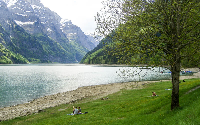
Here’s the lake. The water level rises over the course of the summer, so it might look different when you are there.

There are a couple amusements for the kids including this memory game. Even my 16 year wanted to do this over and over and competed with his brother to see who could do it faster with no mistakes.

Start the hike
We did this hike counterclockwise, so we started across the dam at the northeast end of the lake.

Then up up up the mountain. As I mentioned before, we chose the shorter but steeper climb to get it over with, instead of a long slow burn if we went the opposite direction. I think we made the right decision.

Make sure to follow the signs with the green “Chärpfbrugg Rundweg” marker.

Continuing to go up. I must admit – this part of the trail was a little boring and I was worried. But it gets so good once this climb is over. It’s worth it.

See us climbing up on the right.

Almost to the top. We’ve been hiking for about 30 mins at this point.

The long climb is over when you come over the edge and see this. You’ll still go up, but it’s not nearly as much work as before.

Small detour to a peak
At this sign, we chose to do a little detour up the peak on the right, totally optional.

It took us about 5 mins to scramble to the top, which I think was well worth the effort. We had a little break and snack up here.

Back on the trail, last climb
Back down from the detour and following that green sign again.

The trail continues upwards, very mild and not steep. But my son said: “You said the climb was over. Not true!”

You meander through some rocky bit.

In early June, we crossed a only one snow patch. But 2020 was a low snow year so I’ll bet there could be even more snow on a different year. Probably safer to hike here in late June or July.

At this lake, we jumped off the trail to find a picnic spot. But it was very boggy and lots of cow pies. So we snapped some pics of this beautiful lake and moved on.

You can’t get this pic with the reflection unless you leave the trail. Make sure you do that!

Going down
Now the climb is over, hooray! It’s all downhill from here.

At that building, turn left and head down the valley.

A lot of yellow flowers on your way down.

Join the valley path
Now you join the valley path and follow signs back to Mettmen.

Here’s your path down the valley.

Then you see the Kärpfbrugg, a 50 meter wide natural bridge over the river, the promoted feature of this hike.

I sent my people ahead so I could take a pic of them standing on the top of the bridge. It made me nervous to see them standing there, but once you go over there you see that a reasonable person (not a small child) can safely stand there without getting too close to the edge. But if you have small kids, stick to the trail since there are no barriers along the edge.

Nice mild section through the meadow.


Make sure you leave the main path to visit this observation pod. Inside there are horns from various local animals like Steinbock, showing how old the animal by the rings on the horn.

Back at the lake
View down to the lake where you started.

The trail wraps around the mountain.

Now back to the lake.

The last easy bit along the lake shore.


Last bit across the dam then back to the cable car.

If you are driving, remember that the bus comes up the mountain between xx:00 and xx:30, so if you need to waste time, do it up here by the lake and not in the parking lot. Best to catch the cable car at xx:15 or xx:30.
If you need to catch the bus, it leaves Kies at xx:35, timed with the cable car. So catch the xx:30 cable car.






8 responses
Thank you, Tanya, for the post. We were there today, and it is not possible to drive up to the cable car without a permit. The only option is to take the bus from Schanden, as proposed here. There is still quite a bit of snow, so we were only able to hike around the lake.
Yes, there was a landslide in this area, which has closed the road to public transport. Instead they offer a shuttle bus to the cable car from Schwanden. I was hoping they would have resolved this by now. But I guess the repairs are taking a long time and danger on that road still exists. Thanks for the reminder. I’ll add a note to my post.
Wonderful thanks for the tip!
When going in other direction actually you can go through the tunnel with the river, which was our favorite part of the hike!
That’s crazy! The river seems much too wild to walk through that tunnel. I’ll have to investigate next time.
Thanks for the tip! I’d been to this area last fall but your post reminded me of the many opportunities in this valley. I went last Wednesday and did an extended version of your route; essentially, route#3 on the map. There was snow only on a few brief patches at the higher end. https://davidkotz.org/2020/06/24/mettmen-leglerhutte/
Thanks for the tip on the alternate route. I’d love to try it!
Great detailed description on how to get there, what you are going to see, how difficult the trail is, the pricing of the gondola, the bus schedule. What a beautiful hike. Can’t wait to see it in person.
Can’t wait to take you there!