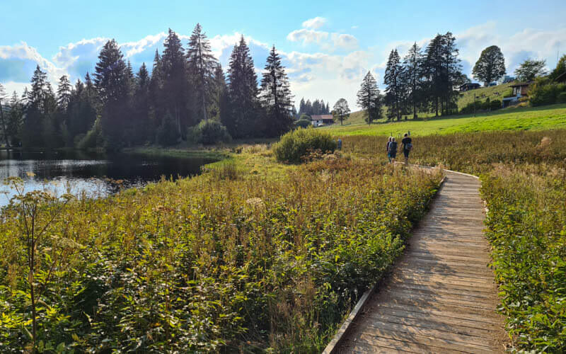
This easy trail loops around a small lake in the Jura region of western Switzerland. It’s a peaceful place in the center of a nature reserve, home to many birds. In summer, this lake is a popular spot for picnics and swimming, but only for confident swimmers as there are no shallow entry points. For travelers, this pretty hike is a nice addition to an itinerary in this area. For locals, a relaxing walk any time of day in any season.
| Location: | Saignelégier, Jura 3 Lakes region, Switzerland |
| Car: | Parking: near La Theurre 6, 2350 Saignelégier – 47°14’22.9″N 7°02’19.6″E From Bern 1hr30, Basel 1hr15, Zürich 1hr40 |
| Train: | Bus stop: Saignelégier, La Theurre From Bern 1hr50, Basel 2hr10, Zürich 2hr10 |
| Trail: | 2.7 km loop, about 45 mins |
| Elevation: | highest point 1010m |
| Condition: | dirt path and wooden walkways, ok for all-terrain strollers but not wheelchairs |
| Skill: | easy, 20m up/down |
| Services: | picnic area with fire, restaurants within walking distance |
| Cost: | free |
| Open: | May to October |
| More info: | centre-cerlatez.ch • nearby webcam |
Location
This small lake is located in western Switzerland, north of Neuchâtel.
Hiking map
There is a walking path around the lake as shown below. Since it’s a nature reserve, they ask you to stay on the path. For the most part, the path is wide and smooth dirt, some wooden walkways.
See hiking map on Komoot • SchweizMobil
Accessibility: I think you could bring an all-terrain stroller. But I didn’t pay enough attention to know if it is completely obstacle-free for wheelchairs.
How to get there
By car: The closest address to the parking is near La Theurre 6, 2350 Saignelégier – 47°14’22.9″N 7°02’19.6″E. If that lot is full, the “south” parking lot is at 47°14’07.3″N 7°03’00.8″E. There is path directly from this parking through the forest to the lake. You don’t have to walk along the road.
By public transport: Most connections have you take a train to Saignelégier, gare, then bus 32 to Saignelégier, La Theurre. The bus stop is just a few meters from the start of the path.
Where to eat
There is a picnic area with firepits near the start of the trail, not next to the lake. The lake is a nature reserve, so no fires allowed on the lakeshore. If you need picnic supplies, the closest grocery store is Migros at Rue de la Gruère 23, 2350 Saignelégier, about a 3 mins drive from the lake.
Near the parking area, there is Auberge de la Couronne, which has a restaurant (see on map). There are more restaurants in nearby Saignelégier.
Where to swim
There are a couple wooden platforms with stairs where people enter the water for swimming. See approximate location on map.
What to wear and bring
You can wear any comfortable walking shoe, you don’t need hiking shoes. Dress appropriate to the weather forecast. There are no water fountains, so bring water with you.
Photo story
Much of the path is very close to the water.

Lovely reflections on a calm sunny afternoon.

Wooden walkways and bridges to protect the marsh.

Here’s one of the platforms where people enter the lake for swimming.

I swam in this part of the lake, but no pictures of that.

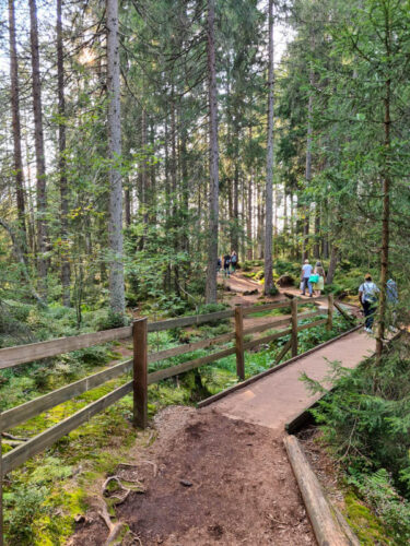
Lots of shade in the forest, nice for hot summer days.

Some of the path is in the forest away from the water.
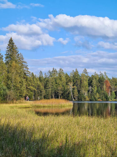
Ending our loop.