Engstligenalp has the 2nd highest waterfall in Switzerland, which you can admire as you ride up the cable car. At the top, there is an enormous, strangely flat alpine valley surrounded by impressive snowy peaks. There are lots of hiking options including an easy stroller-friendly path circling the valley with a boulder parkour course.
This area felt special and unique and definitely worth the long drive, at least for our family. It’s a bit far for a day trip from Zurich, but there are plenty of activities in the Adelboden area to keep you busy for a weekend or longer.
| Location: | Adelboden, Bernese Oberland, Switzerland |
| Address: | Engstligenalp cable car Unter dem Birg, 3715 Adelboden |
| Car: | Parking at cable car: 46°27’34.0″N 7°33’56.6″E Interlaken 1hr • Bern 1hr10 • Zürich 2hr30 |
| Train: | Bus stop: Adelboden, Unter dem Birg Interlaken 2hr10 • Bern 2hr • Zürich 3hr |
| Trail: | 4.5 km loop around valley, optional detour to waterfall viewpoint 2 km round trip |
| Technical skill: | easy, smooth dirt, obstacle free |
| Stamina: | easy |
| Open: | mid June through mid Oct |
| Cost 2023: | cable car round trip CHF 37/adult discounts for families, SBB GA, Half-fare, Swisspass, Junior card, etc. |
| More info: | engstligenalp.ch • webcams • weather |
Overview
Engstligenalp is located in the Bernese Oberland, southwest of Interlaken.
Summer hiking map
The summer hiking map below shows the hiking options in this area. You can get a free map available at the gondola station. We did hike #6 that loops around the valley. We also did a short detour down the mountain to see the falls a bit more close up.

Trail map
Here’s a map of the obstacle free trail that loops around the valley.
See map on Komoot • Schweiz Mobil • AllTrails • OutdoorActive
Optional detour to waterfall viewpoint: Before our hike, we did a slight detour down the mountain to see the waterfalls. This is about 1 km each way to the lookout point. It’s a narrow dirt footpath, not suitable for strollers.
Free options: You can also hike from the valley to the the lower falls on this hike. You can hike up the mountain and skip the cable car on this hike. I have a friend that did this with her five children, including toddlers.
Getting There
By car
Drive to the Engstligenalp cable car – Unter dem Birg, 3715 Adelboden (46°27’34.0″N 7°33’56.6″E). There is metered parking adjacent to the cable car.
By public transport
Take a train to Frutigen, then a bus to Adelboden, Oey, then another bus to Adelboden, Unter dem Birg , which drops directly at the cable car station. See SBB.ch for current train and bus schedule.
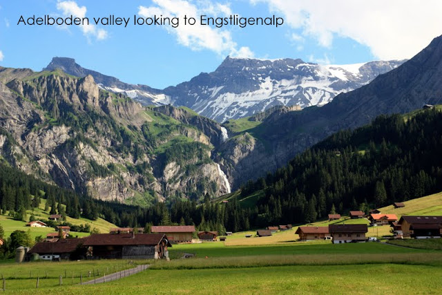
As you approach the gondola base station, you can see the big waterfall in the distance as shown above. At the end of the road, you’ll find a big parking lot next to the gondola station, where you’ll also find a restaurant and a small playground.
Ticket prices
You can simply hike to the base of the waterfall from here for free. Or you can take the gondola up for an aerial view as it takes you up Engstligenalp, like we did. The gondola goes up every 15 minutes and was quite affordable.
In 2021, a return ticket cost 32 CHF/adult and 12 CHF/child. The accept SBB Half-fare and Junior cards. They also offer a family card: 56 CHF for 2 adults and max. 4 children. See current prices on their website. Their summer season runs from mid June through mid October, daily 8:30 to 17:10.
Where to eat
Near the top of the cable car, there are a few mountain restaurants including Berghotel Engstligenalp, Berghaus Bärtichi, and Raclette Hütte. I didn’t see any official picnic areas with fire pits along the trail. But there are plenty of nice places to stop for a cold picnic.
What to wear
Check the forecast and wear clothing appropriate for the weather. If there is a chance of rain or clouds, bring a light rain jacket in case the weather changes quickly in the mountains. Bring a sun hat and wear sunscreen. Some of this trail is a narrow dirt footpath with uneven terrain. It’s not super difficult, but you may feel more comfortable with hiking shoes with good tread.
What to bring
There are restaurants at the beginning of the trail. But I would still bring 1 liter of water per person and snacks. If you need picnic supplies, you can stop at the Volg (Bodenstrasse 38, 3715 Adelboden) on the road leading to the cable car.
Photo story of the trail
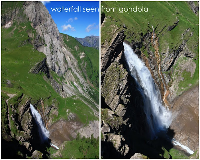
Here is the view of the waterfall as seen from the gondola.
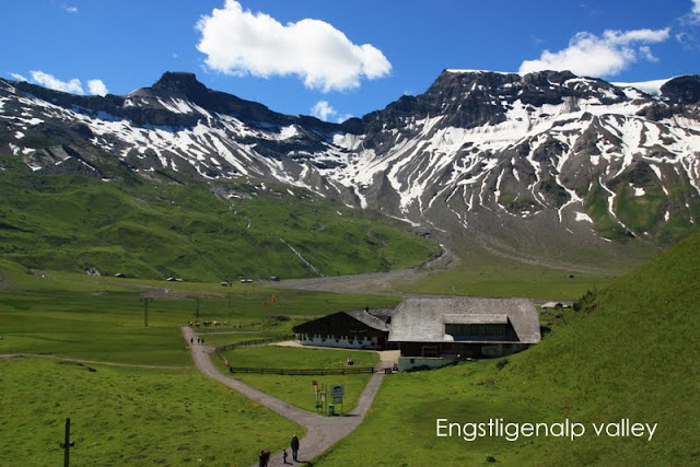
At the top, you arrive at the high alpine valley, where there are a couple restaurants and cheese makers.
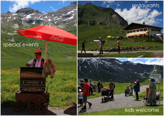
We happened to be there on a special event day, when organ grinder enthusiasts were stationed along the trail, grinding out happy tunes and adding some vintage atmosphere. It’s a good idea to check out the resort’s event calendar and coordinating your visit with one of these events.
Both hikes described below start from the top of the gondola.
#1: Hike to waterfall viewing point
Before we did the easy valley walk, we hiked down to get a closer look at the waterfall. This trail is not stroller-friendly, but it’s not particularly long or difficult and you get a really great view of the waterfall and surrounding peaks. I recommend doing this first when everyone is at full energy, then moving on to the easier valley walk. We spent about 90 mins going down and back, walking slowly and taking lots of recreational breaks. But actually walking time was about 20 mins each way.
To see the waterfall, follow the main trail into the valley until you reach the big river, then turn right and follow the trail along the river (it passes a little dam) and down the mountain. There are few different trails splitting off the main trail; it doesn’t matter so much which you take as they all converge sooner or later at a cow gate. If you take the dirt trail close to the river, there is a nice spot (about 10 minutes down the trail) where you can you splash around, throw rocks and enjoy a couple of the smaller waterfalls before you get to the really big one. Two of our crew even swam in the chilly water.
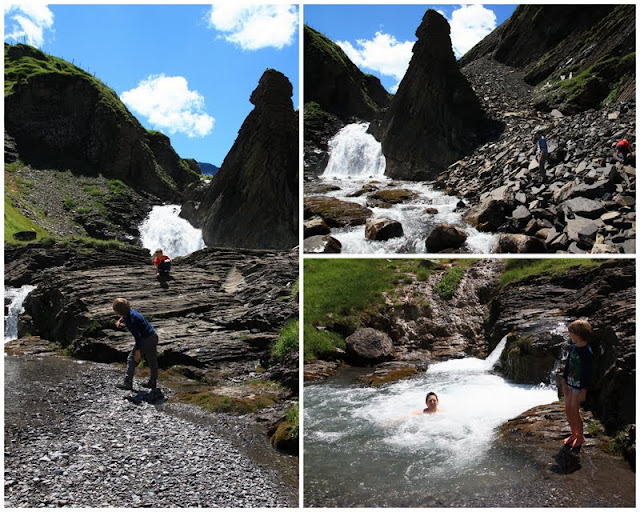
Continue on the trail until you reach the cow gate. After you go through a gate, the trail weaves around to a view point near to the waterfall.
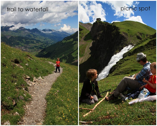
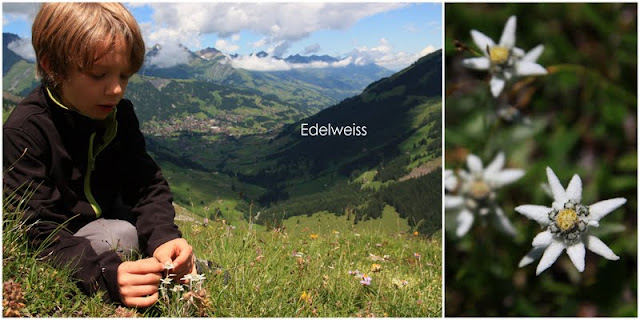
This was a great picnic spot, not only because of the view but because we finally found wild Edelweiss. Almost seven years hiking in the alps and never once have we seen it growing in the wild. Very exciting!
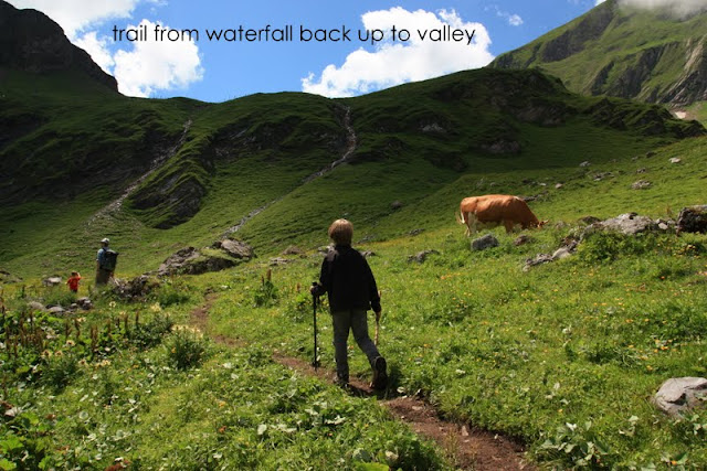
When you’ve seen enough, make your way back up to the valley. We took a different trail back up, farther from the main river, which had lots of wildflowers and cows.
#2: Stroller-friendly valley loop trail
The obvious option with kids is the valley loop trail that is specifically designed for accessibility, with a picture of a wheelchair right on the trail sign. You can see in the pic below, a family with a stroller cruising through the alpine meadow. The trail is 2.5km long and I think the posted walking time is 1 hour. We spent about 2 hours on the trail, including lots of “rock climbing”.
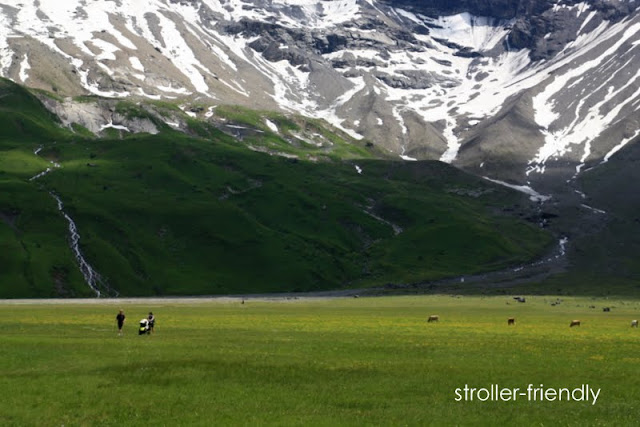
Parts of this trail follow along streams and rivers, which is always a nice distraction for the kids.
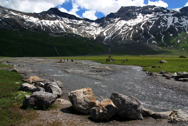
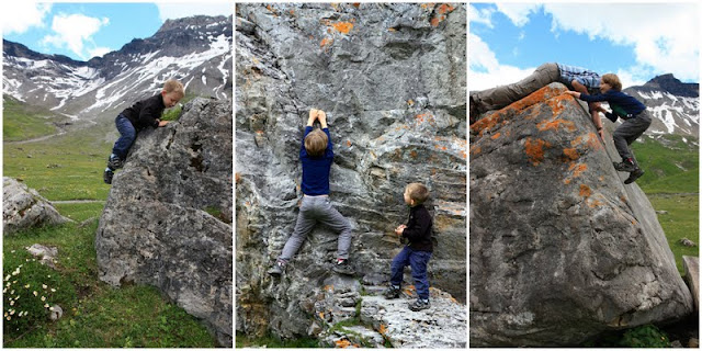
At the far end of the valley, there is a big boulder garden, which is promoted as the Mammut Boulder Parkour course. There is a brochure and boulder map available at the gondola station (and here as a PDF).
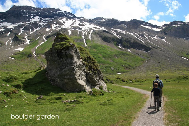
I didn’t find the brochure particularly helpful. But from what I could tell, various boulder have marked routes, painted with a number and arrow on the rock itself. The color indicates the difficulty: green = easy/children, blue = medium, red = hard, grey = impossible.
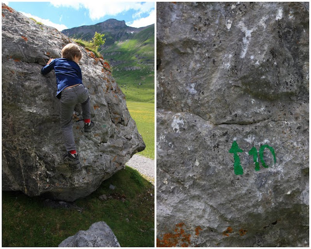
This was very exciting for my boys as we’ve been watching lots of parkour/free running videos and following Ninja warrior. So my boys wanted to try out their “skills” in the wild. My 8 YO could do some of the green ones and my 4 YO had fun trying. There are lots of smaller rocks that even very little kids could safely and easily climb around on, even if they can’t do the marked routes.
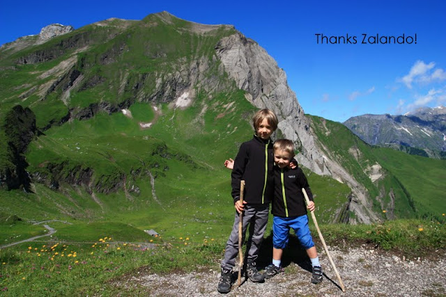
By the way, don’t my boys look handsome in their new jackets, courtesy of Zalando.ch. Zalando makes online shopping in Switzerland easy, especially with the free shipping. Thanks Zalando!
Happy hiking!






9 responses
I am sorry but I found it clear about the walk to the Engstligenalp Falls in you Swissfamilyfun But it appears the walk to the falls could be harder on the beginning half? I am 77 years old and healthy but at the same time I need to be careful, and not get into a climb situation on rock or dirt. I do not mind going up and down both the same way, but we want to see the falls.
Hi. In your case, I would suggest walking to the falls via the private country road that leads from Ribi to the falls viewpoint. Do not ride the cable car and do the mountain trail. The road is fairly easy walking, no dangers. I hope this helps.
@Kayli – you are amazing! Now I'll have to harder hikes to keep up with you.
@Sylvia – Thanks! I'm glad you are enjoying the blog. If you've got something great to suggest in Geneva, maybe you could do a guest post 🙂
I'm really enjoying your detailed blog posts with pictures! We're based in Geneva but hope to by trying many of the trips you mention. I have two boys similar in age to yours – 5 and 8, so they should be right up our alley.
This comment has been removed by the author.
Oh, oh – edelweiss in the wild.
I am SO excited, and now I just have to go there.
Thanks Tanya!
Hi Melinda,
How nice to get this news. Thank you! I'm glad you've found the blog helpful. I wish you and those in your community a fun filled summer.
– Tanya
Hello,
I just wanted you to know that you were recently featured as a “blog to watch” in the Basel Children's Trust newsletter on technology. I recently stumbled across your blog and thought it was certainly worthy of sharing with our community. Thank you for the job well done and for sharing all of your experiences.
Best,
Melinda