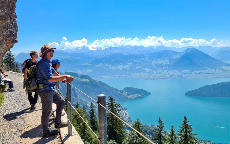
This beautiful trail traverses mountain high above the Schächen valley south of Lucerne. It has dramatic peaks, wide panorama views, rolling alpine meadows, forests and a little alpine lake popular for picnics.
This trail is a particularly nice choice for spring and fall, since the cable cars run all year round and it faces the sun. You can even do a version of this trail in winter as a snowshoe hike. I hope you like it!
Quick info
| Region | Canton Uri • Lake Lucerne Region |
| Start: | Brügg-Biel cable car |
| End: | Eggberge-Flüelen cable car |
| By car: | Parking: Eggberge cable car at Flüelerstrasse 132, 6460 Altdorf 30mins from Lucerne, 50mins from Zürich |
| By public transport: | Start: Brügg (Seilbahn) bus stop End: Flüelen, Eggberge Talstation bus stop From Lucerne 1h15, Zürich 1hr30 |
| Trail: | 3h • ⬇️trail map |
| Distance: | 9.2 km one way |
| Difficulty: | moderate • 260m up, 430m down |
| Condition: | partial service road, partial dirt footpath with uneven terrain |
| Elevation: | 1619m to 1836m |
| Open: | May to November, assuming no snow |
| Cost 2026: | cable car ticket CHF 23 No discount with travel cards. Free with Lucerne Travel Pass |
| Services: | restaurants on both ends of trail, mountain hut cafes in the middle |
| More info: | schächentaler-höhenweg.ch • webcam |
Trail Overview
Here is a summer hiking map of this area. The red line traversing the mountain is the Schächentalerweg trail. We hiked the second half of this trail, from Biel to Eggberge.

Hiking map
Here is the detailed trail map for the hike we did. It starts at the top of the Brügg-Biel cable car and ends at the top of the Eggberge-Flüelen cable car, about 9 km.
We were on the trail for about 4 hours including breaks and lunch. I chose this direction because it had less uphill climb and had a view toward the western mountains and lake.

See trail on Komoot • SchweizMobil • OutdoorActive • AllTrails
The path mostly follows a dirt road, with a few sections of narrower foot paths. Very easy walking. Best with sturdy shoes but no need for hiking sticks.
Shorter option with strollers:
If you want to bring a stroller, you can follow Route 595, which stays on a service road. In this case, use the Brügg-Ruogig cable car instead, which connects directly to the road. Then follow 595 signs to Eggberge, not my trail map above. This version is about 6 km.
Longer option:
The full Schächentalerweg is 21 km and starts at the Klausenpass, further up the road from Brügg. See that trail map here. See more hikes in this area here.
Services
At about 3.7 km, there is Alpstubi Selez. At the Fleschsee lake (5.2km), there is a picnic area with tables, grills and wood as well as a kiosk selling drinks, snacks and light meals. At the end at Eggberge, there are a few restaurants. There is a playground above the Biel cable car station and one next to the Eggberge station.
Getting there
This hike is located southwest of Lucerne in central Switzerland. The trail is accessed with cable cars. You can easily drive or take public transportation to the cable car stations.
This is a one way trail, so you’ll start in a different place than you end up.
By public transport:
Take a bus to Brügg (Seilbahn), where you will catch the cable car to the start of the trail. The trail ends at Eggberge, where you ride the cable car down to Flüelen. You can catch at bus at the Flüelen, Eggberge Talstation stop directly outside the cable car station. Or it is a short walk to the Flüelen train station or boat dock for more options.
By car:
We recommend parking at the end of the trail at the Eggberge cable car, taking a bus to the cable car at Brügg, then hiking back to Eggberge.
So drive to Flüelen and park the metered lot next to the Flüelen-Eggberge- cable car (next to Flüelerstrasse 112, 6460 Altdorf). This main lot (circled in red below) is usually full. There is another lot at the back (circled in blue) that is kinda hidden. If both of these are full, you can next door at the indoor pool (circled in green). Last time we went, parking cost CHF 5 for the day. You can pay with cash or the EasyPark mobile app.

Then catch the bus (across the street from the parking lot, circled in yellow above) to Brügg (Seilbahn), where you will ride the cable car up to reach the hike. Bus 408 is a direct connection and in summer, runs every hour on the xx:38. But there are other bus connections about every 20 mins. Check the current schedule here.
Tickets for the cable cars
They offer a combo hiking ticket for this area, which covers the cable cars on both ends, which is slightly cheaper than buying the single rides individually. See the current prices for the “Kombibillet” here.
In 2021, this hiking ticket costs CHF 21/adult, CHF 10.50/child aged 6-15, under 6 free, CHF 6/dog. No discounts with travel cards like SBB GA, Half-fare or Junior cards. Included in Tell Pass. You can pay for the tickets using Reka checks.
You can also buy a “Rundreisebillet mit ÖV” ticket that includes the bus between Eggberge and the other cable cars, CHF 25/adult. But if you have a SBB Half-fare card, the bus fare is only CHF 2.20. So it’s cheaper to pay for that separately.
They also offer a family discount. If you have 2 children, one of the parents pays the child fare. So for a family of four, it would cost CHF 52.50 total.
Operating times for cable cars
Summer hiking season in this area is typically late May through October, depending on snow conditions.
The Eggberge cable car runs every day all year from 7:00 – 19:00 (a little earlier and later in summer and on weekends, check current schedule). It runs every 30 minutes on the xx:00 and xx:30. It sometimes closes over lunch between 12:00 – 13:00. On busy days, it will run continually with at least 4 people.
The Brügg-Biel cable car runs every day all year from 6:15 to 19:15. It runs every 30 mins on the xx15 and xx:45, closing over lunch between 11:30 – 12:30. On busy days, they run it continually when at least 4 people are riding. Check current schedule here.
Photo story of the trail
1. Getting to Biel
We parked in the Eggberge lot shown below (I took the pic from the cable car at the end of the hike). We arrived at 9:15 on a sunny November Saturday and we got one of the last parking spots. We caught the bus to Brügg on the main street next to the parking lot.

Here’s the Brügg bus stop where we got off the bus. From here you’ll walk up the hill to your right to the the Biel Kinzigag cable car.
There is also another cable car here, the Ruogig cable car down the hill to your left. If you take that cable car, it shortens your distance by about 3 km and is a better option with a stroller.

To get to Biel, you ride a series of two cable cars. Both fit 8 people. If the car is full, it’s best to set your backpack in the luggage area outside the car.

There was no one selling tickets the valley station. Instead we purchased our tickets at the middle station. We had to pay in cash. Remember to buy the combo hiking ticket, which is a bit cheaper.
Here’s the second cable car taking us up to Biel.

2. Arriving at Biel and starting the trail
At the top of the cable car, there is a hotel/restaurant Berggasthaus Biel where you can enjoy a hot drink with the view before setting out on the trail.

So many destinations on these trail signs! You are going to Eggberge Bergstation, marked as 2hr25 from Biel.

The trail starts up this steep path, but it’s short.

Here’s the playground, about 500m / 10 mins from the Biel cable car station.

After the playground you join a road. Turn left and follow signs to Eggberge. I wasn’t so happy on this part. Walking on a road, passing cars, makes me sad. But it doesn’t last long.

The views are nice in any case.

Once you leave the village, you are still on a road but it’s much quieter and nicer.

We passed a farmhouse that has a self-service syrup drink station. You could fill your cup up from the water fountain and pour in flavored syrup. My son thought this was the best thing ever. You could also buy cheese made on this alp.

Looking back down the road to Biel.

3. From Ruogig to the arena
After about 2.7 km (about 40 mins), you’ll pass the Ruogig cable car (also spelled Roegig on some signs), the other cable car that came up from Brügg. You can see how it connects directly to the road you are walking on. You don’t have to climb up the mountain to reach the trail. This is where you would want to start if you have a stroller.

After Ruogig, you reach the nicest part of the trail, the “arena.” The trail forks as shown below. Take the road to your right. If you have a stroller, you’ll need to stay on the smoother road to your left. Both roads lead to Fleschsee.

Heading off into the arena, my favorite part of the trail.

Still a road but very quiet out here. There’s at least one footpath branching off to the right. Just stay on the road.

Looking back toward Ruogig.

Leaving the arena, one of the prettiest views I think.

You briefly walk through a forest. When you reach this sign, turn left toward Fleschsee.

4. Fleschsee picnic area and kiosk
Arriving at Fleschsee, which was quite crowded unlike the rest of the trail. Honestly, it didn’t look very attractive from this side in November. There are several grills and picnic tables around the lake.

The lake was prettier from the other side.

The kiosk cafe above the lake. They have a small simple menu with drinks, soup, sausage, cheese, and ice cream sundaes. You can see the menu on their website. It was completely full when we got there at 12:30, so we didn’t eat there.

5. Descending to Eggberge
When you are ready to leave Fleshsee, you have a lot of options. This is the trail sign near the restaurant. We took the road following the green 595 trail to Eggberge. If you want to take the footpath, following the 1hr10 Eggbergen Bergst. sign to the left, starting by the benches on the ridge near the restaurant. Do not follow the Eggberge trail to the right 1hr20, which goes down before it goes back up.

This map shows the road and higher trail that starts at the kiosk and follows a footpath. Both lead to Eggberge. I would definitely do that next time and that’s what I’ve marked on my trail map above.

From the Fleschsee lake, we took the dirt road to Eggberge, which descends rather steeply through the forest for about 25 mins before popping back into the sunshine. I was a little grumpy on this part because we didn’t have any views, just the trees. And it was very chilly in November.

In November, you get the shade early in the day, already at 13:30.

Finally popping out of the cold forest, so happy!

Now a view of Lake Lucerne (aka Vierwaldstättersee). We saw this lovely footpath branching off the road. It’s not marked with a trail sign, so we didn’t know if it would lead to Eggberge. But later I checked the map and it looks like it does go to the cable car. I’d probably take that way next time.

If you stay on the dirt road, just follow signs to Eggberge Bergstation, which is the cable car. You’ll wind through the village.

Right before you reach the cable car, you’ll find a nice playground with a view.

Now ride down the cable car to Flüelen to your car or the bus stop. This cable car runs on the xx:00 and xx:30 unless there are more than 4 people. Sometimes closed during lunch. See current schedule. There’s no one at the top station. You can pay for your tickets when you get to the bottom.


2 responses
Komoot is a great map. I have an account with them and changed the default units to km/meters but on your site the embedded maps are still showing miles/feet. Not sure if this can be updated?
I contacted Komoot support about this and they haven’t answered me. The embedded maps used to show in meters but have been in miles for several months. I have my own account on km/meters as well but apparently it doesn’t affect the embedded maps. I might have to swap out the maps again. I’m so annoyed! Sorry it’s annoying you too.