This short snowshoe trail loops through a small mountain area near Lucerne. It has lots of charm, with cute chalets, quiet forests, wide open meadows, tall mountain peaks, and a beautiful view across the valley to many more mountains.
We really enjoyed the scenery on this snowshoe hike, particularly the dramatic peaks that are so close to some parts of the trail, making for beautiful photos.
But there were a few things that weren’t ideal. Even though the ski resort here is quite small, it was a bit noisy at times, disturbing the peaceful feel a snowshoe hike usually provides. Also, there are quite a few power lines in the area, which take away slightly from the natural beauty.
In any case, I think this trail would be best with fresh snowfall, as full snow coverage would make everything look more magical. When we visited, the snow had melted in some spots, leaving patches of dirt and dead grass, which took away from the winter wonderland feel. Another thing to keep in mind is that much of the trail stays in the shade, so be sure to bring warmer layers than you think you’ll need!
Overall, despite these small downsides, it was still a really nice hike, and I’d love to come back after fresh snow for an even better experience.
| Region: | Lake Lucerne Region • Canton Uri |
| Starting point: | Attinghausen-Brüsti cable car – Kohlpl., 6468 Attinghausen |
| By car: | Parking at cable car station – see on map From Lucerne 40 mins, Zürich 1hr |
| By public transport: | Bus stop: Attinghausen. From Lucerne 1h30, Zürich 1h40 |
| Trail: | 4 km loop |
| Time: | 2 hours |
| Difficulty: | moderate • 300 m up & down |
| Condition: | marked snowshoe path |
| Elevation: | highest point 1590 |
| Open: | mid Dec through March • check trail status |
| Cost: | return ticket on cable car no discount with travel passes |
| Extras: | Alp Catrina restaurant on trail |
| More info: | Brüsti website • webcam • weather |
Gallery
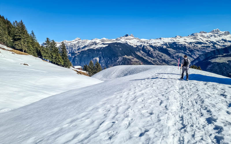
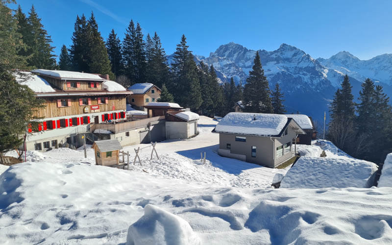

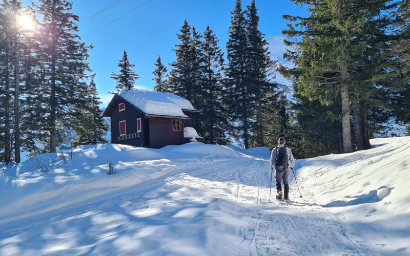
Trail overview
This marked snowshoe route is a loop, starting at the top of the Attinghausen-Brüsti cable car.

There are two sections to the cable car. If are coming by public transport, the bus drops you at the first cable car. By car, you can drive and park next to the second cable car, saving you time and expense.
At the top of the second cable car, you start by hike up through the little alpine village, passing a couple restaurants. Near point 4 on the map, you leave the village and head into nature.
Trail map
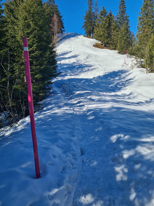
The map below shows the marked snowshoe path. They suggest hiking clockwise and we agree. The path may be slightly different when you go. Make sure to follow the pink poles that indicate the official snowshoe route.
See trail map on Komoot • SchweizMobil
The trail has some steep ascents that require good fitness. The trail does not have any dangerous or exposed sections.
Conditions can vary widely depending on recent snow and weather conditions. Check the Brüsti website for the trail status and webcams before making plans.
How to get there
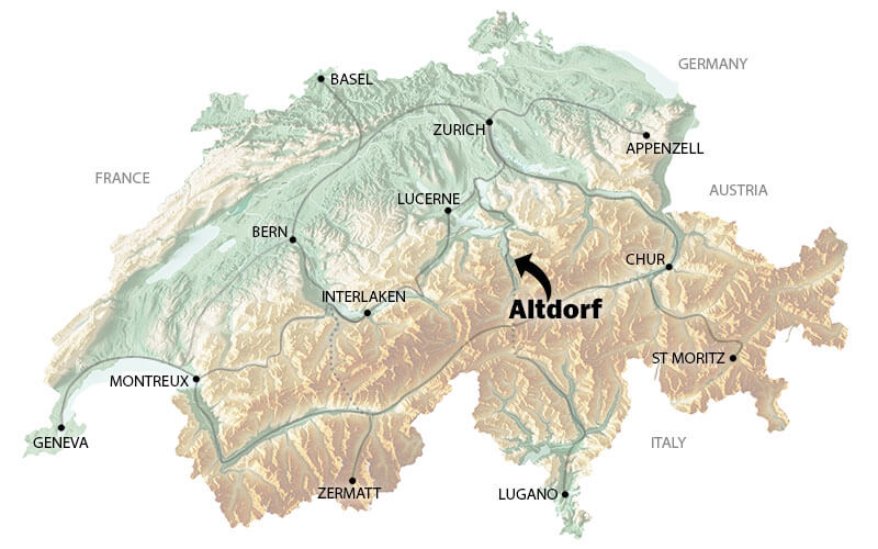
This snowshoe route is located near Altdorf, southeast of Lucerne. You reach the trail with the Attinghausen-Brüsti cable car.
By public transport
Take a train to Altdorf. Then a bus to Attinghausen, Seilbahn. Travel time from Lucerne about 1h30, from Zürich about 1h40.
The bus drops you at the first section of the Attinghausen-Brusti cable car. Ride up and transfer to the second cable car the rest of the way to Brüsti. Both cable cars are small so there may be a long wait on busy days.
By car
You can drive directly to the section section of the cable car and park there – Kohlpl., 6468 Attinghausen.
Make sure to park within the official parking zone (see map of that zone) or you will get a fine. You can pay for the parking via a parking app like Easy Park or Twint.

Planning your day
Tickets
You’ll need a return ticket on cable cars to reach Brüsti. It’s slightly less if you only need to the second section.
In 2025, a return ticket on both cable cars costs CHF 20. Discount for children, but no discount for travel passes or cards. See current prices.
Opening Times
Winter season is usually mid December through the end of March. Check trail status.
The cable car runs daily from 7:00 – 18:00, with a break at lunch time. It runs every 30 mins or more frequently on busy days. Check current opening times.
It leaves every 20 mins and the journey is 7 mins. They usually close for a lunchbreak from 12:00 – 13:00.
What to wear & bring
You’ll need waterproof winter hiking boots, snowshoes, and hiking sticks with snow baskets.
Dress appropriate to the weather forecast. This trail is partly in the forest and shade, where it can feel much colder than in the sunshine. So dress in layers so you can adjust as needed. Learn more about what to wear for a winter hike.
The cable car does not rent snowshoes. See list of nearby sports stores that rent snowshoes.
Where to eat
At the top of the Brüsti cable car, there is a restaurant at Berggasthaus Brüsti, which has a terrace with a great view.
About 10 min walk above the cable car, you’ll find the Alp Catrina restaurant, where lots of skiers eat lunch.
Photo story of trail
This is the station for the first section of the cable car, where the bus drops off.

Both the cable cars are very small. In the pic below, the first cable car is orange, the second cable car is blue. I took these pics during summer when we were doing the Surenenpass hike in this area.

View of the second cable car station as we ride up to Brüsti.
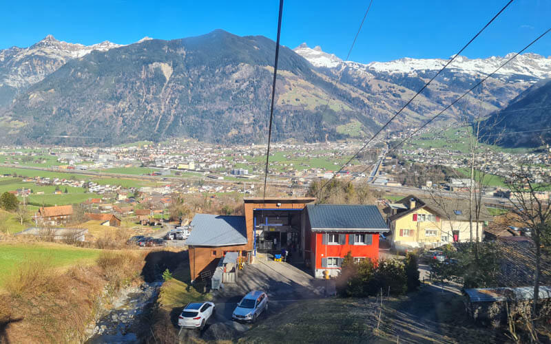
The station at the top of the second cable car. There is a restaurant here.

For the snowshoe route, follow the pink “886” signs and pink poles. You’ll see a semi-groomed path going directly uphill to Alp Catrina. Skiers use that to more directly access the ski area. You can walk on that too. But the snowshoe route is a bit more interesting, winding through the forest.
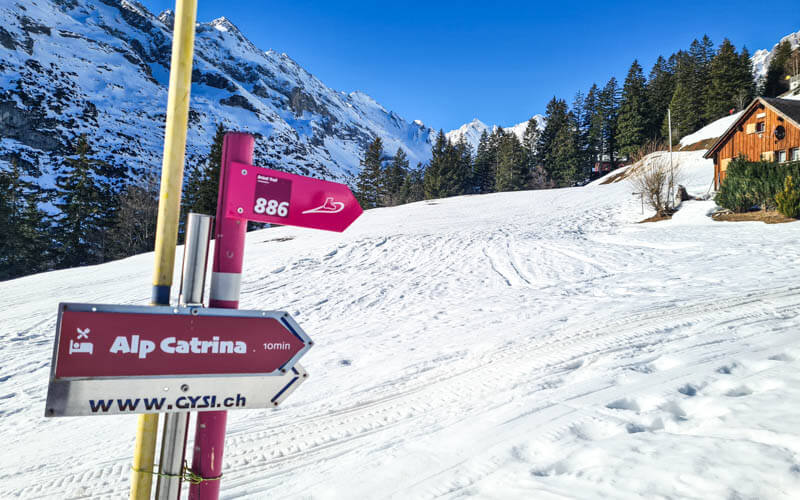
Starting the snowshoe route.
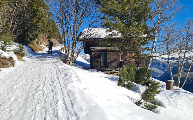
Looking back at the cable car station.

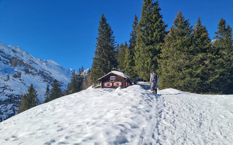
Cute log cabins in the forest.

Passing more chalets in the forest. Some of these appeared to be holiday homes.
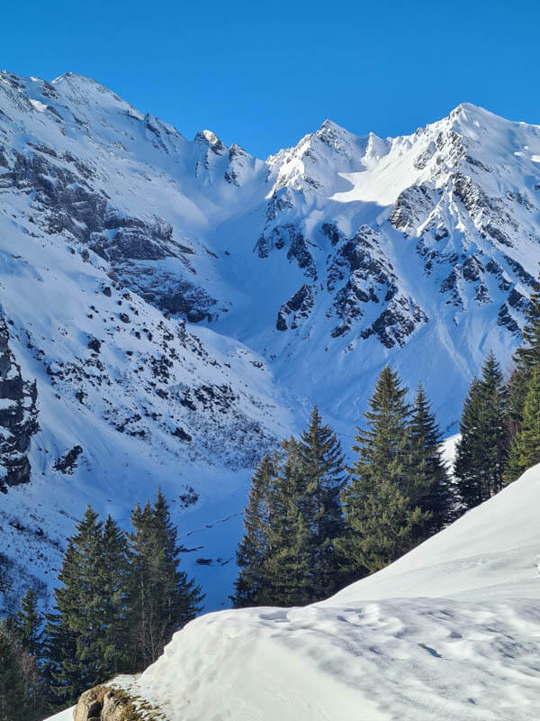
The mountain peaks are very close, making for great pics.
Here is Alp Catrina, which has a restaurant.
Heading up the snowshoe trail, away from the ski area.
It got a little steep here. Make sure to follow the pink poles. There were tracks leading elsewhere on the mountain, no guarantee of safety if you go off the official route.
The steep climb led to this nice viewpoint, the prettiest sections of the trail in my opinion.

Proving that I was on this hike 😊

Then we descended through the forest.

Traversing the mountain into this arena. It was little tricky in the compact snow conditions, hard to get traction sometimes.

Happy to be in the sunshine again. Honestly, I didn’t find it so pretty in this part because we couldn’t see the big peaks anymore and the dirt patches showing through the snow were unattractive. I expect it would be nicer more snow.

There were some groomed tracks leading elsewhere, but we followed the pink poles to see where the snowshoe trail was supposed to go.
Crossing a small stream.

Walking down meadow.

Very nice views here, looking across the valley.
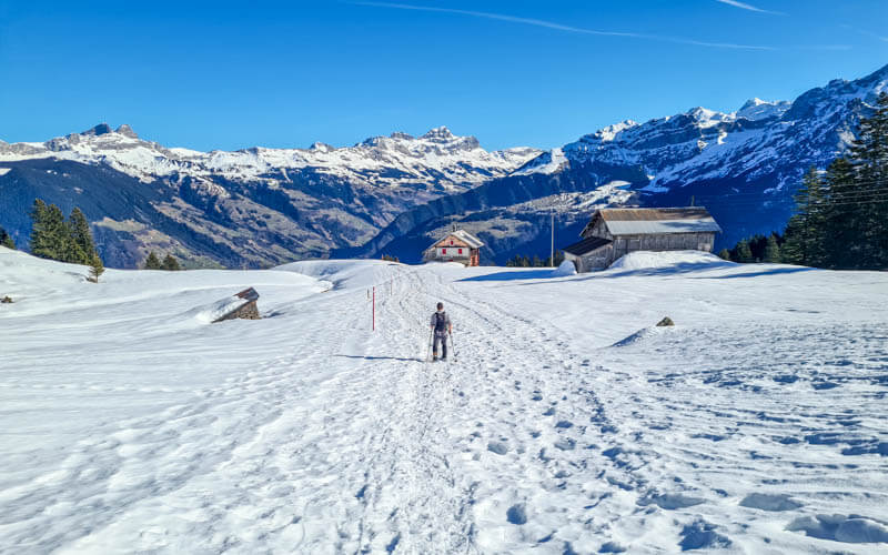
Looking back towards the arena.
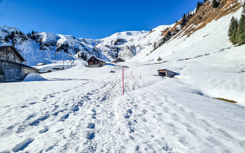
Now we can see the big peaks again, my favorite part.

You can see the lack of snow across the valley. Brüsti actually had more snow that other mountain areas in this area at a similar elevation.
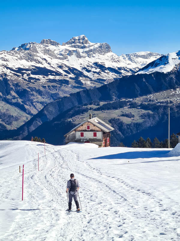
Last big views before we head into the forest again.
Now some shady switchbacks in the forest back to Alp Catrina.

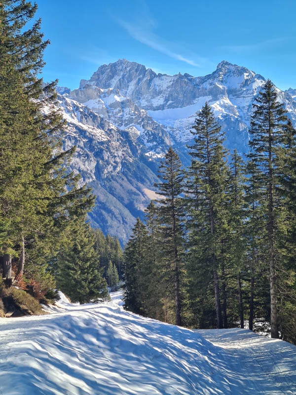
Still some nice mountains peeking through the trees.
A simple lunch at the Berggasthaus Brüsti, while we waited for the cable car station lunch break to be over.

Hope you enjoy this snowshoe hike!



