This challenging mountain trail in Braunwald in eastern Switzerland is an exciting and somewhat scary adventure, best suited to experienced hikers. After riding a funicular and chair lift, you hike further up the mountain to a high plateau, then hike along the cliffs, sometimes quite close to the edge. Then a steep descent on slippery switchbacks, clinging to safety cables.
Both the gorgeous views and dangerous sections made it our family’s most memorable hike of 2020, an amazing experience but one we probably won’t repeat because of the high-risk. This hike has some serious danger, with steep drop-offs and tricky footing throughout. So I only suggest this for experienced hikers and older children (over 12) that are prepared to very carefully manage the dangerous sections. I offer this detailed article to help you understand and prepare for the risks if you choose to do this trail. But please use your best judgment and use extreme caution.
If you are hiking with children, I suggest the Braunwald theme trail instead.
| Location: | Glarnerland, Eastern Switzerland |
| Address: | Braunwald funicular in Linthal, Glarus |
| Car: | Parking: Stachelbergstrasse 2, 8783 Glarus Süd Switzerland 1hr10 from Zurich |
| Train: | Train station: Linthal Braunwaldbahn 1hr30 from Zurich HB |
| Trail: | 10 km one way, about 4.5 hours |
| Elevation: | highest point 2125m, 340m up, 1010m down |
| Condition: | dirt, rocky, steep sections with safety cables |
| Skill: | challenging, rated T3 |
| Open: | mid-June through October |
| Cost 2020: | Adult CHF 37, partial discount for SBB Half-fare & Junior cards |
| More info: | www.braunwald.ch • webcam |
Location
This trail is located in Braunwald, an alpine village in the Glarnerland region of eastern Switzerland (see on Google Maps). You can drive or take the train to Linthal in the valley. Then you must ride a funicular to the Braunwald alpine village, then a gondola to where the trail starts.

Trail overview
This is the summer hiking map for the Braunwald area, with important parts of this trail marked. Download the original map.

This trail starts at the top of the Gumen chair lift and hikes down to the top of the Braunwald funicular.
You can avoid the most dangerous parts of the trail by hiking up to Bützi Alp, then hiking back down the same way to the Panorama trail and continue down to Braunwald. It is still a challenging hike, but a much better choice for younger children.
If you want to skip the second long elevation descent, you can hike from Ober Stafel across to the Grötzenbüel gondola and ride down to Braunwald.
How to get there
Get yourself to Linthal in the Glarus valley, where you can ride the funicular train up to Braunwald.
By car: Drive to Linthal in the Glarus region. The parking address is Stachelbergstrasse 2, 8783 Glarus Süd Switzerland. Follow signs to the metered parking lot adjacent to the funicular station. If the parking lot next to the station is full, there is additional parking on the south side of the train tracks.
By public transit: Take the train to Linthal Braunwaldbahnstation (not Linthal, which is one stop further). The train station is below the funicular station. If you have an Ostwind daypass, it may also cover the funicular up to Braunwald, but you need to show your train ticket at the Braunwald ticket booth to collect the funicular ticket. More details on tickets below.
Ticket prices
Buy a return ticket on the Linthal-Braunwald funicular and a one-way ticket on the Burstberg-Gumen lift, since you will be hiking down to Braunwald.
In 2020, this hiking ticket cost CHF 31/adult, CHF 13/child age 6 to 16. Under 6 ride free. You get a discount for SBB GA and Half-fare. The SBB Junior Cards is only valid on the Braunwald funicular, not the Gumen lift, which costs CHF 9/child for one-way. See current prices on their website.
Opening Times
The Braunwaldbahn from Linthal runs about every 30 mins, first train 7:25, last train 19:48. The train runs all year round. Check current schedule on their website.
The Burstberg – Gumen lift starts its daily summer season in mid-June. It usually runs from 8:00 – 17:00, sometimes breaking for lunch between 12:00 – 13:00.
1. Riding up to Braunwald, then Gumen
From Linthal, ride the funicular (shown below) up to the Braunwald village.
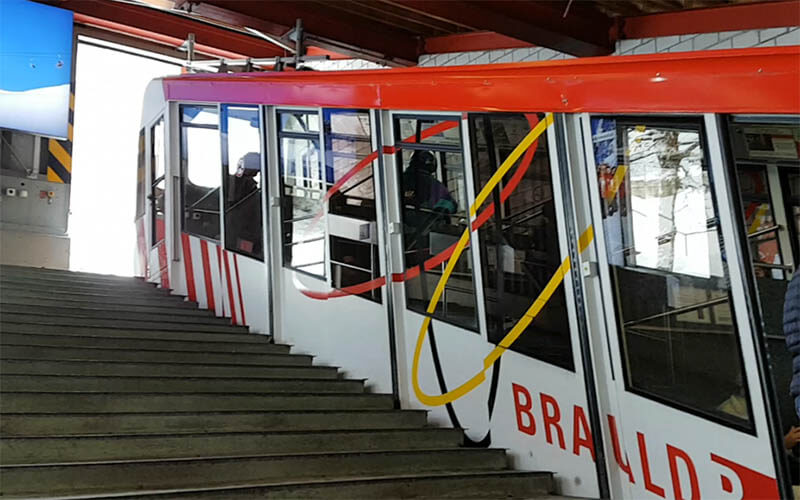
At the top, you’ll find a WC and kiosk with drinks and snacks. There is a small grocery a few meters up the road from the funicular station (see on map). To reach the Burstberg-Gumen lift, follow the road shown below, following signs to Burstberg (take the split to your right walking uphill).

This map shows the path to the Burstberg-Gumen lift. It’s 1 km and takes about 10-15 mins.
Here is the Gumen lift. Later, you’ll be hiking on the cliffs in the distance.
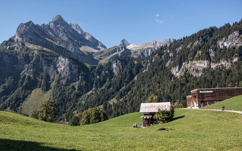
This lift has both gondola cars and open chair lifts.
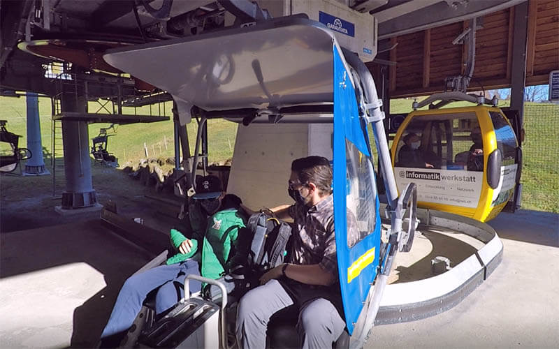
The chair lift drops you off at the Gumen mountain hut. There is a cafe and WC here.

2. Start panorama trail
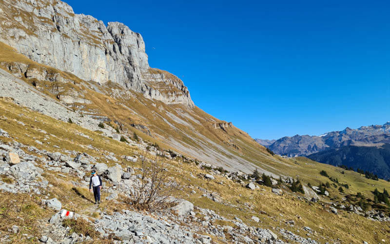
The trail starts to the left of the Gumen hut, traversing this mountain.

This is looking back on the trail toward Gumen.
3. Climb up to Bützi Alp
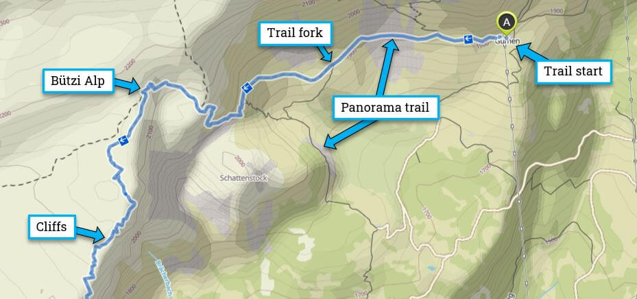
After about 900m after Gumen (about 10-15 mins), the trail splits, with the panorama trail leading down the mountain and the trail to Bützi Alp going straight ahead toward the mountain ahead of you, as shown below.
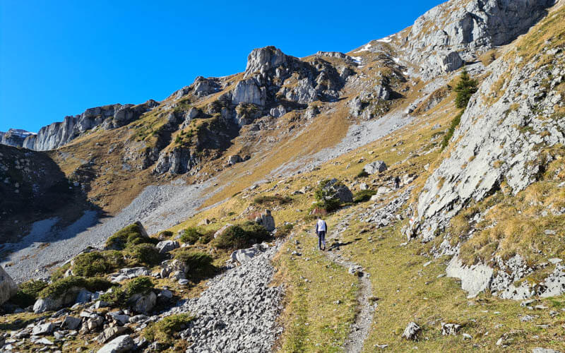
There is no trail sign, so I’m including a close up of the map to show you where that fork is. Do not take the earlier split that lead up the mountain to your right. It helps to have the trail map on your phone to make sure you are on the right trail.
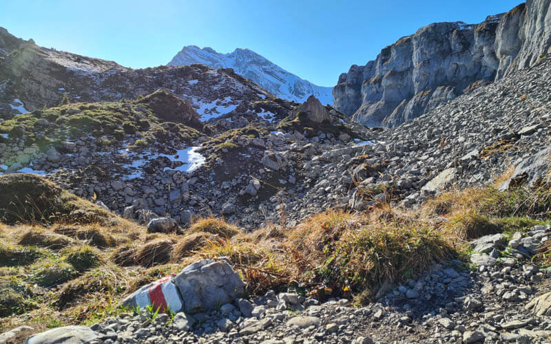
The Bützi Alp trail leads to this rocky landscape.
Then the trail goes up this mountain.

It gets rather steep and rocky. Sometimes I needed my hands to climb it safely. We saw one family with a child of about 8 on this part of the trail. But they just hiked up to Bützi Alp and back and did not do the cliff section.
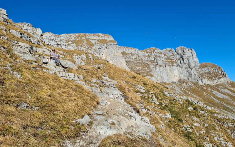
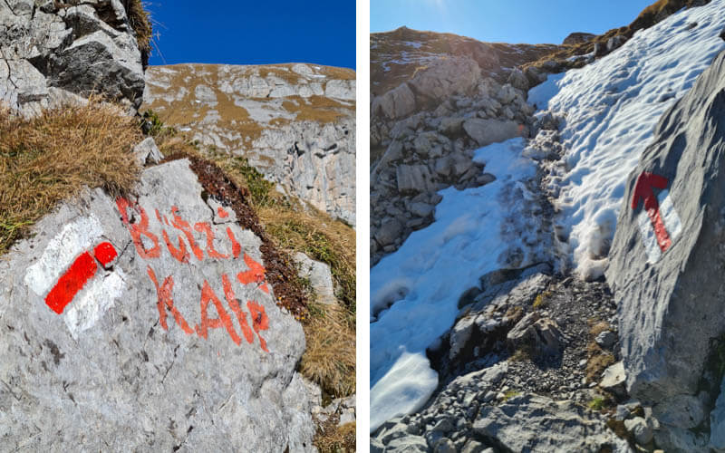
There are plenty of red/white trail markers to keep you on the path. A couple times, we saw “Bützi Alp” painted on the rocks. We were there in early November and there was snow on the trail. Best to do this trail in July or August.
4. Arriving at Bützi Alp
Here is Bützi Alp, the first trail sign we saw.
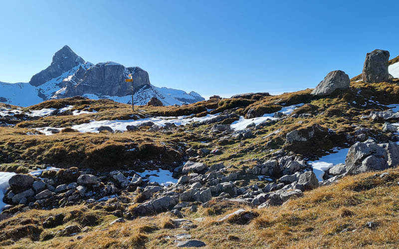
If you want to continue on our trail, follow the sign to Bärentritt and Braunwald (2hr50).

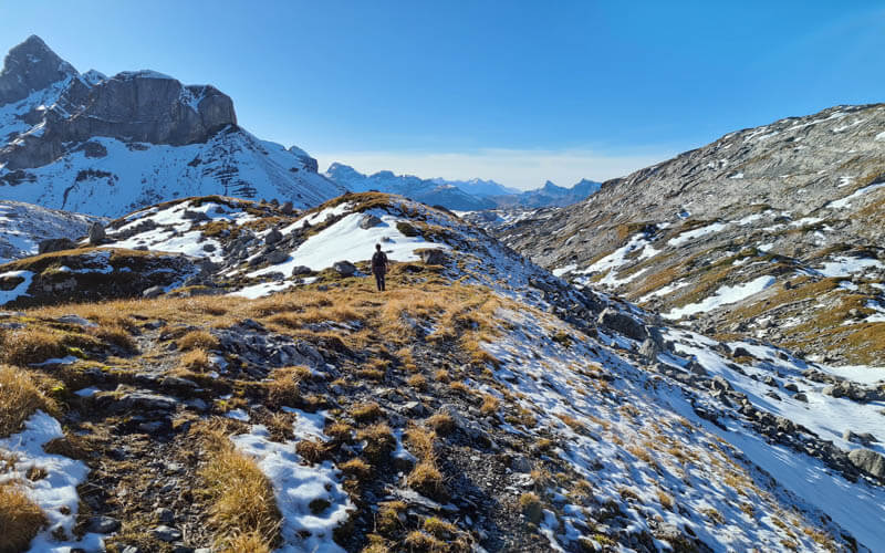
Amazing views from Bützi Alp looking westward. There is a trail leading to Glattalp, which we hope to do next summer.
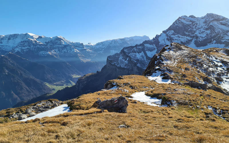
Bützi Alp also has views over the cliffs down to Braunwald. If you plan to skip the cliffs and hike back down to the panorama trail, this would be a great place for a picnic. There’s plenty of room to explore away from the cliffs before you head down.
5. Hike along cliffs
If you are continuing on our trail, follow trail markers leading out to the cliffs. In early November, we had to cross a lot of snow patches, not ideal.
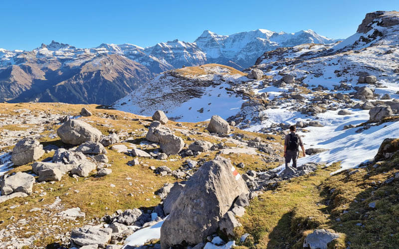
We loved this rocky landscape, very fun to hike on.
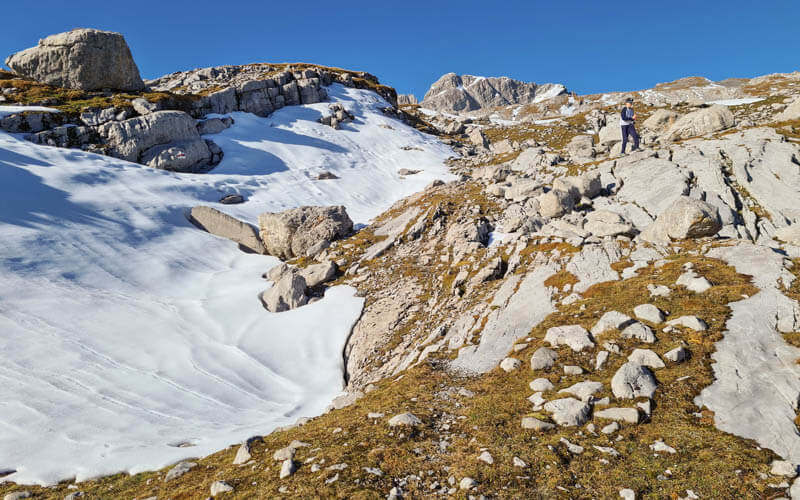
Now heading down to the cliffs.

Now I started to get nervous as I realized our trail was literally on the edges of these cliffs.
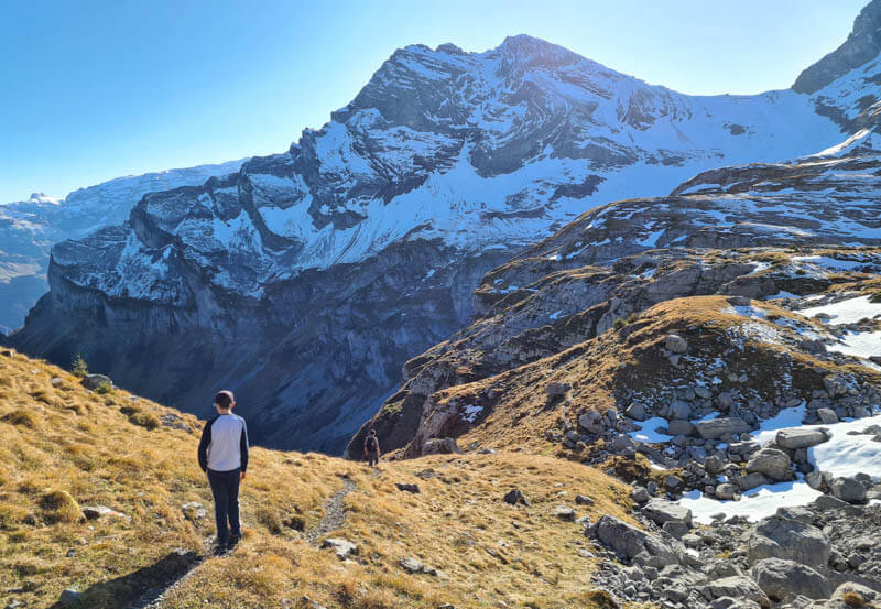
Looking down to the valley and forest where our trail eventually leads.
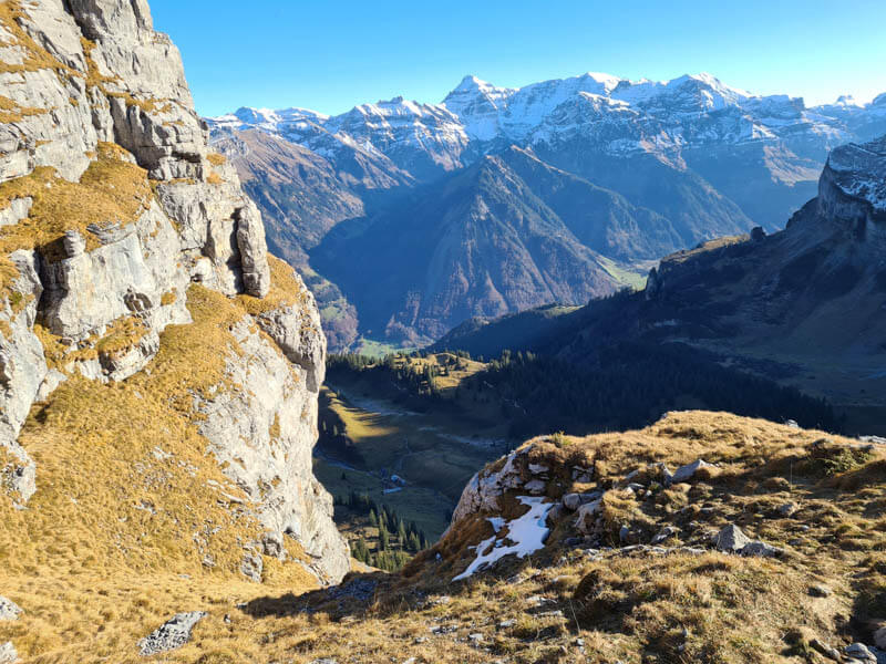
Lots of interesting rocks to walk over.
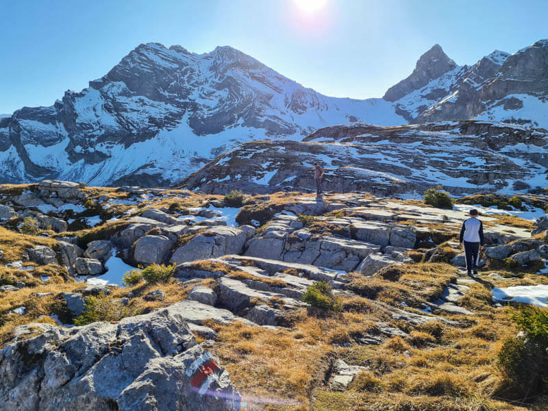
That’s my husband on the cliff’s edge, only two steps off the official trail. I’m not kidding. This trail is right along the cliffs. It’s a well built trail but very dangerous. Do not underestimate the risk.

Part of the trail near the cliffs, which are just out of view to the left. The path is skirts under the rock wall on the right.
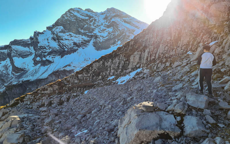
Some parts required a bit of scrambling, where we had to use our hands to get up the rocks.
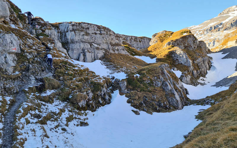
One of the beautiful flat spots above the cliffs.
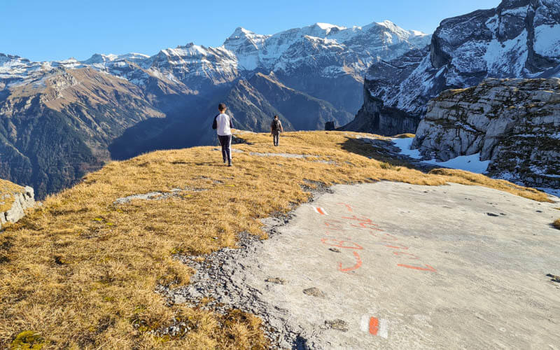
Getting close to the Höchturm peak, one of the most beautiful parts of the trail for me.

Crossing lots of limestone, also my favorite.

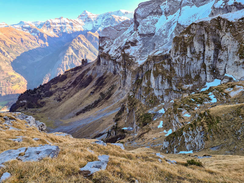
Getting a better view of our trail down the cliffs.
6. Hike from Bärentritt down cliffs to Ober Stafel
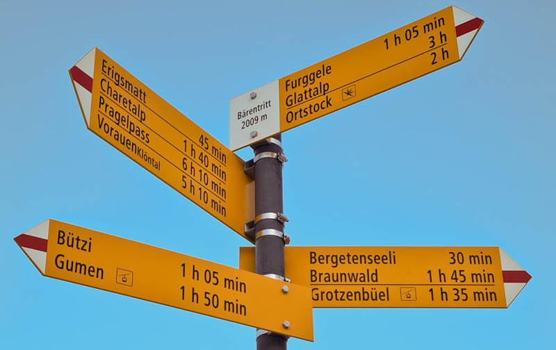
Here is Bärentritt at 2009m, where we found only the second trail sign we had seen in hours. There is a big alpine meadow under the peaks and a little stream (frozen when we were there).

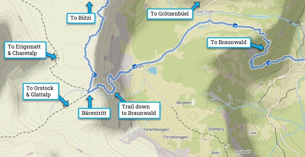
The trail forks in multiple directions and the trail sign was very misleading. Although our trail to Braunwald was directly down the mountain (following the stream), the Braunwald trail sign was pointing in the wrong direction. I can only assume it was accidently moved.
Here is a close up of the trail map so you can see how the destinations correlate to the map.
After wandering around confused, following trail markers in different directions, we decided to follow the trail markers down the mountain, which was the correct choice. The trail starts out like a normal downward switchback, which falsely led me to believe that it wasn’t so bad after all.

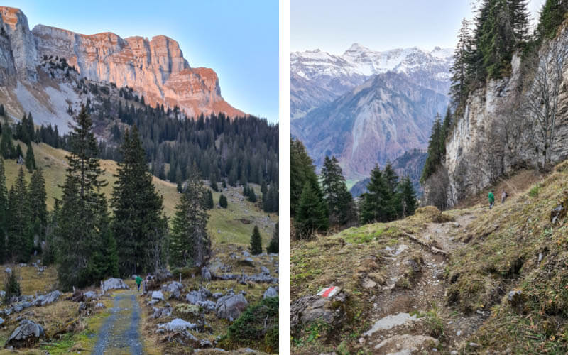
As you descend, you get a view of the cliffs you were just walking along.

Now the trail gets very steep with chains to hold onto for safety. Put your hiking sticks away so you have both hands available to hold the chains as needed. Then trail traverses the mountain with a steep drop off to the right.
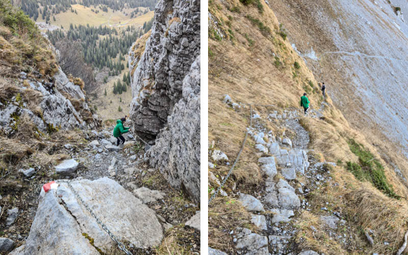
I found this the scariest part of the trail and I had a little panic attack here and found it very difficult to continue. My husband and 13 year old didn’t think it was so bad.
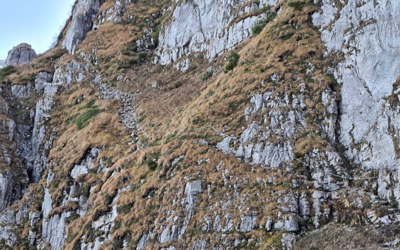
I’m including more pics so you get a good sense of the trail before choosing to hike it. I almost think it might be better going up this trail than down.
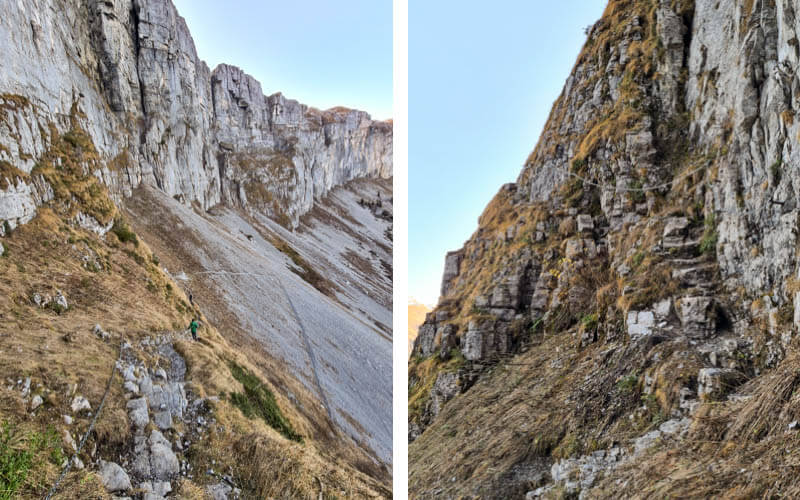
Off the scary part and now some slippery shale until you reach the first valley.
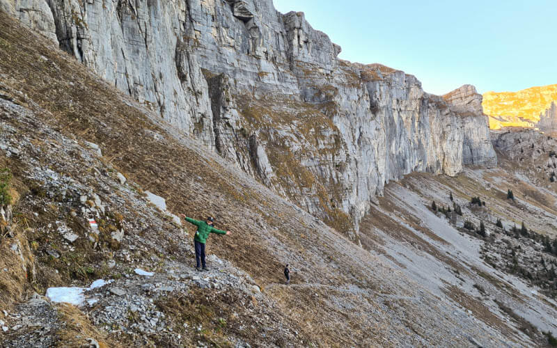
7. Another downhill and final stretch to Braunwald
Here we are feeling happy we made it down those cliffs safely.

Then a short wander through a forest.
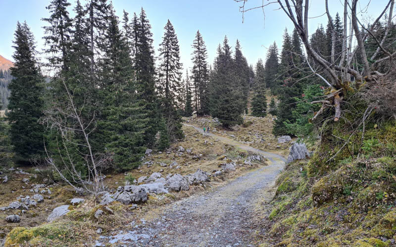
We were there in the late evening, 16:30 in November. So we got a beautiful alpine glow on the mountains. When you reach the fork at Ober Stafel, turn right following signs to Braunwald. It’s about another hour until you reach the funicular. That trail has another steep 350m of elevation through a dark forest, but the trail is safe without cliff drop-offs . But since we were exhausted from the previous descent, it was quite difficult for us with wobbly knees.
Alternatively, from Ober Stafel, you can turn left, following signs to Grötzenbüel. It’s about the same distance as to Braunwald, but you don’t have to descend a steep mountain. At Grötzenbüel, you can catch a gondola down, then an easy 1km to the Braunwald funicular. The Grötzenbüel gondola runs until about 17:00 but check the schedule so you don’t miss the last one down.
I stopped taking pics at this point because it was dark and not super interesting. At the end of the descent through the forest, you join a road. Just follow the road and signs to Braunwald and you’ll end up at the funicular. The funicular runs quite late (usually to at least 21:00 in summer), but best to check the schedule beforehand.
Video of the trail
Here’s a video of our day at Bützialp.





