This mountain hike ticks all the boxes: rushing waterfall, wild rivers, dramatic peaks, alpine wildflowers, a scenic mountain pass, and charming villages.
Starting in the peaceful Sertig valley, the train begins with an easy walk along a river to the pretty Ducan Falls. From here, the path climbs steadily upstream through a forest, then a rugged rocky landscape framed by towering peaks.
Eventually the scenery opens into high alpine meadows, bursting with yellow wildflowers in July. After crossing the Fanez pass, you descend through more flower-filled pastures, past grazing cows and traditional alpine dairy huts.
The trail ends in the mountain village Monstein, where you can reward yourself with local cheese and beer brewed in the former village church before catching the bus back to Davos.
This trail is part of the multi-stage Walserweg route, so you could include this as part of a multi-day thru hike.
TIP: If you hike on a Friday, you can visit the Monstein brewery after the hike (open 4-7pm on Fridays).
Quick Info
| Region | Davos Klosters • Graubünden • southeast Switzerland |
| Start: | Sertig, Sand bus stop |
| End: | Davos Monstein, Dorf bus stop |
| By car: | Parking at Davos Platz train station. Then bus to trail head at Sertig, Sand bus stop. From Zürich to Davos 1h45 + 23 min bus ride |
| By public transport: | Sertig, Sand bus stop From Davos 23 mins, Zürich 2h42 |
| Trail: | 5h • ⬇️ trail map |
| Distance: | 12.4 km one way |
| Difficulty: | challenging • +790m -1043m |
| Condition: | dirt footpath, uneven rocky terrain |
| Elevation: | highest point 2579m |
| Open: | late June to mid October |
| Cost: | parking fees and bus fare to reach trail |
| Discounts: | bus free with Swiss Travel Pass, Saver Day Pass, GA bus partially covered by Davos Premium Card, see details below |
| Services: | restaurant at start of trail |
| More info: | davos.ch • walserweg.ch • Sertig valley webcam • forecast |
Gallery
These pics are from our hike the second week of July.
Trail Overview
This is a one way trail, starting in the Sertig valley and ending at Monstein. There is bus service on each end, connecting you to Davos.
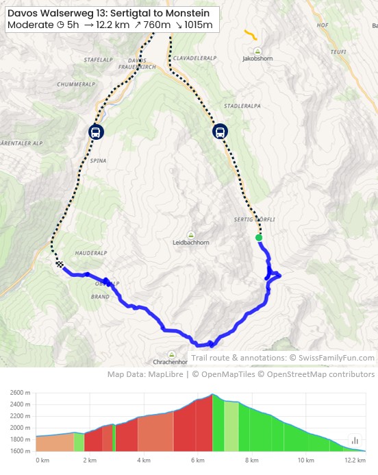
See map on SchweizMobil • Komoot
We were on the trail for 5h45, actual walking time 3h35.
You could also hike in this in the opposite direction, but it would have more elevation gain.
NOTE: This trail can be used by mountain bikers, so keep watch and listen for their bells so you can pass each other safely. We passed about 8 bikers during our hike.
Flow of day
- From Davos Platz train station, we rode the bus to Sertig, Sand. There is a restaurant here.
- We followed the signs to Route 35, direction Fanezfurgga & Monstein.
- After 20 mins, we did the short detour to the Ducan Falls, then back to the main trail.
- After about 2h45, we reached the pass, the highest part of the trail.
- After another 1h15, we reached the hut at Oberalp where we had drinks and a cheese platter.
- Then about 40 mins to reach Monstein, the end of the trail. There are restaurants here and a self-service grocery. We caught the bus here (departs hourly, check schedule) and road back to Davos Platz.
Trail conditions
The trail is a typical mountain hiking path. The terrain includes lots of uneven rocky terrain.
A few sections had scree and loose rock, making it a bit slippery. We suggest hiking sticks and shoes with good tread to make these sections easier and safer.
No dangerous or exposed sections. Suitable for any casual hiker.
Longer option
This trail is stage 13 of the multi-stage Walserweg route. You could stay overnight at either end of the trail and keep hiking on the next stages. See info for Walserweg.
How to get there
This trail is located in the Sertig valley near Davos, in the Graubünden region of southeast Switzerland.

It does not require mountain transport. You start the trail directly from the bus stop.
By public transport:
There is bus service from Davos to both ends of the trail.
Start: Timetable Davos Platz, Bahnhof > Sertig, Sand. Travel time 23 mins. Departs every 30 mins.
End: Timetable Davos Monstein, Dorf > Davos, Platz. Travel time 32 mins. Bus schedule is irregular and infrequent, so check carefully so you aren’t stuck too long in Monstein. In the afternoon, it runs about every 30 mins.
By car:
Since this is a one-way trail, it’s best to park in Davos and use the bus to reach the trail, as described above.
We suggest parking near the Davos Platz train station, at the large metered parking lot near the Jakobshorn cable car – see on map.
Planning your day
When to go
This trail is goes to a high elevation (2579m). So it can take longer for the snow to melt there. The trail is usually open from late June to mid October, but
Check for trail closure notices.
Costs
This is a one-way hike, so you’ll need bus tickets to reach the trailhead and return from the endpoint. If you arrive by car, you will also need to pay for parking in Davos.
A Davos Day Ticket (aka “VBD”) is the best option, as it costs the same as buying separate one-way tickets and includes unlimited public transport in the whole Davos region for the entire day.
In 2026, the Davos Day Ticket costs CHF 16 (adult full fare). Discount 50% with Swiss Half Fare Card and for children age 6-15. Under age 6 free.
Best to purchase tickets on SBB.ch shortly before your journey, not on the bus.
Travel Pass Discount
The buses are regular public transport, so free with Swiss Travel Pass, Saver Day Pass, SBB GA. Also free for children with SBB Junior Card or Swiss Family Card.
Guest Card Discount
If you are staying overnight in the region, you get the Davos Premium Card, which covers local bus transport near your hotel.
But the guest card doesn’t cover the mountain buses to the Sertig valley or Monstein unless you are staying in those areas. So check the zone plan carefully to see what your card covers. You’ll probably need to purchase a ticket for the zones that your guest card doesn’t cover.

For example: if you are staying in Davos, your card covers the bus as far as the Davos Clavadel, Klinikstrasse stop. You would need to purchase a ticket (on SBB.ch) for the remainder of the journey to Sertig, Sand.
On the way back from Monstein, you would need to buy a ticket from Monstein to Glaris, Ardüsch. The guest card would cover the rest of the ride in zones 420 & 400 to Davos Platz.
Where to eat
Next to the bus stop and parking, you’ll find Walserhuus Sertig, which has a restaurant with a large outdoor terrace overlooking the view.
At Oberalp (about 3h30 into the hike), there is a mountain hut serving cold drinks, simple dishes, and homemade cakes.
At the end of the trail in Monstein, there are a couple restaurants: Veltlinerstübli and Hotel Ducan. The Monstein Brewery is open Friday afternoons from 4-7 pm. The village grocery is self-service, open 24/7.
Where to stay
We suggest staying in nearby Davos, which is a convenient base for this hike and exploring other parts of this region.
We enjoyed our recent stay at Hotel Waldhuus Davos (4-stars), which has a quiet location. The room was very comfortable and we loved the beautiful mountain views from the balcony.


Their breakfast is generous with a nice selection of local cheese and freshly cooked omelets. Their restaurants serves elevated versions of Swiss classics, very tasty.


This hotel is especially family-friendly, with a spacious family suites, supervised kids club, playground, indoor pool, mini golf and game room.
Note: our recent stay was hosted by Hotel Waldhuus Davos. As always, all opinions are our own.
Photo story of trail
From Davos Platz train station, we rode the bus to Sertig, Sand, dropping us at the Walserhuus hotel & restaurant.
SponsoredDiscover top exclusive offers today!
Click here to learn more and take advantage of these limited-time deals.


From here, you start the walk on the service road. We will first go to the waterfall, then join the Walserweg trail.

Follow the river.
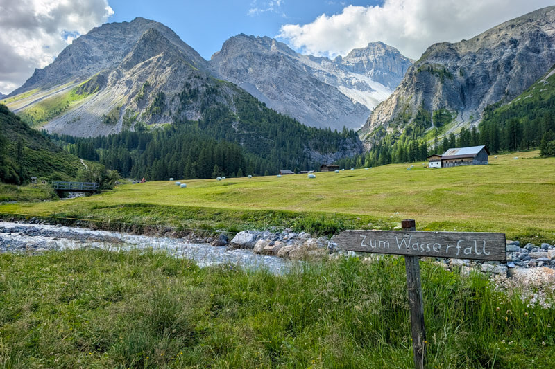
After about 10 mins, the trail splits. Keep right following signs to Wasserfall and Monstein.


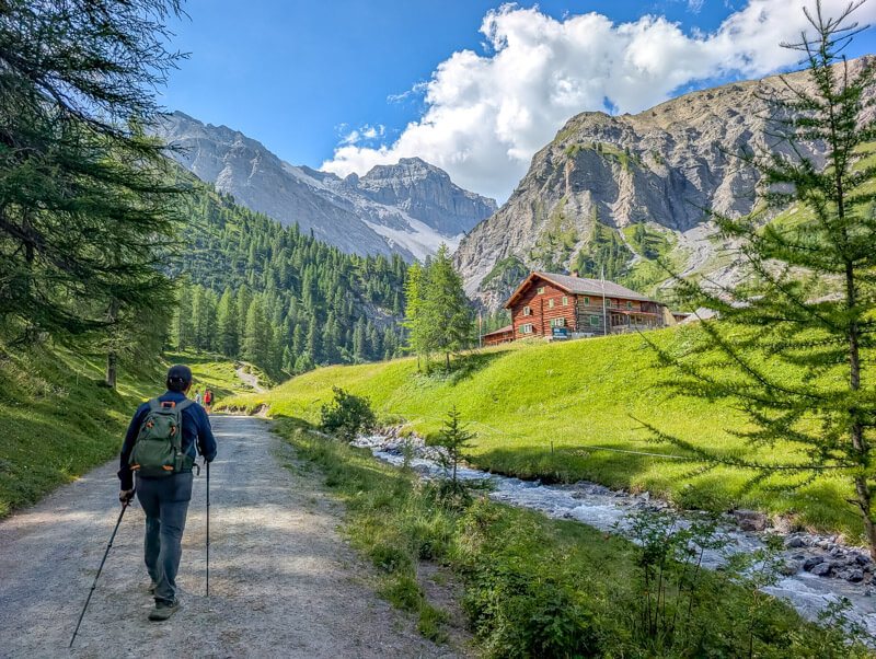
Detour to Ducan waterfall
Here the trail splits again. The Walserweg trail goes uphill to the left. But before that, I suggest the short detour to the waterfall. After the falls, you will come back to this point to join the Walserweg trail.

Just a couple more minutes to the falls.
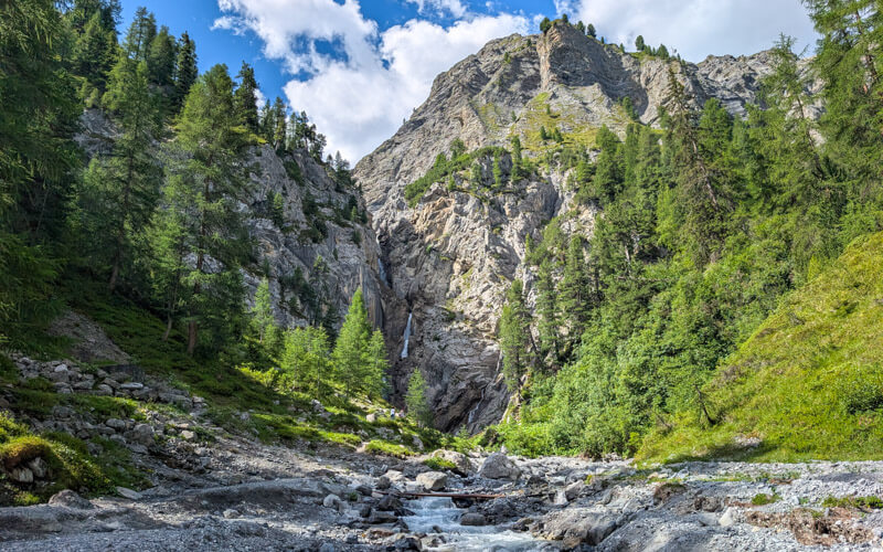
Heading up the Walserweg trail
From the falls, walk back to the split and now follow trail signs for Route 35, direction Fanezfurgga and Monstein.


You start through a forest, lots of birds singing here.


Looking back on the Sertig valley where we started.

Now entering a quite barren landscape along the river.

It was quite dry in this part, making it difficult to get traction on the dirt. Happy to have good tread and hiking sticks on this part.

Happy to be in meadows again.

The views getting more and more dramatic as we climb higher up.
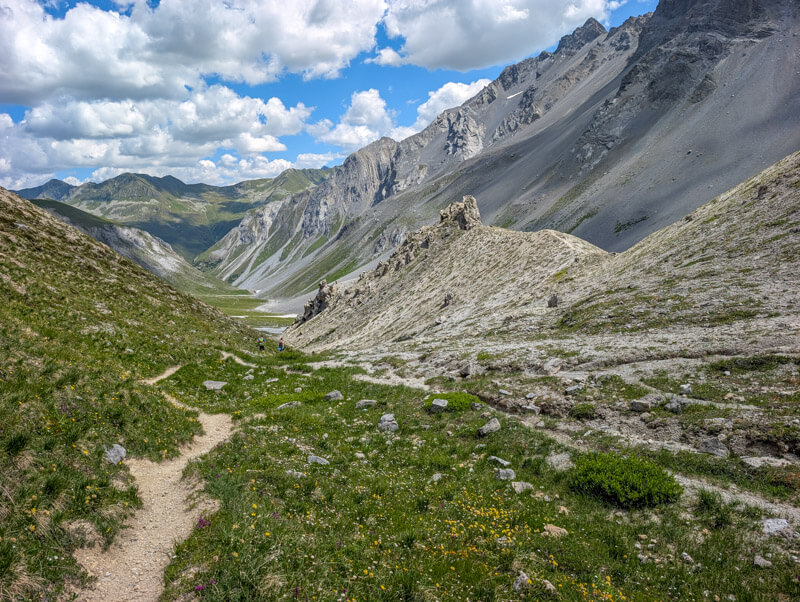
Crossing a couple streams. It was quite dry when we were there, but I can imagine that the streams could be much larger if there was more snow melt or recent storms.

As we approach the pass, some very interesting geological formations.

So much drama up here.

Wildflower meadows
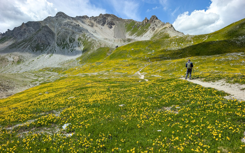
In mid July, these meadows were filled with yellow flowers, a real special sight.
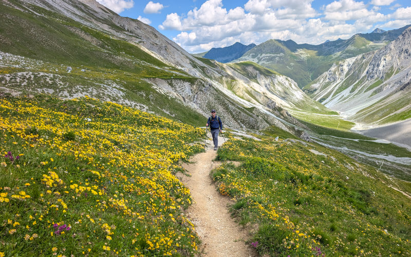
Just couldn’t get enough of the yellow.


Now just a few more minutes up the pass.
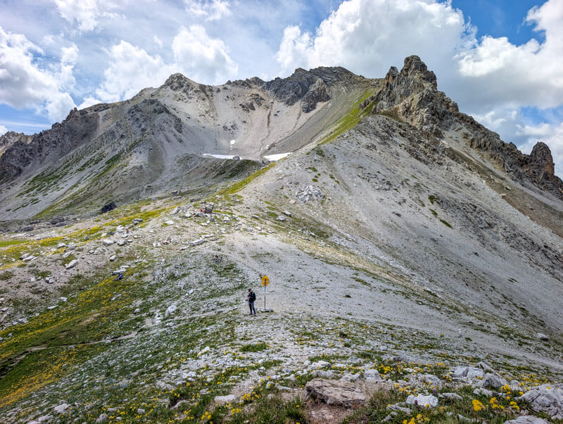
At these junctions, continue following the green 35 towards Monstein.


Fanzafürgga Pass
Crossing the mountain pass.
Honestly, I was a little underwhelmed looking over the pass and was a little sad to leave the yellow fields behind. But don’t worry! It gets really pretty in a few minutes.

It’s a long descent to Monstein, but not too steep.

Feeling happy that the climb is over. All downhill from here.

Lots of yellow on this side too.


Now seeing more variety of flowers along the stream.
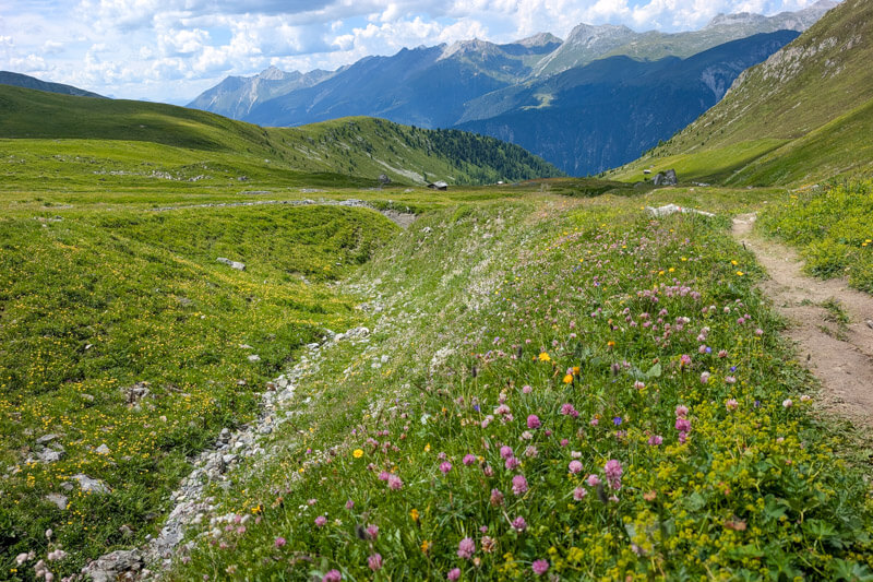
No cows up here yet.

Getting closer to the forest.

Refreshments at Oberalp hut
We were excited to arrive at this small hut to get refreshments. The staff were so cheerful and friendly.

We had the local Monsteiner beer and a plate with cheese from their alp, very tasty!


Really sweet hut, you should definitely stop here. Best to pay with cash.

Passing a few more huts in Oberalp.

Ending in Monstein
Now we join the road for the final descent to Monstein.

Not my favorite part of the hike, but not that bad.

Prettier when we are along the river.

At this point, we realized we would miss bus by a few minutes. In the afternoon, the bus runs every 30 mins. Check the schedule carefully so you don’t have a long wait. Timetable Davos Monstein, Dorf > Davos, Platz.

One of the restaurants in Monstein, but not always open.

View of the Monstein village before we catch the bus.

I hope you enjoy this hike!




