Verbier was one of our favorites during our first Valais vacation in the summer of 2008. We were happy to be able to visit a high elevation peak (3330m) with our little kids since nearby Mont Blanc prohibited children under 4. We did an easy trail that followed a Bisse, aka ancient water irrigation channel, which wound its way around the mountain, giving unobstructed panoramic views the entire way. It’s kinda far away from everything, so best for a weekend or summer holiday, not as a day trip.
| Location: | Valais Switzerland |
| Address: | Le Châble – Verbier cable car |
| Car: | Parking: Chemin de la Gare 1, 1934 Bagnes (46°04’41.0″N 7°12’56.5″E) 1hr from Lausanne, 1hr30 from Bern, 1hr10 from Brig, 2hr10 from Interlaken |
| Train: | Le Châble train station 1hr25 from Lausanne, 1hr40 from Brig, 2hr45 from Interlaken or Bern |
| Trail: | 2 km, about 45 mins |
| Condition: | narrow dirt path, no strollers |
| Skill: | easy |
| Open: | June through mid October 9:00 – 17:00 |
| Services: | mountain restaurants, no fire pits or playgrounds |
| More info: | www.verbier.ch |
Location
Verbier is a mountain village in the Valais in southwest Switzerland. You can drive or ride a cable car up to Verbier. Then you access the hiking trails with a variety of mountain transport.
There are many hiking options in the Verbier area. We chose to first ride to the very top to visit the panorama lookout at the top of Mt. Fort. Then we rode back down to La Chaux and hiked to Les Ruinettes. I’ve marked the important elements from our outing on the map below.

In the trail map below, the trail we did is between La Chaux and Les Ruinettes, along the Bisse du Levron waterway, an easy 2.6 km. FYI, the Verbier website promotes another Bisse du Levron trail, much longer route (10 km) following the waterway past Les Ruinettes.
The Verbier website has improved since our visit with descriptions of the hiking trails. But still a bit difficult to navigate in my opinion. They finally have a summer hiking map you can download. The website also says the cable car now provides a free hiking map, which was not available when we went. For more Bisse trails in the Valais, check these websites:
www.les-bisses-du-valais.ch/
www.valais.ch
Getting There
Verbier is a resort town up the mountain. You can drive up there, but it’s more convenient to ride the cable car from in the valley at the village of Bagnes.
By car: Drive to Bagnes, follow signs to Le Châble cable car. Park in the large lot next to the cable car station. The address for the parking is Chemin de La Gare 5, 1920 Martigny
By public transport: Take the train to Le Châble VS, gare. The train station is adjacent to the cable car station.
Tickets & Opening Times
You have several options for cable car tickets.
- If you want to visit the big peak Mt. Fort, then buy a return ticket from Le Châble to Mt. Fort. To do the hike, on the way back down from Mt. Fort, get off at La Chaux and walk to the middle station Les Ruinettes. Then take the cable car back to Le Châble from there.
- If you just want to do the Bisse hike described here, buy a return ticket to La Chaux. You will walk from La Chaux to Les Ruinettes and take the cable car back down from there.
Trail Impressions
1. Riding up the cable cars to Mt. Fort 3330m
The cable car goes first from Le Châble to Verbier. You will then take a second cable car to Les Ruinettes. Then either another ride or a short walk along a road to the La Chaux cable car. When we went, the lift from Les Ruinettes to La Chaux wasn’t running, but it was an easy walk.
Here’s the view from near the La Chaux cable car.

The view from La Chaux up to Mt. Fort.

From La Chaux, you take two more cable cars up to Mt. Fort at 3330m. Here is looking up the last leg to Mt. Fort, crossing the glacier.

2. Observation desk at Mt Fort
At the top, there is an observation deck and cafe directly outside the cable car station. But you’ll want to walk up the short steep rocky path up to the panorama lookout. Here’s a pic of the rocky path, no strollers on this part.
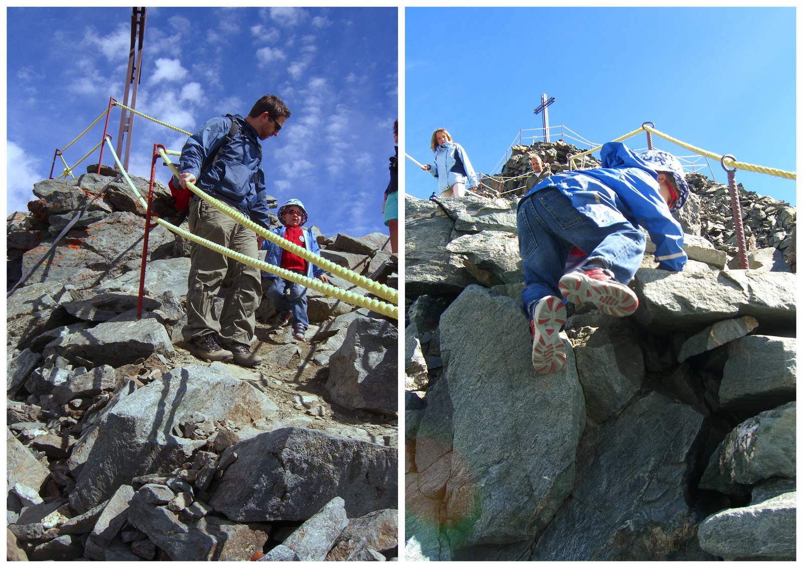
View from the top of Mt. Fort.

There are hiking options from the top, but not for kids. You won’t need to spend too long at the top. Just admire the view for awhile, then head back down to La Chaux where you will start your hike.
3. Ride back to La Chaux and find trailhead
Once you are back down at La Chaux, follow signs to the Bisse du Levron trail. The trail follows the irrigation channel all the way back to Les Ruinettes. The trail is about 2km and took us about an hour with a 4yr old walking slowly and requiring some assistance after toppling into the irrigation ditch. The trail is relatively smooth and flat and could be managed with an all-terrain stroller.
Here is the Bisse du Levron trail.

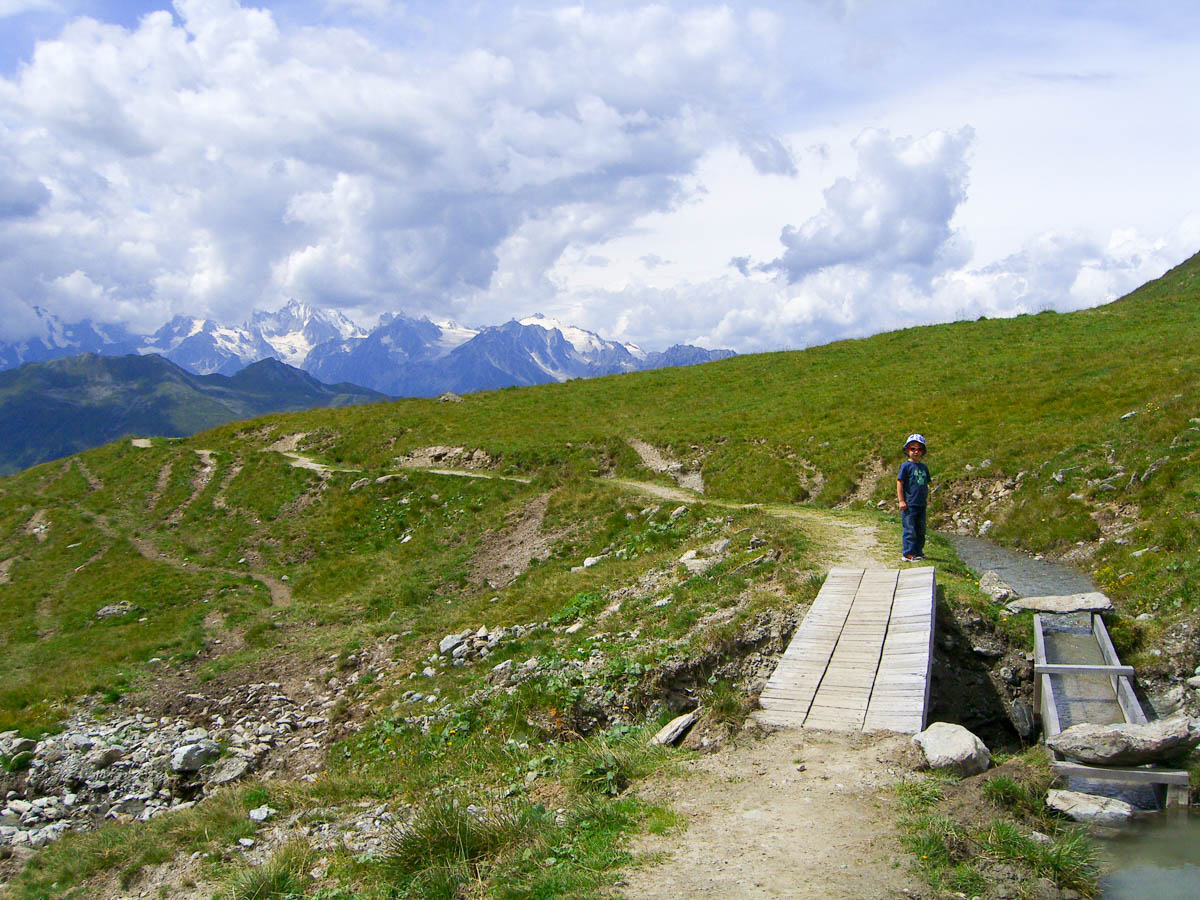
Lots of water and flowers. The irrigation channel was irresistible and my 4yr old stumbled in and got drenched head to toe. It wasn’t deep or dangerous, just wet. I didn’t have extra clothes, so he finished the hike in his underwear and jacket. Luckily it was a warm day. So let this be a reminder to bring extra clothes for curious little ones.

4. End trail at Les Ruinettes and ride down
Then take the cable car back down to Verbier and Le Châble.






One Response
Great blog, may I offer a few updates.
You can actually save yourself a few bucks by driving to La Chaux in the summer and getting the lift upto Mount Fort.
If your taking the lift go to the top of Mont Fort, then do lunch at La Dahu before walking back to Ruinettes.
The full walk is about 8 kms
Kev
http://www.kartingextremeverbier.com
If your fit then why not walk the full route and grab a cake at La marmot they have the best desserts in town. Then walk down to verbier.