Uetliberg is the mountain above Zürich city, with a panorama view across Lake Zürich and countryside. You can easily reach the top by train. But if you want a workout, there are well-maintained trails leading from the city to the top.
Below I describe three options for hiking up Uetliberg.
Video of the Uetliberg trail
There are lots of tiny unmarked paths leading to Uetliberg. But most are not well maintained and can be dangerous, especially after wet weather.
All of my recommended trails are well maintained trails but do include very steep climbs/descents, which can be hard on the knees and sometimes slippery with loose gravel. So wear good shoes and use good judgement.
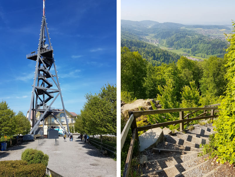
Uetliberg Kulm viewpoint
The trails described below all lead to the Uetliberg Kulm, a viewpoint looking over Zürich. You can easily reach this by train and an easy 600m walk (info about that here). But it’s much more satisfying when you hike up.

There is a restaurant and hotel at the top. There are toilets, but require a coin to enter.
There is a tower you can climb for a fee, a bit expensive in my opinion. If you walk just north of the viewpoint staying on the ridge, you’ll come to a picnic area with a playground and water fountain.
Trail A: Up & Back – Föhreneggweg to Uetlibergweg
This trail simply goes up and down Uetliberg on parallel trails, the shortest option here. If you live in Zürich, you could probably fit this in while the kids are at school in the morning and still make it back home in time to cook lunch. I’ve shown the trail starting from the Albisgüetli stop (end of the line for Tram 13) at the base of Uetliberg, right near the trailhead that starts in the forest.
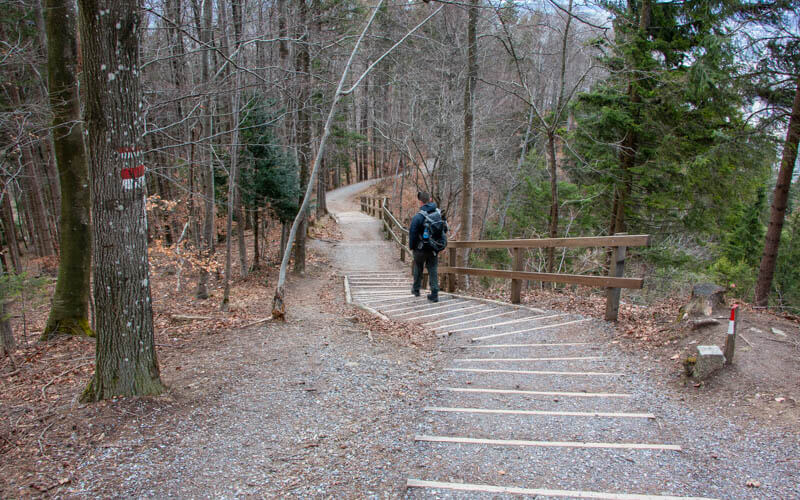
There are two parallel trails going up the mountain. I usually go up the trail on the right on the map below and down the other one. The section on the right is labeled “exponiert”, which means it’s exposed with sections not in the forest, so you get views to the lake. The trail on the left is all in the forest with no views. Both trails are very steep, but well maintained.
Here’s one of the viewpoints on the way up Uetliberg.

Some of the stairs on the trail up.

Trail B: Zürich Uetliberg Loop – Gratweg to Hohensteinweg
This trail is a loop, hiking up Uetliberg, then north along the ridge (aka Gratwegli) then down the Hohensteinweg, then back along the Panorama trail on the edge of the forest. This is a good option if you want to hike longer but want to loop back your starting point or if you don’t want to leave the city.
The trail down feels less challenging that the way up because there are more switchbacks and more stairs, which make the climb/descent slightly easier.

Trail C: Uetliberg via Waldegg to Hohensteinstrasse
This is the easiest option and you can make it even easier by taking the train one direction, so just hiking up or just hiking down.
There is a large parking lot at Birmensdorferstrasse 12, 8142 Uitikon Waldegg where I’ve started the trail shown below. The bus stop Waldegg, Birmensdorferstrasse is also near here, serviced by many bus lines.
If you want to take the train there or back, use the Uitikon Waldegg station, which is a short walk from the parking. There are a few parking spots next to this train station if you prefer.
At about the halfway point there is a very nice playground and picnic area at Hohensteinplatz.

Trail D: Hike up Uetliberg + Panorama trail to Felsenegg
This trail climbs up to Uetliberg, then heads south on the Panorama/Planeta trail to Felsenegg, where you can ride the cable car down to Adliswil, which saves you about 1.5km distance and 400m of elevation descent.
You’ll need at least 4 hours for this one because the hike ends at the Adliswil train station and you’ll need to take the train back to Zürich. I marked the trail starting at the Saalsporthalle train station at Sihlcity (Train S4, Tram 5 & 13), which is convenient because train back from Adliswil stops here. But you could shorten this trail by taking tram 13 to the Albisgütli stop and start there.
If you do ride the Felsenegg cable car, note that the ticket is part of the Adliswil ZVV zone, so the same as buying a ticket from Adliswil train station. So just buy a ticket from here to your final destination. If you are going to Zürich, it costs about CHF 3.20.
Here are a couple views along the Panorama trail. It’s an easy path, with gradual ups and downs. More details for the Panorama/Planet trail here.


11 responses
The extra credit option looks like the same route as option 1 but just extended to Felsenegg
Yes, you are correct. I just wanted to include a separate trail map so you have an idea of the distance and elevation profile.
thank you this looks amazing! I am visiting Zurich and want to do option 2 – I don’t mind a hard climb, but are there any points where you walk on the edge of a cliff, where you need to be careful not to fall? or when you climb the steep mountain you are still safe from falling?
I don’t recall any parts near a cliff edge. Parts of the trail are steep though and you need to walk slowly so you don’t slip.
Nice post!
I was thinking, are these trails “hike-able” during winter months? Any experience? I mean safety-wise could they be dangerous because of ice/mud? Also, beauty-wise, which time of the year you would say is the best time to go for it?
Thanks in advance!
It depends on the snow situation. I wouldn’t suggest it if there is snow, ice or mud. It wouldn’t be too dangerous as there are no cliffs to fall off. But you could get hurt slipping on the ice or mud. Much better to ride the train to Uetliberg and walk along the ridge instead. But during winter, there isn’t often snow up there. So just check the conditions before heading out.
My wife and I almost skipped the mountain because we found out the train is not running on weekdays and this is the last day I was free from work. After we found your blog we decided to hike up on route 1 and it was great. Thanks so much for writing this!
I’m glad you were able to visit Uetliberg with the hike. But I’m positive that this train runs on weekdays. I’ve ridden it lots of times on weekdays.
So glad to learn about these short routes at Zurich. I would be going there in coming February. I am from Hong Kong and loves hiking in my place. Hope to do some gentle hiking when I go to Switzerland then. Thanks, Tanya.
Hi there,
thanks for this post.
I was searching for an easy way to go there with my family and your second option, Uetliberg – Waldegg to Hohensteinstrasse, looks like the best one for me.
Cheers
Alessandro
The easiest way is to simply ride the train 🙂 Hope you had fun!