
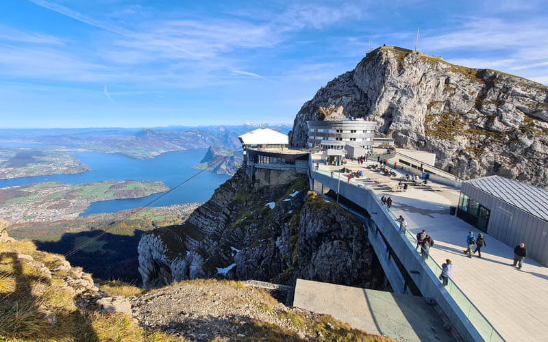
When visiting Mt Pilatus, we suggest the short hike to the Tomlishorn peak for even more spectacular views. This well maintained path is cut into the cliffs, leading to the highest point on the Pilatus range at 2129m.
While this hike is not particularly difficult, it does climb 150m with some switchbacks and stairs and has a few sections with rocky and bumpy terrain that require sturdy shoes and steady footing. The hike is suitable for casual walkers, families and children if you wear proper shoes and use caution.
Since Mt Pilatus is so popular with tourists, this trail can get a bit crowded, particularly with unprepared hikers with inappropriate footwear. But don’t let that stop you. The viewpoint is well worth the small effort and a nice way to escape some of the touristy feel of the main complex.
| Location: | Lake Lucerne Region |
| Address: | Pilatus gondola: Schlossweg 1, 6010 Kriens |
| Car: | Parking: Schlossweg 1, 6010 Kriens 10mins from Luzern, 45 mins from Zürich. |
| Train: | Bus stop: Kriens Pilatus Bahnen 20 mins from Luzern, 1hr20 from Zürich HB |
| Trail: | 3 km round trip, about 1 hour |
| Condition: | narrow path with some uneven terrain and stairs, not suitable for strollers |
| Skill: | moderate, 150m up/down |
| Services: | restaurant, ropes park, summer toboggan, playground |
| Cost 2026: | Adult CHF 84 SBB Half-fare and Junior cards accepted |
| Open: | observation deck year round hiking June thru October |
| More info: | www.pilatus.ch • webcams |
Gallery



Hiking map
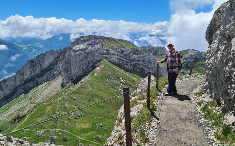
This “there and back” trail follows a path cut into the cliffs to the Tomlishorn peak, the highest point of the Pilatus range at 2129m. The trail is about 1.5 km each way. The trail signs indicate walking time of about 50 mins each way, which is exactly how long it took us walking pretty slow with our 4yr old. As adults, it took us about 30 mins each way.
See interactive map on Komoot • Schweiz Mobil
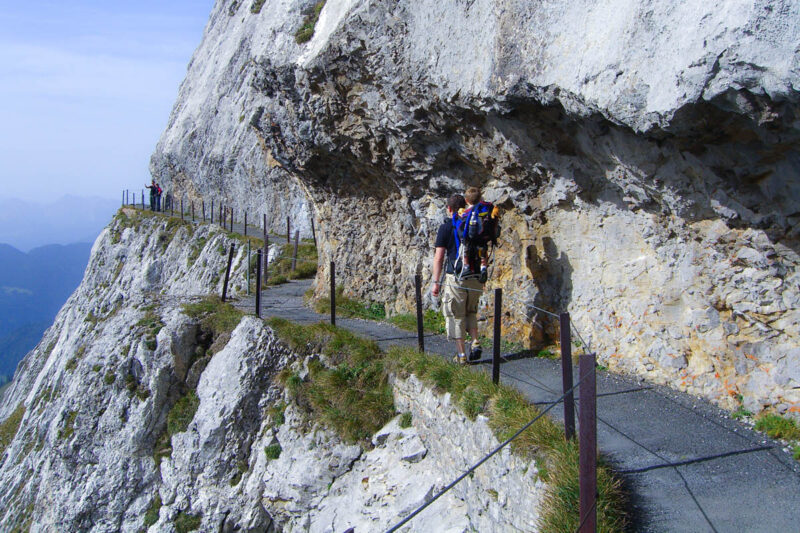
Although the path starts rather smooth, it gets very lumpy and rocky by the ends. with stairs and often quite lumpy and rocky. Requires steady footing and best with sturdy hiking shoes. The path is narrow No strollers. It has a safety railing along the whole trail but I would still use caution with small children who could easily climb through the barrier.
How to get there
This hike is located at the top of Mt Pilatus, a mountain peak near Lucerne. See location on Google Maps. The Tomlishorn hike is accessible by cable car or mountain train.
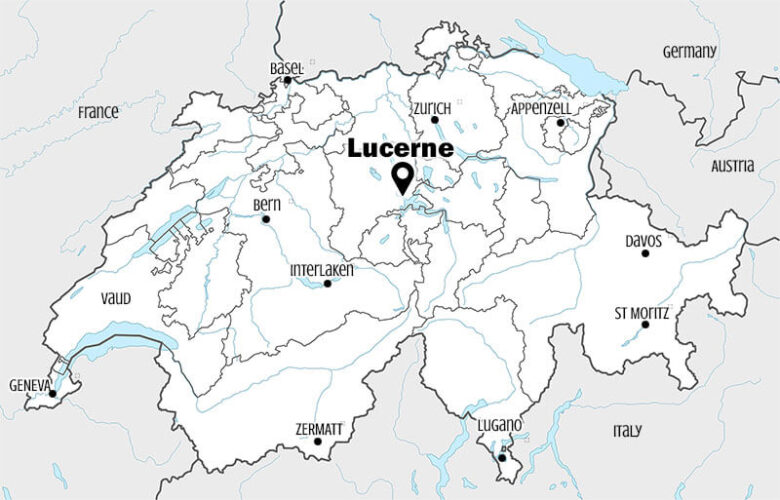
There are two ways to get to the top of Pilatus: the gondola and cable car from Kriens or cogwheel mountain train from Alpnachstad. We typically ride up from Kriens because it’s closer to Zürich and has a more frequent schedule (gondola runs continually, cable car runs every 15 mins). The Alpnachstad train runs more infrequently and is more crowded.
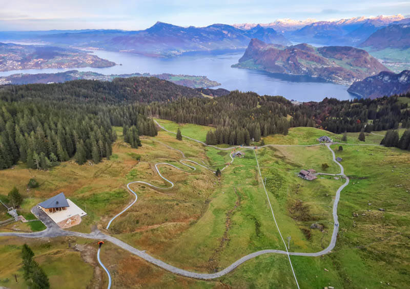
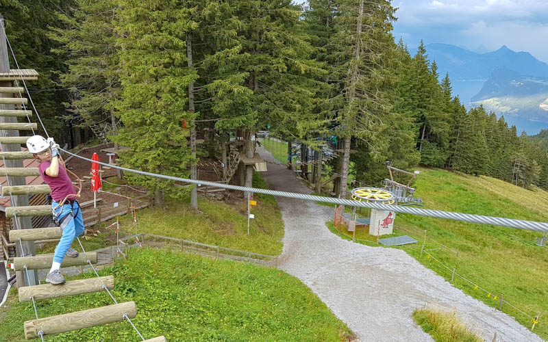
We also prefer Kriens when traveling with kids, because the middle stations have attractions like summer toboggan run, the ropes climbing park, and a big playground.
By car to Kreins: Drive to Kriens (Schlossweg 1, 6010 Kriens) and follow signs to Pilatusbahn. There are 3 small metered parking lots adjacent to the cable car station (In 2020, parking costs CHF 5 for 24 hours). These can quickly fill up on busy days, which happened to us on our last visit. There is another parking lot about a 5 min walk down the street: Parkhaus Hofmatt at Horwerstrasse 13, 6010 Kriens.
By public transport to Kriens: Take Bus 1 from Luzern train station to the Kriens, Busschleife stop. Get off the bus and transfer to Bus 15, direction Kriens, Pilatus-Bahnen and get off at the Kriens Pilatus Bahnen stop. This connection runs hourly, leaving Luzern on the xx:00. Check current schedule.
Planning your day
Ticket prices
In 2026, a round trip ticket to Pilatus is CHF 84/adults. See current prices here.
Children aged 6-15 are 50%. Children under 6 and those with SBB Junior card or Swiss Family Card ride free.
Discounted 50% with Swiss Travel Pass, Swiss Half Fare Card, GA.
Free with the Lucerne Travel Pass.
Book tickets
Opening hours
The trail is usually open from June to mid October.
The cable car and gondola are open year round, with a short maintenance break, typically at the end of October or early November. They run every day from about 8:00 to 17:00. The cogwheel train is open end of May through mid November. The first ride up is usually 8:10, last ride down 5:45.
In all cases, the schedules vary depending on the season. Check current timetable here.
Where to stay
For a special experience, you can stay at Hotel Pilatus Kulm at the top of Pilatus. Otherwise, I would suggest staying in Lucerne, where you can enjoy the charms of the city in the evening and have access to more restaurants.
In the city, our friends suggest Hotel des Balances, which is right on the river near the famous tower bridge. We’ve also enjoyed Hotel Anker, which has a cool, funky vibe and a great breakfast. Boutique Hotel Karl is along the river. For a budget stay, you might consider Ibis Budget Hotel near the Lucerne train station.
Photo story of the trail
1. Starting the trail
The trail starts just past the hotel/restaurant at the far ends of the Pilatus complex. You’ll pass through a gate warning you that the trail can be dangerous and that you should wear appropriate shoes.

The trail is cut into the side of the cliff. The first part of the path is mostly paved and quite smooth as shown below. But it gets much lumpier later so keep that in mind.
Everyone wants to take this pic and there can be a hold up as you wait for people to finish posing.
PromotedDon't miss out on today's trending deals!
Join thousands of users enjoying exclusive benefits right now.

My kids loved the signs describing the flowers, even if the flowers were all dead when we went.

Make sure you go up in clear weather so you can see these views.

The path is still pretty smooth for awhile.

2. Up the stairs
Now the first set of stairs. After this the trail gets much more rough.

More stairs.

Now we can see our destination, the top of that tall peak ahead.

Now you can see that the path is lumpy and rocky. It only gets “worse” from here. I mention this for casual walkers that aren’t used to walking on unstable paths. It’s important to know what you are getting into.
3. Arriving at Tomlishorn
Looking back on the last stairs leading up to Tomlishorn.
There is small fenced observation area with benches.

View from Tomlishorn back toward Pilatus. I think it’s worth the small effort.
View west towards the Berner Oberland

From the top, you can see a ridge trail leading west. This is a dangerous long ridge trail leading to Gfellen. Although you may see lots of hikers on this trail, do not attempt this trail unless you are an experienced hiker and use extreme caution.
When you’re done, just walk back the way you came.






8 responses
Would there be any need for poles on the out ‘n back route to Tomlinshorn?
Pictures suggest they are not necessary.
Poles aren’t necessary on this one. It’s quite rocky anyway so sticks with metal tips aren’t much use. have fun!
Looks like you have indicated an out and back distance of 5.5km, then 2.5, then 2.0, while the elevation change changes from 130m to 150.
Which is the correct one?
Sorry for the confusion and thanks for bringing this to my attention. It’s 3km round trip and I’ve corrected the info the post. Hope you enjoy it!
Great to read how you experienced it
I have one question in june I am going hiking with my dog on mount pilatus is it possible to hike up to tomlishorn with my dog?
I don’t see any info prohibiting it. Definitely bring your dog on a leash though.
This is very detailed and helpful, pictures are awesome. I will be going there on August 10th for the first time and we (my son and I) are not experienced hikers, but just can not resist the scenery and the thrill of hiking up the Tomlishorn. I was curious, about how much time does the gondola take going up and coming down, is there a long queue? At what time it would be best to arrive to get the best view possible. I read that it is quite normal for weather patterns to change quite rapidly. We enjoy your blog, so excited to visit beautiful Switzerland, thank you.
Hi. I think that if you are motivated, you can manage the hike to Tomlishorn. The cable car ride from Kriens to Pilatus takes about 40 mins. There is sometimes a queue, but probably not more than 10 minutes. I would suggest checking the weather forecast before your visit. I cannot tell you what time of day to go since that will be entirely dependent the forecast. I like https://meteo.search.ch/cloud/Pilatus-Kulm which shows you an animated forecast for the rain and clouds.