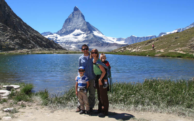
This trail will get you as close to the Matterhorn as you can get without climbing up it directly on it, allowing for some epic family pics with the big M if the weather is clear. If you only have time for a couple trails while in Zermatt, the Matterhorn Glacier Trail should be at the top of your list.
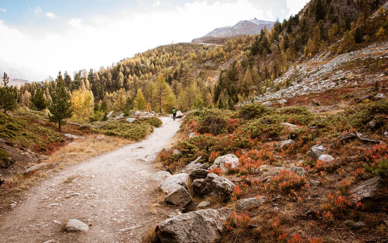
The trail passes by the glacier that carved out this barren rocky landscape, pretty in its own way with colorful stones and lots of little ponds and a river along the way. You’ll also have great views of the Zermatt valley and other glaciers and mountain peaks in all directions.
At this elevation, you can get extreme weather, even in summer, so come prepared. You also have the chance to see some wildlife; we saw a Steinbock up there, a real treat! The trail requires some sure footing at times, but it’s not too long, difficult or dangerous, so suitable for kids as young as 5 or 6 that can go the distance.
| Location: | Valais Switzerland |
| Address: | Zermatt Bergbahnen (aka cable cars) Schluhmattstrasse 28, 3920 Zermatt 20 min (1.2 km) walk from Zermatt train station |
| Car: | about 3hr40 drive from Zürich to Täsch, then 20 min train to Zermatt |
| Train: | about 3hr15 from Zürich HB or Luzern to Zermatt, about 2hr10 from Bern |
| Trail: | 6.4 km one way, about 2.5 hrs with kids |
| Elevation: | highest point 2920m, total climb 150m, descent 500m |
| Condition: | red/white mountain trail, rocky dirt path, no strollers |
| Skill: | moderate |
| Open: | best July through September, weather dependent |
| Cost 2023: | Cable car Adult CHF 62 – 79, depending on the season 50% for children, SBB Half-fare, GA or Swiss Travel Pass. Children under 9 and those with Junior cards free. |
| More info: | zermatt.ch – webcam |
Overview
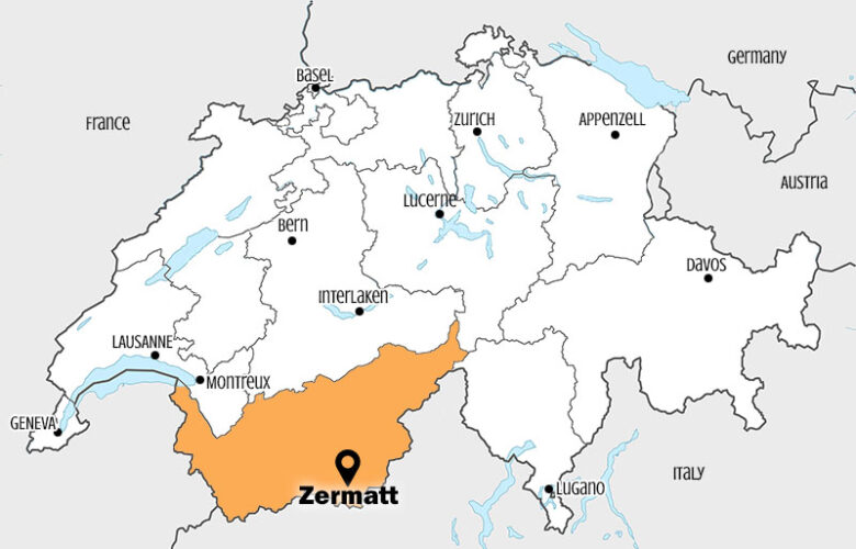
This trail is located in the Zermatt area in southern Switzerland.
Trail Overview
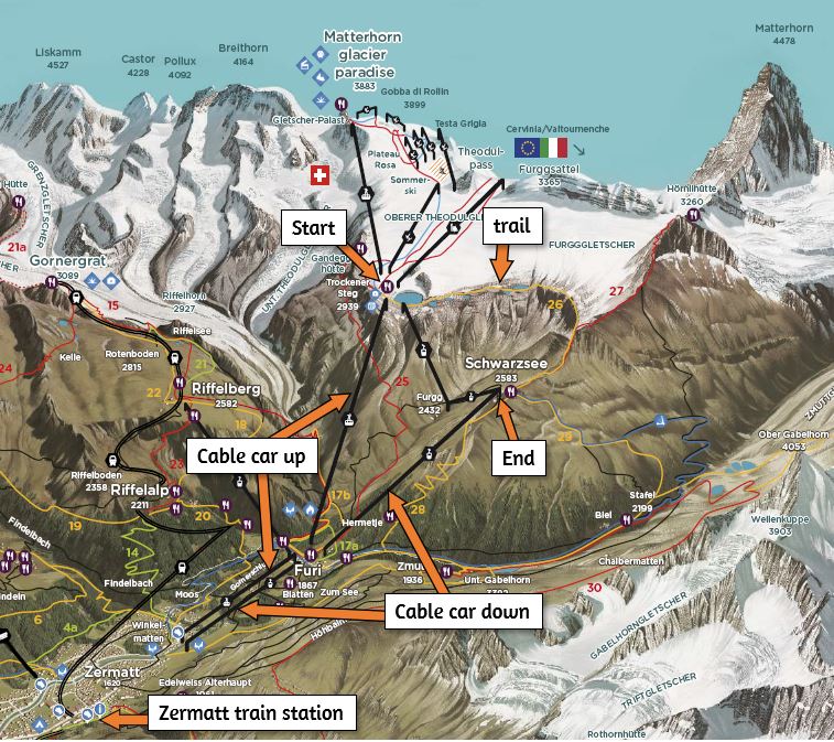
This trail is accessed with the Zermatt Bergbahnen (aka cable cars) on the south side of Zermatt. Here is the summer panorama map for this area.
Trail map
The trail starts at the Trockener Steg and passes over a rocky landscape below the Furg glacier and Matterhorn, ending at the Schwarzsee cable car, which takes you back down to Zermatt. There are restaurants and WC at the start and end of the trail, but no services in between. Here’s the detailed trail map that you can download and print.
View trail map on Komoot
The trail is not particularly difficult, but it has some rough terrain, with lots of loose rocks. So no strollers and you might want hiking sticks for parts of it. The trail is well marked with red/white trail markers painted on stones and tall red/white sticks that you can see from a distance, which helps because it can sometimes be hard to see the path among the rocks. Keep kids close by so they don’t accidentally wander off trail like mine did.
Note about Schwarzsee dirt scooters: We were hoping to combine this hike with riding dirt scooters from the end of the hike at Schwarzsee down to Zermatt, a 12.7 km ride. However, you can only rent these scooters at the valley station, not at Schwarzsee (missed opportunity bike company!).
I couldn’t find any info online about the prices, so I asked in the shop. They sell a package deal, which includes the dirt scooters and cable car ride for about CHF 50/adult, expensive! If you have a Half-fare card or Junior cards for the kids, you could rent the dirt scooter separately (about CHF 32), then buy the one-way Schwarzsee cable car ticket separately, but do some calculations first.
How to get there
From the Zermatt train station, the Zermatt cable cars are a 20 mins walk (1.2 km) as shown below. With kids, this is a long haul.
There is a bus that runs from the train station to the cable cars (the Matterhorn Glacier Paradise stop), which runs about every 25 mins. See the current schedule here. The bus is free if you already have a cable car ticket (e.g. online purchase). You can also buy a weekly bus ticket for CHF 22. A single ride costs about CHF 2.50, discounts with SBB Half-fare and other travel passes, children under 9 and with Junior cards ride free. Tickets sold on the bus, probably cash only. See current prices here.

Tickets & Opening Times
They sell a combo hiking ticket for the Matterhorn Glacier Trail, which includes travel on the cable cars at each end of the trail. This includes Zermatt-Furi-Trockener Steg and Schwarzsee-Furi-Zermatt (you can hike either direction).
This combo ticket costs CHF 70.50/Adult (CHF 64 in spring and fall). Children under 9, children with Junior cards and dogs ride free. 50% for children aged 9 to 15, SBB Half-fare, Swiss Travel Pass.
You can buy tickets online beforehand to avoid lines in high season. But you can’t use any discount cards online. So best to purchase in person, with card or cash.
These lifts are usually open from the last week of June to the first week of October. They operate daily from about 8:30 to 16:30. But check the website for exact opening times, last descent, and current trail conditions.
Photo story of trail
1. Riding up the cable car
Here’s the Zermatt cable car station. You can buy tickets here.

The first cable car takes you to Furi, where you change to another car that takes you to Trockener Steg. Make sure to follow the signs so you get on the correct cable car. This is the view from Furi looking up to Trockener Steg.

Looking back from Trockener Steg back down to Zermatt.

To access the trail, you get out at Trockener Steg. But FYI, another cable car continues from Trockener Steg up the Matterhorn Glacier Paradise (the photo shows us looking up to that point). This is a a tourist complex with beautiful viewpoints, an ice cave in the glacier to explore, restaurants, and summer sledding and skiing.
You could visit that first, then ride back down to Trockener Steg to do the hike. But don’t forget that the cable car at the end of the hike closes around 16:30, so get an early start if you want to fit it all in.

2. Starting the trail
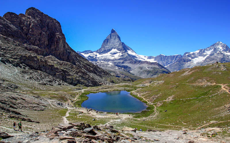
The Matterhorn Glacier trail starts to the west toward this large lake.

Follow trail signs labeled #26 Matterhorn glacier trail.

The trail wraps around the first lake.

Then goes up toward the glacier. The trail is marked but the path is often rather faint, so I was glad we saw other hikers ahead of us so we knew where to go.

Lots of loose rock on the trail, wear good shoes.

Lots of little lakes spotting the landscape. Someone told me that this lake wasn’t there when they did the trail earlier this summer. So I suspect the snow and water levels vary depending on recent rainfall and snow melt. We went the first week of October after a very hot, dry summer.

I was surprised that the trail wasn’t closer to the glacier snow. But I’m guessing the snow line changes over the course of the summer, so the trail has to be far enough away to be passable during most of the season. You can easily go off trail and hike over to the glacier snow in a few minutes if you like.

There are lots of educational signboards along the trail with interesting info about glaciers.

The trail can be a little difficult to see sometimes since you are walking on rocks and it’s not always a distinct path. My son accidentally wandered off trail and I had to go look for him after he didn’t catch up after a few minutes. So best to keep together on this part.

I hope you are lucky and get a clear view of the Matterhorn. We saw it clear a few times but not the whole hike.

Then you descend into this river valley, water flowing out of the glacier. On a sunny day, this might be a nice place for a picnic. But when we were there, an icy wind was ripping through the valley and it even started hailing even though it was 18C in the sun at the beginning of the trail.

The trail crosses the river over a bridge and climb up this hill. It looks tall, but it only took us 10 mins to make it to the top. Small kids will need a little encouragement on this part.

Looking back down at the river valley just to give you some perspective.

As you leave the glacier valley, you’ll see a trail heading up the cliff wall. This trail leads to the Hörnli hut, which is a base camp for mountain climbers that attempt to summit the Matterhorn. Save that for next time 😉

At this point, we were extremely lucky to see a wild Steinbock on the trail. Keep your eyes out!

3. Finishing at Schwarzsee
At the top of the hill, you pass under a cable car that’s not running and wrap around the mountain, bringing the Gorner glacier back into view. You now have about 1.5 km to go, which took us about 30 mins. Remember that the last cable car down from Schwarzsee is around 16:30, depending on the season. So check that before heading out so you don’t miss it.

Then you’ll see the Schwarzsee-Furi cable car in the distance. That is your destination.

A few more switchbacks, a short sketchy section down this rock wall, then relatively smooth sailing to the finish.

At the end of the trail, you’ll pass the Schwarzsee shown below.

All done! Now ride the cable car down to Furi, then a second cable car to your starting point at Zermatt.

If you do this trail, please come back and leave a comment to let me know how you liked it.


14 responses
Thanks so much for the first-hand practical information! I am planning on the Matterhorn Glacier Trail hiking and shocked with the cable-car prices if purchasing online. Well noted, combo hiking ticket at the station! 🙂
Thank you for this great description. I’ll be heading there next week from California and plan to run the trail from Trockener to Hornli hut and then back to town. It’s very helpful for creating this page. Thanks!
Hi, we find this website very informative. Thank you.
My wife and I are elders in our sixties and planning a trip on this hike. I was encouraged until I read about the sketchy short stretch. Don’t know how you trekked down this rocky wall but I don’t think we can do this. Is there another way down?
Perhaps we can hike to the valley before the climb uphill and then turn around back to the station. Your views on this please?
Keep this up please, am sure others will find this most helpfull.
Thank you
That short sketchy section wasn’t too bad. It just had slippery loose rock, so we had to go slow and use our hiking sticks. I mentioned it more for those with smaller children that tend to run forward and might find themselves tripping and falling on such conditions. The whole trail is quite lumpy with all the rocks, so if you can manage that, I don’t think this short section would be a deal breaker. But if you felt more comfortable skipping that, you could hike out about 3.5km where you get the closest to the Matterhorn, then hike back instead of going over to the Schwarzsee. I think that would also be a very enjoyable hike. Good luck!
Hi! Your website is incredible! I am already making a list of hikes that I need to make next year. Appreciate how much detail you have put into this.
I had a question or two regarding Glacier hiking. 1) What is the best month or season to do this? And 1) Is a guided tour recommended for a glacier crossing adventure?
Hi. We did an intro glacier walk this summer with a guide, which was great. I would highly recommend going with a guide if you want to walk around on the glacier itself. We went with Swiss Alpine Guides (https://www.swissalpineguides.ch/), which provided all the equipment including crampons, sturdy hiking boots required for crampons, harness, safety ropes and ice ax. Our guide was very friendly and helpful and knew so much about the particular glacier we were on and had years of experience with a variety of conditions on glaciers.
I’m a low risk person in general, but I think for a first time on a glacier, I would absolutely go with a guide. Glacier tours are generally run June through October. Hope you find one you like!
Hi there! i commented on your Eiger Trail blog too!
Again, I’m worried about my 72 yr old mother on this trail where you mentioned a sketchy portion. Do you know degree angle of that? Would it be maybe 45 degree angle scree slope? And how long/short is that portion? Would this be the only portion that is sketchy or are there others? She is also planning to take hiking poles for support.
I would probably not do this hike with your mother. It is very rocky, mostly rocks, not dirt on the path. So lots of places to twist a foot or ankle. I think the Riffelalp hike or maybe the 5 lakes hike (or my shorter 3 lake version) might be better for her. https://swissfamilyfun.com/riffelalp-sunegga-naturweg/
We hope to do these lovely walks sometime soon . Would you kindly type out all details of walks we must do around Zermatt and e-mail or send to us at Ken Poole. 4. Ritabrook road Ipswich. Suffolk England. IP29JH. We are looking for about. 5 or 6. Average walks thanks. Ken
Hi Ken. All the details for these hikes are on the website. I don’t have anymore information than that. So perhaps you can simply print the information from the blog post or copy and paste it into a document. Good luck.
We have yet to do this hike, but I need to tell you that your website has been SO helpful in allowing us to plan our trip and feel prepared. It can be tricky figuring out how to actually get to a hike, but you make it so clear.
Thanks so much for taking the time to leave such a nice comment. Hope you make it to this trail someday!
One of the most beautiful trails I did in my last vacation, I want to thank you for your site it was very helpful in planning my vacation.
So happy you enjoyed it! Thanks for taking the time to leave a comment. Wishing you many more happy hiking on future trips.