What a delightful oasis right next to Lucerne city! This beautiful little lake is only an 8 min bus ride from the Lucerne train station, but it feels like a world away from the hustle and bustle of the city. Fondly called the little brother of Lake Lucerne, it’s nestled in a long quiet valley with views of famous mountain peaks in the distance.
There’s an easy stroller-friendly path around the lake, plus a ferry in the middle if you want to cut it short. It’s a protected nature reserve, which keeps the lakeside area pristine and not over developed. There are lots of places to lounge and enjoy the view, including a huge grassy area for lawn games and a nice playground with swings and a tall slide. Happily you can swim at the Badi at one end of the lake.
This is a perfect quick and easy nature outing if you live or are staying in Lucerne city, especially because the bus trip is included in the Zone 10 city ticket, free for anyone staying in a hotel or holiday accommodation in Lucerne. If the kids need a break from the city and a place to run around after a long day, this would be my first choice. I hope you like it as much as we did!
Note: This outing was sponsored by Lucerne Tourism as part of their “Be a summer child again” campaign.
| Location: | near Luzern, Central Switzerland |
| Address: | Seehüsliweg 6, 6004 Luzern |
| Car: | 6 mins from Luzern, 35 mins from Zürich Parking: Seehüsliweg 6, 6004 Luzern |
| Train: | 8 mins from Luzern, Bahnhof Bus stop: Maihof, Luzern |
| Trail: | 6.3 km loop, about 2 hours. Can shorten with ferry ride. |
| Highest point: | 439m |
| Condition: | part dirt path, part paved, possible with strollers |
| Skill: | easy |
| Services: | restaurant, playground, swimming area, no fires |
| Cost: | free |
| Open: | year round |
| More info: | luzern.ch Lucerne webcams |
First a short video from our day by 110 in partnership with Lucerne Tourism.
1. Trail Overview
The Rotsee lake is located in Lucerne, just north of the city center, easy to access by car or public transport.
Here is the official map of the lake. I’ve marked important elements that I discuss below. The lake is a protected nature reserve, so no fires, you must stick to the path and you can only swim at the Rotsee Badi (CHF 5/adult, CHF 2/child aged 6-16).

The full path around the lake is about 6.4 km. You can cut this in half by taking the ferry in the middle of the lake. The southwest side of the lake is the easier side and with the ferry, it’s only about a 3.2 km loop. Here is a more detailed trail map that you can download on your phone.
Accessibility. The north side of the lake is a paved path, sometimes lumpy but obstacle-free. The south side of the lake is mostly a wide gravel path. There is a short section between the swimming area and the ferry that is a narrow dirt path next to the water. But there is an alternate obstacle-free route for this section, on the quiet neighborhood street parallel to the lake. It is clearly marked and easy to follow.
2. Getting There
By public transport: Get yourself to Luzern. From the Luzern Bahnhof, take bus 1 to the Maihof stop, about an 8 min ride. This bus runs every 8 mins all day. It is included in the Luzern city ticket, that all overnight guests in the city receive for free.
From the bus stop, it’s short walk to the lake as shown below.
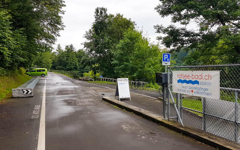
By car: Drive to Seehüsliweg 6, 6004 Luzern and park in the metered lot next to the restaurant. It costs CHF 2/hr. You enter your license plate number (including canton abbreviation) into the machine and pay. You don’t get a receipt.

Alternatively, you can park next to the Rotsee Badi, which is located at Rotseeweg 21, 6030 Ebikon. Parking here costs CHF 0.50 for the first hour, CHF 1 for the second hour, 2 for each additional hour. If you go to the Badi, you can get a parking day pass for CHF 5.
3. Planning your day
You can simply walk around the lake, which is about 6.4 km and takes about 90-120 mins. It’s easy walking with only a couple mild ups and downs. On a hot day, I’d suggest parking at the Badi and ending your hike swimming in the lake. Note that you are only allowed to swim at the Badi, no where else on the lake, which is a protected nature reserve.
For a shorter trip with kids, you could park at the west side of the lake, walk along the north shore, take the ferry across. Then a short walk to the playground, where you’ll also find a big grassy field, water fountain, WC and benches on the lakeshore for lounging. Then walk back to the car. Total distance 3.2 km.
4. Ferry
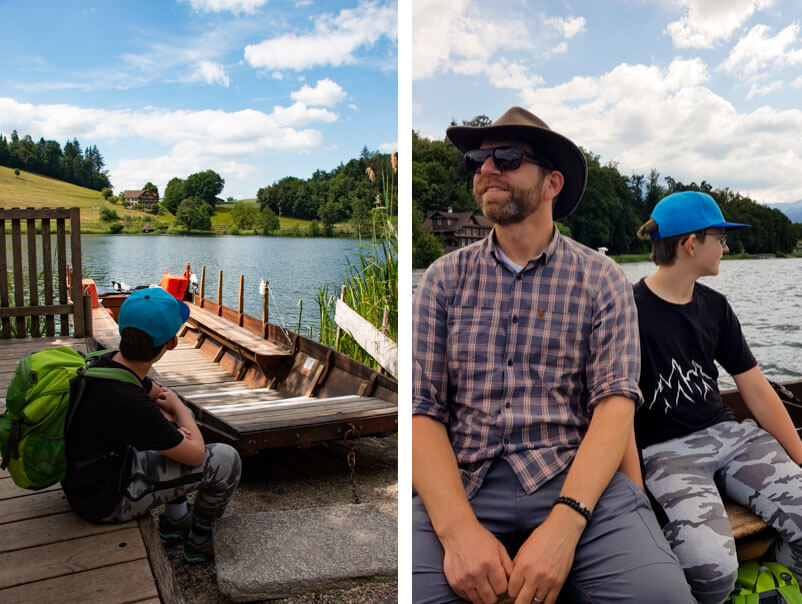
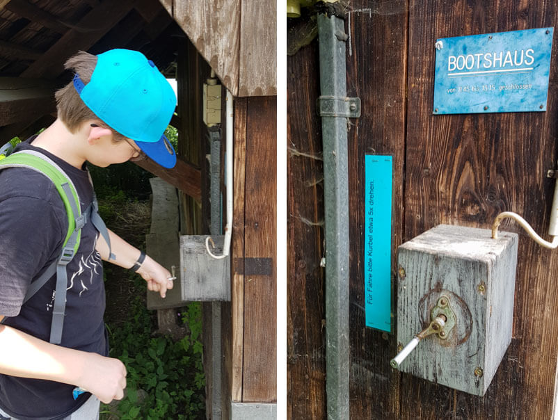
The ferry runs daily 9:00 – 11:45 and 13:15-17:00 (18:00 in July & August). A one way trip costs CHF 3/adult and CHF 1/child. No bicycles or wet dogs allowed. If no one is at the ferry dock, you can ring the bell. On the south side, there’s a buzzer on the house wall. You have to hold it down for 7 seconds. On the north side, there is a crank to turn that makes a ringing noise.
5. Arriving at Rotsee
One time we came here by bus on a sunny day. Another time I came by car on a cloudy day. So you’ll see pics from both days here, both of which were lovely.
I’ll start at the parking at the Seehüseli restaurant on the southwest side of the lake and show you the trail clockwise around the lake. Of course, you can hike any which way you like. If you came by bus, you’ll start at the big grassy field next to the playground. We’ll get to that soon.
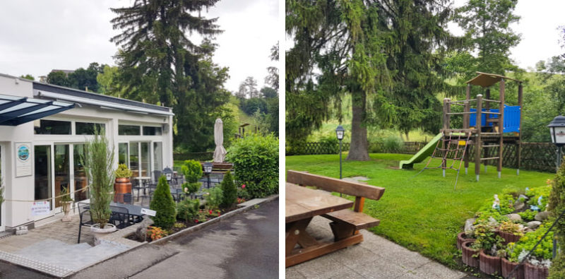
The Seehüsli restaurant is adjacent to the parking and does not have a lake view. It’s open every day except Tuesdays, 10:30-17:30 (except Saturday it doesn’t open until 13:30). It has a nice playground but only for customers. The WC is also only for customers, but there is a portable toilet on the far end of the parking lot. The only other toilet on the trail is near the playground.
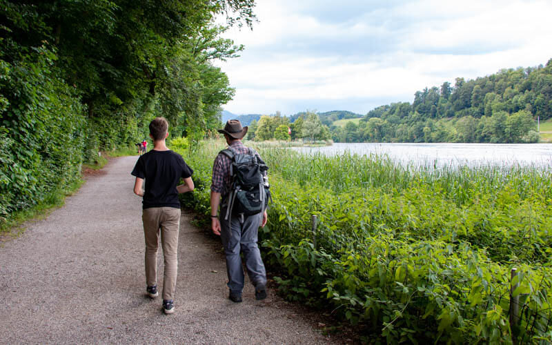
The path on this north side is paved the whole way. It’s super easy walking, very quiet and beautiful next to the water.
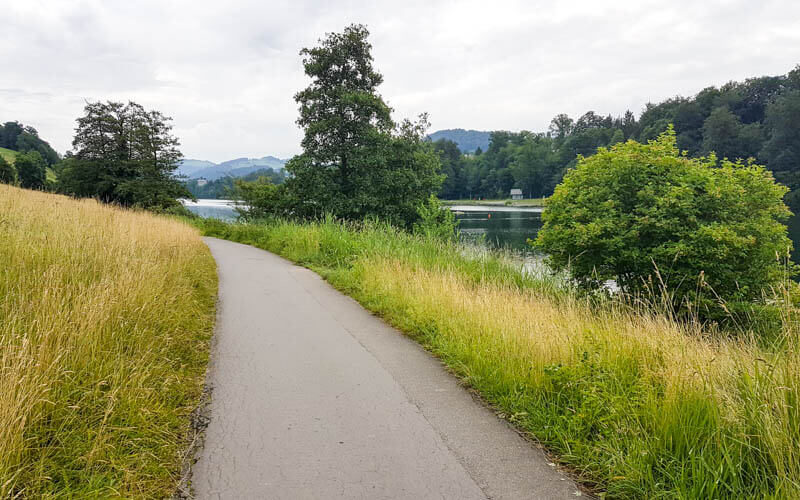
On a clear day, you can see both Mt. Pilatus and Mt. Rigi from the lake. In this pic, the top of Pilatus is covered in clouds.

6. The ferry ride
After about 30 mins walking, you reach the ferry dock.

If the boat isn’t there, walk back to the boathouse and crank the bell, minimum 5 times. Then wait.
It’s a short ride but beautiful. Once you get to the other side, you can walk south to reach the playground and do the shorter loop. But for now, I’ll continue walking on the north side.

7. Continue walking on the north side.
Assuming you didn’t take the ferry, we will continue the full loop. The trail ducts under the train tracks, then turns right parallel to the tracks. Follow the signs to Ebikon.
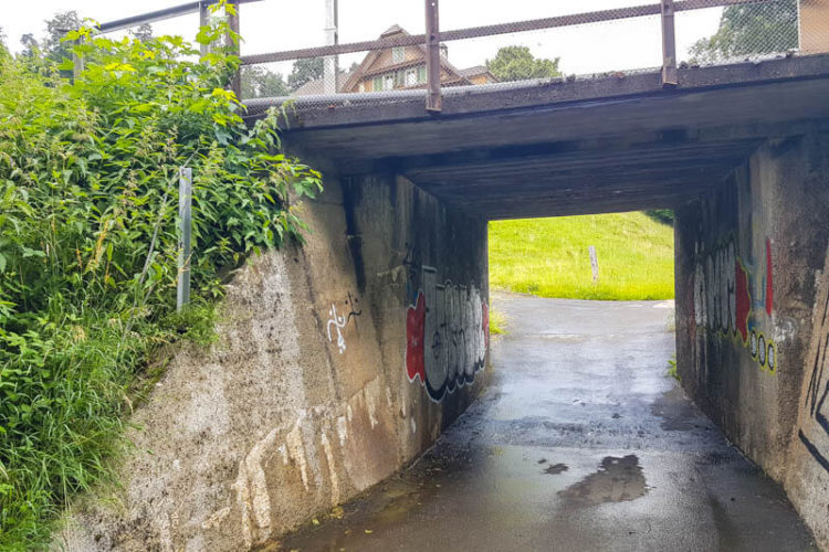
This pic is looking back down the trail. The trail continues on this side of the tracks until you reach the east end of the lake.
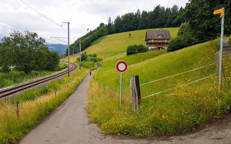
A train only comes by about every 10 mins, so it didn’t really bother me.

I was initially worried about being away from the shore but actually it was nice to climb the hill a bit and get an overview of the lake.

You can see the Badi, aka swimming area, on the other side of the lake. We’ll be there soon.

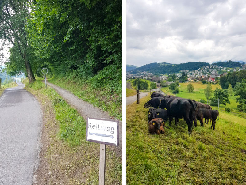
A horse path (aka Reitweg) parallels the walking path for a bit. Stay on the paved path to avoid the horse poop. You’ll pass some cows along the way. We got to see some young calves.
8. Around the end of the lake
Now at the end of the lake, where we cross the tracks and wrap around to the south side of the lake.

Looping around the east end of the lake. Although it doesn’t look like, you are just one street away from the small village Ebikon that has a couple restaurants and other services if you need it.

Here’s the Rotsee Badi. They have grassy areas for lounging and two diving platforms in the lake.

9. Detour for strollers
At the Badi parking lot, the trail forks, with a foot path to the right, on the other side of these big rocks blocking the path. They really don’t want you to go down their with wheels.

Strollers instead follow the road, which bypass the lumpy narrow footpath and instead passes through a quiet neighborhood for about 10-15 mins before coming back down to the lake.

Meanwhile, the footpath is in the forest right along the water’s edge, so lovely and maybe my favorite part of the path.

The paths rejoin at the southside ferry dock. If you want to take the ferry here and no one is outside, you need to press the buzzer on the side of the main building for 7 seconds. The instructions are on the wall.

10. Destination playground
It’s just a couple minutes from the ferry dock to the big field and playground.
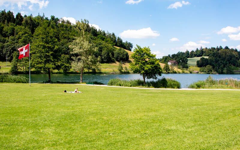
This large grassy field has lots of room for playing and lounging. We saw people playing football and other lawn games. Remember, you can’t swim in this part because it’s a protected nature reserve.
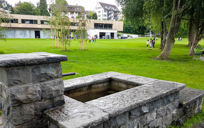
There’s a water fountain along the path and a free WC at the east corner of this building behind the field. No picnic areas or fire pits, but a few benches along the lake shore to enjoy the view.
At the west side of the grassy field, you’ll find a nice playground.
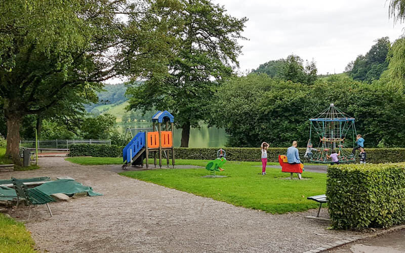
The long slide down the hill was popular.

Although there aren’t picnic areas with tables, there are lots of pretty places along the water to sit.

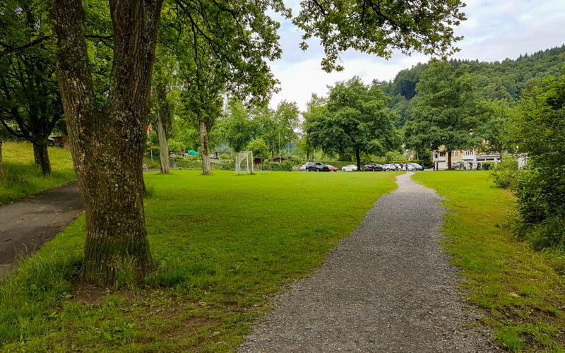
Back at the parking. There’s a big field here with football goals. The restaurant is on your right. There’s a portable toilet on your right along the path.
Well, that’s the whole hike. I hope you go there soon and enjoy it!
You might also like…





2 responses
Thank you so much for all this information! I am grateful for the work you’ve put into all the details. Definitely going to go here next week!
Thanks so much! I hope you enjoyed your visit to Rotsee.