When Zurich is stuck in low clouds, you can often drive to the sun at a higher elevation. The forecast on search.ch will sometimes indicate at what elevation the clouds end. Back in October, we saw that the clouds would end at 900m, so we found a hike above that and hoped for the best. We ended up in Steg, Liechtenstein and enjoyed a lovely relaxing stroll along a little river.
This is a good example of a shoulder season hike. Since you don’t have to take a gondola to reach this hike, you can start doing this one as soon as the snow has melted. I bet in May it’ll be pretty nice with all the wildflowers coming out. I can’t wait to go there again as there are other longer hikes I’d like to try in the area.
| Location: | Valais Switzerland |
| Address: | Gänglesee, Steg, Liechtenstein |
| Car: | about 1hr30 from Zürich to Gänglesee, Steg, Liechtenstein |
| Train: | about 2hr from Zürich HB to Steg FL, Tunnel |
| Trail: | 5.5 km round trip, about 2.5 hrs with kids |
| Elevation: | highest point 1420m, total climb/descent 110m |
| Condition: | dirt path, ok for strollers |
| Skill: | moderate |
| Open: | May through October, weather dependent |
| Cost: | free |
| More info: | tourismus.li |
Trail Map
This trail starts at a small reservoir and follows the river upstream to a mountain restaurant. Then retrace your steps back to your starting point. It’s easy walking but the path is rather lumpy and not suitable for strollers.
Getting There
This trail is located in Liechtenstein, near the eastern border of Switzerland.
By car: Drive to Liechtenstein and up the mountain following signs to Malbun. After driving through the narrow tunnel at the top, take your first right (before reaching the Steg village) and take a right on Valunastrasse. At the end of this road, you’ll find some dirt parking spaces next to the Gänglesee lake. Park here and start your walk along the lake.
By public transport: Take a train to Sargans, then a bus to Vaduz, then a bus to Steg FL, Tunnel.
Trail Impressions
start of the hike at the small Gänglesee lake

Continue on the right side of the river. Most of the trail is a dirt road, so it’s pretty easy with the stroller. There are a lot of bridges along the way and the east side of the river has a paved road if you find that necessary.

It’s flat and follows the river the whole way, which provides a good distraction for the little ones. Our four year easily walked the whole way without much coaching.
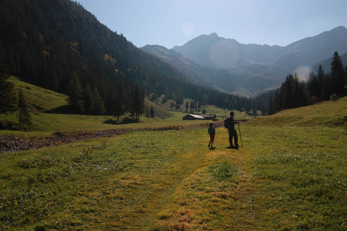
After about an hour or so, you’ll reach a restaurant. It’s a small simple menu (cash only), but our soup and cheese/meat plate was pretty tasty. There’s a sand box and a clean bathroom.

near the end of our hike, we spent some time in the river bed building water traps, a favorite pastime of my boys

Liechtenstein tourism website
Liechtenstein summer stuff
Brochure with family hikes





2 responses
Can I just say that your website is incredible! I wish I had the diligence to document family outing like you have here. This is something that your kids will treasure later if they don’t already. Thanks for being so helpful and providing a great resource for our family!!
Thanks for all the kind words! Yes, I hope all this work helps my kids remember the good times. Hope you have many happy adventures with your family.