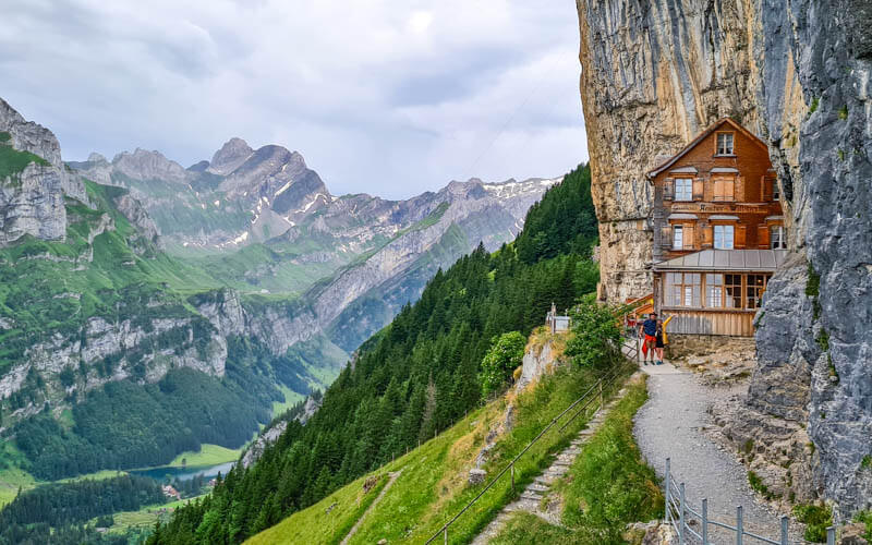
This beautiful mountain resort in the Appenzell region has fantastic views of both the Alpstein mountain range and classic rolling Swiss farmland.
It’s a popular hiking area for locals of all ages. But it’s a particularly fun destination for families, with lots of amusements including an alpine coaster, zip line ropes course, and huge playground.
We did part of the Alpine Panorama Trail, starting at the top of Kronberg and hiking down to Appenzell. It’s an easy ramble starting along the ridge and ending in alpine meadows, all downhill. I have options below to make this trail longer and/or more difficult if you want more.
Quick info
| Region | Appenzell region, Eastern Switzerland |
| Address: | Jakobsbad, Kronberg cable car |
| By car: | Parking: St. Josefstrasse 2, 9108 Jakobsbad 12 mins from Appenzell, 1hr15 from Zurich |
| By public transport: | Train station: Jakobsbad 8 mins from Appenzell, 1hr40 from Zürich |
| Trail: | 3hr • ⬇️trail map |
| Distance: | 9 km one way |
| Difficulty: | moderate • +59m -923m |
| Condition: | dirt footpath, uneven terrain, stairs |
| Elevation: | highest point 1658m |
| Open: | May to Octoberr |
| Cost 2026: | cable car one way CHF 21/adult |
| Discounts: | Discount on cable car with Swiss Travel Pass, Half Fare Card, and GA |
| Services: | restaurant, playground, coaster, ropes park, activity trail |
| More info: | kronberg.ch • webcams • weather |
Gallery
Overview
Kronberg is a mountain in the Appenzell region in eastern Switzerland. See on Google maps.

Here is the Kronberg summer map showing where the amusements and trail are.

Trail Map
We hiked the Alpine Panorama Trail from the top of the Kronberg cable car and hiking down to Appenzell. This section took us about 3h30 to complete.

See trail on Komoot
Some people prefer to hiking this the opposite direction, so you get more exercise and you end your hike at the Kronberg restaurant with fantastic views. I would definitely recommend that if you have the energy for it.
The trail is downhill on a dirt path, sometimes with loose rock and a bit steep, so best with hiking sticks for balance.
Longer version
You could the entire Stage 3 of the Alpine Panorama Trail, which ends in Schwägalp instead of Kronberg (or you could start in Schwägalp). This version is 16 km long, 1150m up and 580m down. See trail map.
Shorter trails
Kronberg has a few shorter trails that are suitable for families. There is a short flower trail at the top. We’ve hiked the trail from the top back to the valley (see 7 km trail map). See more Kronberg hikes.
Getting to Kronberg
This is a one way hike. So you’ll need to take the train between the ends of the trail.
By public transport:
The Jakobsbad train station is directly adjacent to the Kronberg cable car station. From Appenzell train station, there is a train to Jakobsbad every 30 mins, an 8 min journey.
By car:
You can park at either end of the trail, at Jakobsbad or Appenzell. Since we were ending our hike in Appenzell, we parked at the Appenzell train station, but there are only a few parking spots there (Wührestrasse 11, Appenzell).

So I think it would be more convenient to park at Jakobsbad, which has multiple parking lots adjacent to the cable car station – St. Josefstrasse 2, 9108 Jakobsbad. You can pay with coins or the EasyPark mobile app.

Planning your day
Operating Times
The Kronberg cable car is open for summer season from early April through late October. The cable car runs daily every 30 mins from 9:00-17:00. On weekends, holidays and summer season, it runs from 8:00-18:00. See current operating times.
Cable car tickets
For this trail, you need a one-way ticket on the cable car. In 2023, the one way ride costs CHF 28/adult. 50% discount for children and those with SBB Half-fare and GA travel cards. Children under 6 and with a SBB Junior card travel free.
Amusements
At the valley station, Kronberg has a variety of amusements including an alpine coaster, huge playground and ropes course with 25 zip lines. All of these amusements are at the valley station, not the top of the mountain.
I recommend doing the alpine coaster at the beginning of your day because the line can get very long later on. We had planned to do the ropes course after the hike, but we ran out of time and were too tired anyway.
The alpine coaster costs CHF 9/adult and CHF 6/child. Your ticket is good for two people, which is a great value and not usually the case at other coasters. The coaster ride is 1 km long and takes about 5-7 mins to ride up and down.

On a sunny Sunday, the play area was very full by the afternoon and 00 the coaster line quite long. When we arrived at 9:30, hardly anyone was there.

Children age 3-15 require a day pass to use the large Fairy Tale playground at the Jakobsbad valley station. It has lots of climbing structures, water play, trampoline (for an extra fee), sand pit, and a puzzle path. In 2025, it cost CHF 19/child aged 3-15 (under 3 and supervising adults are free)
Near the playground entrance, there are lounge chairs and umbrellas you can borrow for free and set up anywhere in the park.

The Zip Line ropes course has 5 routes, two easy ones for a min. 110cm height and three more difficult routes for min. 130cm height.

The full course takes about 2hrs to complete and costs CHF 36/adult, CHF 30 for 15 yrs old and under. It’s slightly less expensive if you just do the easy courses.
The ropes course is not in the forest, but free standing with views of the rolling hills and Kronberg mountain. This can be a disadvantage on a hot day because there is no shade.
There is a restaurant next to all of these amusements, selling drinks, snacks, salad bar and simple meals like sausages.

Photo story of the trail
Riding up to Kronberg
This large cable car takes about 8 mins to travel from Jakobsbad at 884m to Kronberg at 1657m.

A view from the top down to Jakobsbad.

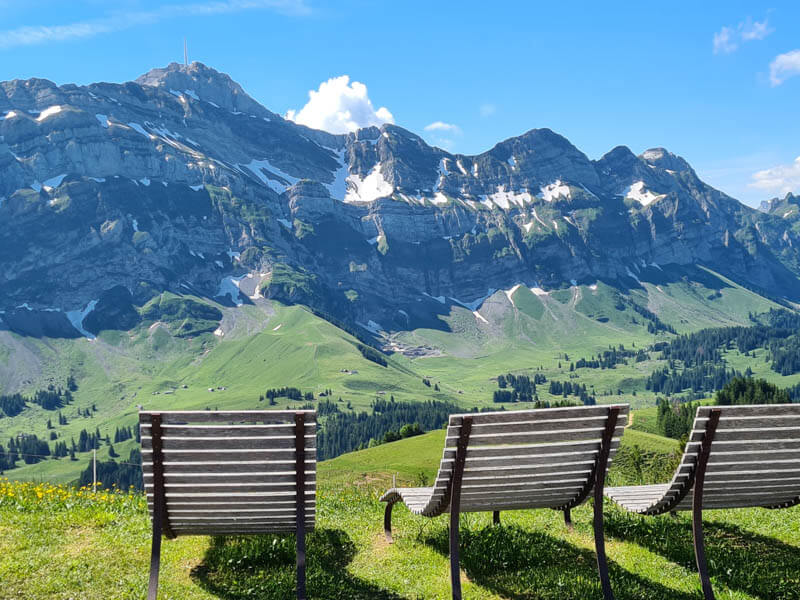
Lounge chairs at the top, looking across the Mt Säntis.
The mountain hotel and restaurant at the top of Kronberg.

This view of the Alpstein is just amazing. I never wanted to leave.

View west with so many more mountains to climb.

Starting the trail
The trail starts along the ridge shown here, descending towards Appenzell.

Make sure to follow signs with the green signs for Alpenpanorama Weg 3

Lots of flowers in May and June.

Squiggles down the ridge.

A picnic area with firewood in the trees.

This section had lots of loose rocks and was a bit tricky to walk on.

You can eat lunch at Berggasthaus Scheidegg, very full on the day we were there.

The playground next to Berggasthaus Scheidegg.

Cutting across wildflower fields. Don’t leave the path – the farmers need that grass to feed their cows. If you walk on it, it ruins it.

Getting closer to the trees.

Passing through a few dairy farms. Be careful around the cows, especially if there are baby cows.

Descend from ridge
The path briefly joins this service road. At the sign ahead, you’ll turn left.

At this sign, make sure to turn off the road onto the small grassy path that descends the hill. Follow the green Alpenpanoramaweg 3 signs.

I loved this part of the trail through the meadow. For a couple minutes, it was a little hard to see the path and it wasn’t well marked. But you will figure it out.

The trail passes through the forest for awhile.

A nice cool break from the sun.

Now off the ridge, the trail wanders through many meadows and a couple forests.

Gradually descending down through the countryside.

Joining a country road for a bit. Don’t worry, you’ll be back in the fields in a few minutes.

Cut through fields and campground
We were there just after the hay had been cut. It may be full of tall grass and flowers when you visit. The path is a little faint here.

Keep following the yellow signs to this farmhouse. Then the trail cuts through the field to your right, heading to a campground.

Looking back from the campground towards the farmhouse and Alpstein mountains. You can see Kronberg on the far right.

The campground has a restaurant shown here. The trail continues past the restaurant and through the parking.

The trail leaving the campground.

So pretty right here, loved it!!!

Arriving in Appenzell
As you reach the end of the dirt path, you’ll have a nice view of Appenzell.

Now follow yellow trail signs leading you to the Appenzell train station.

Walking through the neighborhood.

If you are taking the train back to Jakobsbad or your final destination, here is the cute Appenzell train station.

The red train leaving Appenzell.

Hope you enjoy this trail!