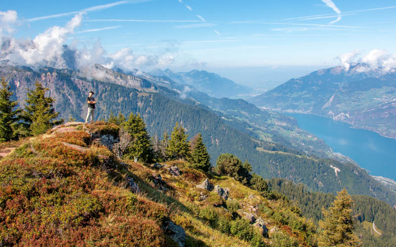
The Flumserberg 7 Peak Tour is gorgeous and rewarding hike that explores the backcountry of the Flumserberg resort.
I loved every minute and recommend this hike to experienced hikers and older children that can manage very uneven terrain, steep ascents/descents and don’t mind ridges.
Note: See Flumserberg 4 Peak Tour for an easier version of this hike that is still very beautiful.
Quick Info
| Region | Heidiland region • Eastern Switzerland |
| Location: | Flumesrberg BergJet gondola (Tannenboden > Maschgenkamm) |
| By car: | Parking next to gondola: Tannenboden From Zürich 1hr15 |
| By public transport: | Train stop: Unterterzen, then gondola up to resort From Zürich 1h20 |
| Trail: | 5h • ⬇️ trail map |
| Distance: | 13.3 km – shorter versions below |
| Difficulty: | difficult • +884m -1294m |
| Terrain: | T2 • mountain trail with uneven rocky terrain |
| Elevation: | highest point 2316m |
| Open: | late June to October |
| Cost 2026: | gondola car one way CHF 38 optional scooter rental CHF 16 |
| Discounts | 50% off with Half Fare Card, GA, Swiss Travel Pass |
| Services: | restaurant at start, middle and end |
| More info: | flumserberg.ch • webcams • weather |
Gallery
Hike overview
The hike is located at the Flumserberg mountain resort. This hike is reached using a gondola from Tannenboden on the mountain. You can reach Tannenboden by car or gondola from Unterterzen, as shown in the map below.

Option A: Full 7 Peak Tour
This trail starts at Maschgenkamm, the top of the BergJet gondola. The trail visits seven peaks as it loops around the backcountry of the resort.
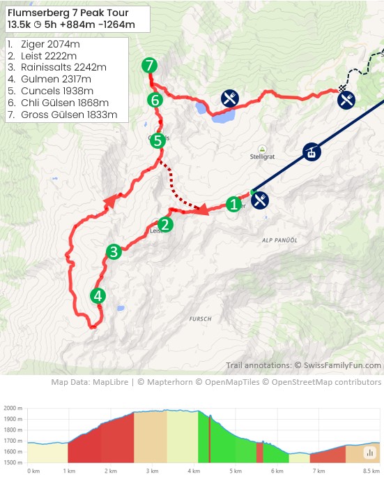
It descends to the Seebenalp lake, where you’ll find a restaurant. Then traverse to Chrüz and ride the Floomzer coaster down to Tannenboden. My hiking map below shows this option.
See trail map on Komoot • SchweizMobil • OutdoorActive
Or you can hike directly to Tannenboden, which increases your distance to 15 km, as shown on the official 7 Peak Tour map.
Option B: Loop – a little shorter
For a shorter hike, you do the first half of the trail, visiting the first 4 peaks. Then loop back to the Maschgenkamm gondola instead of hiking the rest of the way down the mountain.
Loop version: 4h • 10.4 km • 783m up, 790m down.
See trail map on SchweizMobil • Komoot • AllTrails • OutdoorActive.
Option C: 4 Peak Tour – Easier & shorter
If you need an easier version, do the Flumserberg 4 Peak Tour, which skips the three taller backcountry peaks and is mostly downhill. It ends at the coaster.
Easier version: 3h • 7.2 km • 150m up, 525m down. See details.
Trail conditions
The trail has lots of rough uneven terrain that requires agility and steady footing. There are steep climbs without switchbacks, just “steps” in the dirt. There are rocky sections where you must walk on and over lots of rocks.
There are some ridge sections with a cliff on one side and a steep slope on the other. The trail was well built on these sections and set back from the edge. So I didn’t think it was particularly dangerous. But you might not like it if you have a fear of heights.
How to get there
Flumserberg is a mountain resort in Eastern Switzerland, about 1 hour southeast of Zürich (see on Google Maps). You can drive or take a train to the BergJet gondola in Tannenboden, which takes you to the start of the trail.

By car
You can drive directly to the Flumserberg mountain resort at Tannenboden where there is metered parking next to the gondola station.
Do not park at Tannenheim, which also part of Flumserberg but a different part of the resort that doesn’t access your trail.
If you don’t want to drive up the mountain road, you can instead park at Unterterzen near the lake. In this case, you will pay a little more for your gondola tickets to cover the SeeJet gondola from Unterterzen to Tannenboden.
By public transport
Take a train to Unterterzen. The Flumsererg SeeJet gondola station is directly across the street from the train station. You can buy gondola tickets here for your full itinerary.
Ride the gondola up to Tannenbodenalp. Then a short walk across the parking lot to the BergJet gondola, which takes you up to Maschgenkamm where the trail starts.
Ticket prices
The ticket depends on where you start, which version of the trail, and if you ride the coaster.
Their pricing is confusing. It’s best to buy tickets on-site, so you can explain your plan, and get the correct ticket. Current ticket prices.
You don’t have to book in advance. Tickets do not sell out. There are no reserved boarding times.
Ticket options
In most cases, you’ll need a one-way ticket for the BergJet gondola from Tannenboden to Maschgenkamm. If you loop back to Maschgenkamm instead of hiking to the coaster, you would need a round trip ticket for the BergJet gondola.

If you arrive by train or park at Unterterzen, you’ll also need a round trip ticket on the SeeJet gondola from Unterterzen to Tannenboden.
If you plan to ride the coaster at the end of the hike, you’ll also need a ticket for that. When purchasing your gondola ticket, you can include the coaster, which is a bit less than buying these tickets separately.
Sample ticket:
I drive to Tannenboden. I ride the Bergjet gondola up to Maschgenkamm. I hike down to Chruz and rode the coaster to Tannenboden.
In 2026, this ticket costs CHF 38/adult / CHF 31.50 Half Fare, GA, Youth (16-19), CHF 19 Child (6-15)
I travel to Unterterzen by train. I ride the SeeJet gondola to Tannenboden, then the BergJet gondola to Maschgekamm to start the hike. I end the hike at Chruz and ride the coaster the Tannenboden. Then ride the SeeJet gondola to Unterterzen to catch a train back to my home base.
For this scenario, I would purchase the
Discounts
Discounts on the gondolas for Half Fare Card, GA, and Swiss Travel Pass.
Children age 6-15 and youth age 16-19 get a discount. You may have to show ID to prove the age. Children with a SBB Junior Card or Swiss Family Card ride the gondola for free with their parent.
You can sometimes get a 10-30% discount with the Hike’n’Rail offers via SBB. Check current offers.
Planning your day
Opening hours
The BergJet gondola from Tannenboden to Maschgenkamm is open from mid-June to mid-October. It typically runs daily 8:15 to 16:45.
The SeeJet gondola from Unterterzen (next to the train station) is open 7:30 to 17:45.
Check live status of Flumserberg services.
Services
There is a restaurant at Maschgenkamm, the start of the trail, and at Seebenalp lake, near the end of the trail. No other services along the trail – no hut, no water, no WC. So bring everything you need for the trail.
Best time to go
We suggest doing this trail between July to September.
Depending on snow conditions, the trail may be accessible free earlier and later in the season. But check the Flumserberg website for trail status before heading out.

Do not hike this trail in wet weather as there are many steep sections that would be difficult to manage in slippery mud.
What to bring
There are no services along the first 4 hours of this trail. Bring at least 1L water per person and snacks to sustain you.
I recommend hiking sticks, which are very helpful on the steep descents.
Bring your first aid kit in case of emergency, including a thermal blanket. If you get hurt and have to wait for rescue, most of the trail is quite exposed so you could get cold while you wait.
What to wear
Wear sturdy hiking shoes with good tread because this trail has lots of uneven terrain and steep slopes that require traction. I prefer hiking boots for the ankle support, but I have also worn low profile trail running shoes on this trail.
Bring layers as weather changes quickly in the mountains. I would suggest at least a rain jacket/windbreaker and fleece for warmth.
Where to eat
There is a restaurant at the start at Maschgenkamm, another at Seebenalp lake. There is another restaurant at Chruz next to the mountain coaster and multiple restaurants at Tannenboden. All of the restaurants have toilets.
Photo Story
1. Riding up to Maschgenkamm
At Tannenboden, follow signs to BergJet, which is the gondola up to Maschgenkamm. The entrance is inside the large building shown here.

Inside the building, go up the stairs/escalator. Scan your ticket and get on the gondola car.

The gondola takes you up to the Maschgenkamm station shown here. You’ll find a restaurant with outdoor seating, a small play area, and WC. There are no other services on your trail.

2. Hike up to Ziger 2074m (peak 1)
From the Maschgenkamm station, the offical 7 Peak Tour starts up this this small peak shown here. Follow signs to Zigerfurgglen.

If you want a bit easier start, you can follow the flat trail to your left around the peak. You’ll join the 7 Peak trail in about 15 mins.
In about 10 mins, you reach the Ziger peak and get this nice view back to Maschgenkamm.

Continue the trail along the Ziger ridge, with a view of the next peak, Leist, in the middle of this picture.

2. Climbing up Leist 2222m (peak 2)
At the junction of the trails shown below, follow the trail straight up the mountain.

Follow the trail sign with the green 7 towards Leist. The trail starts steep with loose rock. Get your hiking sticks out.

Looking down the trail.
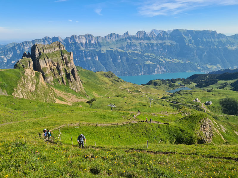
Looking back down the trail towards Ziger and Maschgenkamm.

View from Leist in mid July.

It seems that lots of people were just coming up to Leist for their picnic, then going back down. For an up & down hike to Leist, you could do it in about 2-2.5h.

3. Continue to Rainissalts 2242m (peak 3)
To continue the 7 peak trail, follow signs to Hoch Camatsch, still with the green 7 on the sign.

The trail goes down a bit from Leist then back up, first on this nice dirt path. You can see the next two peaks in the distance.
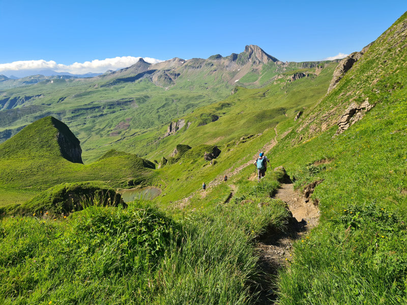

Follow signs to Rainissalts, the next peak. Here is your next climb, only about 70m elevation gain, so don’t worry.

Near the top, the trail gets a little slippery with lots of loose rock. Go slowly.

At the top of Rainissalts 2242m. This pic looks back towards Leist, a tiny speak behind those rock towers.

It’s very round up here, so a good place for a picnic.

4. Continue to Gulmen 2317m (peak 4)
Down a bit from Rainissalts and back up to Gulmen on the trail shown here.

Gorgeous views on your way up.

Near the peak, the trail gets steep with lots of steps. It’s near the edge of the cliff, but not too close. Very dramatic, one of my favorite parts of the trail.

View from Gulmen back to Rainissalts on the left (round peak with white rock) and Leist in the middle just left of the cliff.
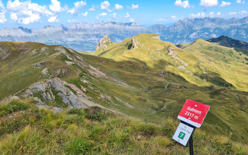

From Gulmen, it’s a crazy steep descent through this grass on dirt “steps” with almost no switchbacks. I relied on my hiking sticks a lot on this section.

Looking back up that trail from Gulmen.

5. Loop back to Chrüzen pass
Keep walking straight ahead until you reach this sign. Then turn right, following signs to Chrüzen with the green 7.

The trail goes below and around the north side of the Gulmen peak.

The views from this side of the trail are very mountainous.

At this dairy farm, you’ll turn right and follow the path up the hill, still following signs to Chrüzen.

This climb is steep but short, only about 15 mins.

At the top of the climb, you can see the Churfirsten peaks and even a bit of the Walensee lake below.

Now a beautiful stretch through a rocky landscape towards Chrüzen. You can see the Leist chair lift station where you were a couple hours ago.

Take your time at these ponds enjoying the reflections. Nice place for a picnic.

I took a couple dozen pics here and ran my battery down to nothing.

Down lots of rocks.

Now a lumpy dirt path to the saddle below that peak ahead.

6. Along ridge to last three peaks
The trail leads you to this bench at the Chruzen pass. The trail forks here.

To continue the 7 Peak Tour by following signs to Chil Güslen (peak 5).
Or for a shorter day, you can turn right and hike back to the Maschgenkamm gondola, about 40 mins (the sign showing the easy path to Maschgenkamm is blocked in my pic). Then ride the gondola down to Tannenboden.
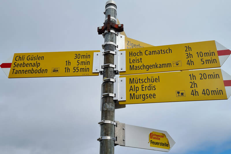
On the 7 Peak Tour, follow the ridge to Cuncels (peak 5) shown below.

Continue along the ridge to the last two peaks.

Next you’ll reach Chil Güslen 1868m (peak 6)

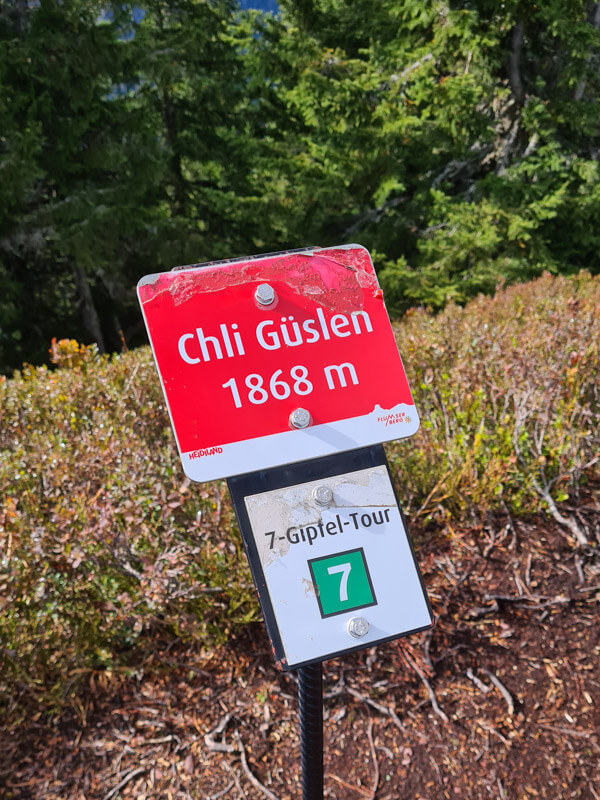
7. Last peak – Grösse Güslen
After Chli Güslen, you’ll reach this fork in the road. For the last peak and spectacular viewpoint, follow the short detour to your left, direction Grosse Güslen.
Afterwards, retrace your steps and follow the path down the hill to Seebenalp.

Here are the signs at the fork. We went to the Aussichtspunkt (aka viewpoint).

The trail got a little difficult in this part, with some chains to hold onto as you scramble up the roots.

After about 10 mins you reach the Grösse Güslen viewpoint.


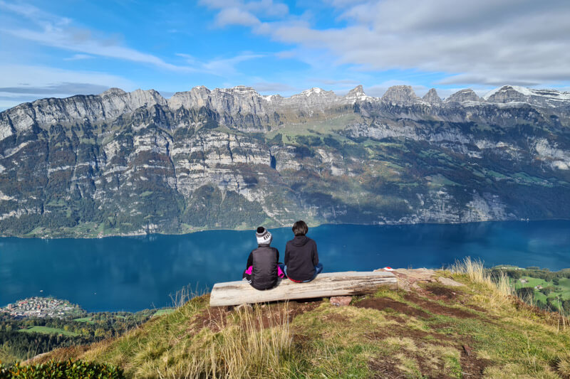
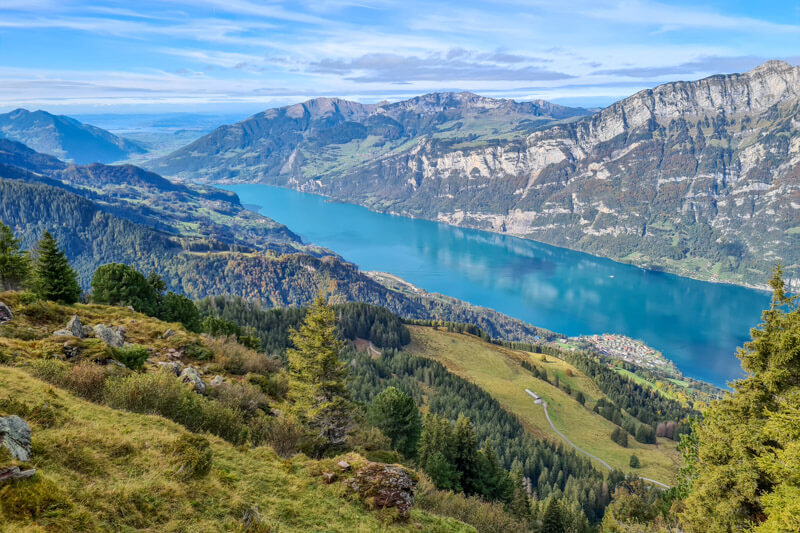
8. Down to Seebenalp lake
Now on the trail down to the lake.

Getting closer to the lake.
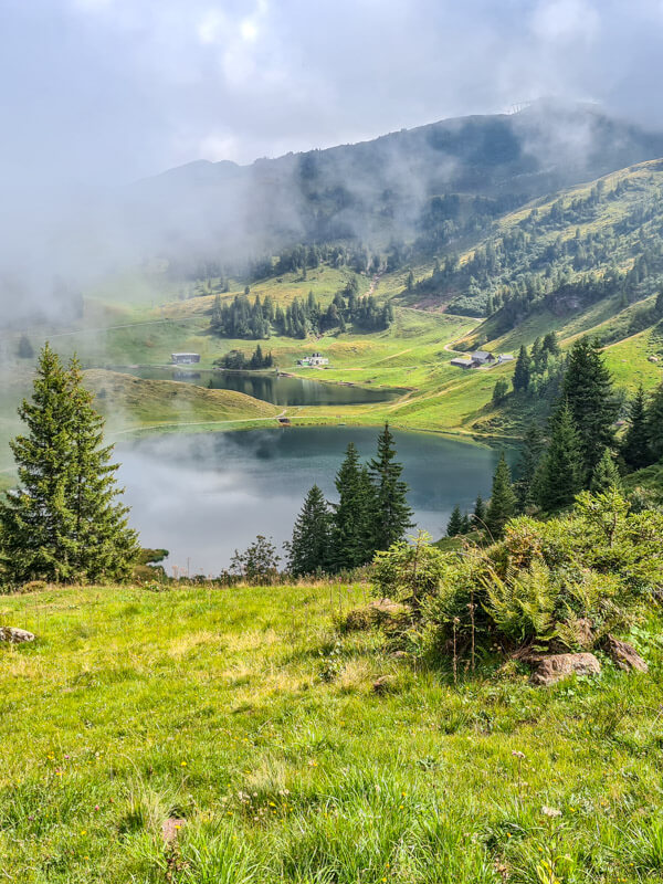

Walk around the left side of the lake to reach the hotel/restaurant.
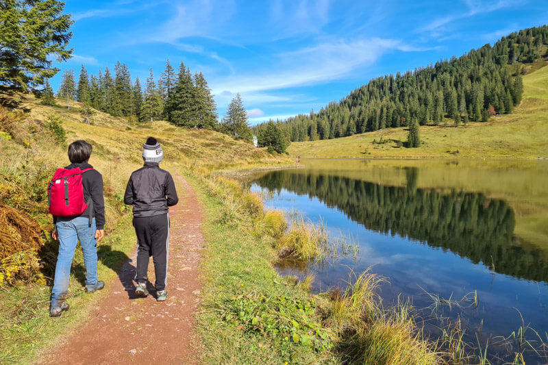
Lots of happy customers sitting on their terrace. They had some yummy autumn dishes on the menu.

Now we’re hiking up the dirt road and looking back at the hotel. There’s a little playground on the side of the hotel.

9. Hiking up to Chrüz for coaster
Now follow signs to You walk on a dirt road for about 1 km, a little boring. Don’t miss the trail that breaks off to the right into the forest. This leads to Chrüz and the Floomzer coaster.

Here’s the sign at that crossing. It’s about another 15 mins to Chrüz.

10. Riding the mountain coaster
Arriving at Chrüz. We bought our Floomzer tickets here. But better to buy a combo ticket with your gondola.

Strapping onto the Floomzer. Two people can ride together. You can place your backpack between your legs, which worried me but it was quite secure.
If you prefer, they will send your backpack down on the chair lift and you can pick it up later.

Heading out. No cameras allowed on the ride, boo hoo.

The track looks like this.

Really fun, with lots of dips, bumps, and curves.
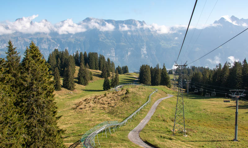
That’s all folks. Hope you like it!
See more hikes at Flumserberg.