Three big waterfalls and a bouncy suspension bridge are your reward for hiking up a long narrow river valley. This is a good choice for spring because it’s lower elevation and you can drive directly to the trail head.
It’s a good choice for cloudy weather because it’s charms don’t rely on mountain peaks or panorama views. We had rain most of the hike and it was still wonderful. It’s popular for locals, so it might be quite busy on sunny Sundays. So make sure to go early (arrive by 9) and better on Saturday.
| Location: | Eastern Switzerland |
| Address: | Weisstannen, Oberdorf |
| Car: | 1hr10 from Zurich to Weisstannen Free parking: 46°59’20.6″N 9°20’34.7″E |
| Transit: | 2hr from Zürich HB to Weisstannen, Oberdorf |
| Trail: | 8 km round trip, about 3-4 hrs |
| Elevation: | highest point 1550m |
| Condition: | dirt mountain trail, no strollers |
| Skill: | moderate, about 520m up/down |
| Open: | best late April through mid October |
| Prices: | free |
| Services: | none |
| More info: | www.weisstannental.ch |
Gallery


Location
The Batöni falls are located in eastern Switzerland, southeast of Zürich. You can drive or take the bus directly to the trail head, no extra fees.
Trail Overview
This trail is located in eastern Switzerland, in the mountains. Here is the summer hiking map for this area. On this map, I’ve marked both the Batöni falls from this hike and the nearby Mattbach falls, which can simply drive to, no hike.

Hiking map
The trail to Batöni is an uphill climb up a long valley to reach three big waterfalls and a suspension bridge across the river.
See trail map on Komoot
If you need an easier option, you can drive right to the Mattbach falls, which are just a few km up the other fork in the road. Details here.
Trail Conditions
The trail is a mountain trail, not suitable for strollers. It has some steep sections without switchbacks, where you might want hiking sticks for balance. It was very muddy when we were there and we had to cross several streams, so waterproof shoes are advised. There were some narrow sections with trail erosion where smaller children should be carefully supervised.
Services
There are no services along the trail. There are no official fire pits, but picnic fires are allowed if safely done. We saw several informal fire pits along the way and at the waterfalls.
Alp Siez is a mountain restaurant up the other fork in the road and they are advertising to leisure customers. There appear to be other village restaurants in Weisstannen, but none of them appeared open when we were there. I didn’t see a grocery or kiosk in the village, so get your supplies in Mels before you drive up the mountain.
Getting There
By public transport: Take a train to Sargans, Bahnhof, then catch bus 432 to Weisstannen, Oberdorf. This bus runs hourly, but check the schedule before you head out.
By car: Drive to Sargans/Mels, taking exit 50 off the A3, then follow signs to Weisstannen, which is up the mountain on a two-lane narrow winding road. When you reach the center of the village, the road forks. Your trail heads up the road on your left. There is free parking in the center of the village, near the bus stop.
In this pic, you can see the parking on the left and the bus stop shelter on the right.

We also saw a few cars parked at the end of the paved road, where the dirt trail starts, shown here on the map. But I didn’t see any parking signs, so I might be hesitant to park there. It would save you 650m of walking, but I thought that part was nice and easy. I wouldn’t skip it.

Start the trail
Start by walking up the road along the river.

The paved road ends and starts a dirt path. Follow signs to Batöni or Hängebrücke, which means suspension bridge.

Lots of pretty on the way up.

Sometimes walking up fields.

Sometimes walking up steep rocky slopes, no switchbacks.

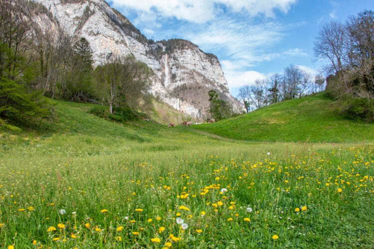
Headed across a few alpine meadows.
Looking back on the trail.
Lots of little valleys with streams.
Keep following signs to Batöni

Sometimes open views, sometimes forest.

This spot had some muddy stairs with some trail erosion. Be careful.

Almost to the waterfalls. You can see one of them toppling over the cliffs.
When you reach the big river, you are pretty close to the falls, which you can see in the second pic.

Arriving at the waterfall arena with the suspension bridge and one of the three big falls flowing into this area.

Here’s the suspension bridge.

Cross the suspension bridge. It’s super bouncy!

I crossed the bridge and took a pic from the other side.
From the other side of the bridge, you can sometimes scramble down to the rocks to get closer to the falls.
On the other side of the bridge, you can see the third falls around the corner on your right and get a closer look at the middle falls.

I hiked up the trail to the left so I could get a nice overview pic of the falls.

I think this box will have a guest book you can sign but it was missing the day we were there.

Here’s looking down the river from the falls. We saw some mountain goats on the rocks above the river, very exciting!

When you’re done, retrace your steps back to your starting point. Hope you enjoy it!


4 responses
Did this hike twice last week with family and friends, one of my new favorites for sure! The waterfalls were stunning, the flowers were in full force and the trail was a great workout. Thanks as always Tanya.
Agreed, it is a bit of workout but definitely worth it. Glad you enjoyed it.
Once again thank you for this hike! We did it on Sunday, the weather forecast wasn’t fantastic so we were alone, but there were beautiful fall colours and it was really nice, super muddy from the rain the day before but the kids though it added a fun touch :D. We parked just like you. Looking forward to more fall hikes!!
So glad you enjoyed it! I haven’t been there in fall but now I definitely want to go.